New Michigan Map Shows off New FracMapper Functionality
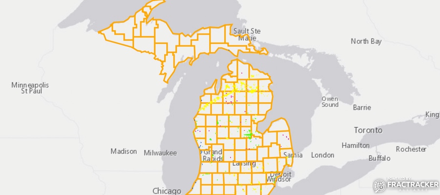
Recently, FracTracker has been getting requests from residents in many locations to map large-scale oil and gas operations in their area. We now have content for Michigan, which happens to correspond with the release of additional map export functionality on FracMapper:
View map fullscreen | How FracTracker maps work
About the Michigan Data
Each state is different in the data it makes available to the public, so it is always interesting to take a look at how new areas approach their duties of data transparency. After having recently produced maps for New Mexico and Colorado, I confess to being excited to work with data from a state that embraces designating locations in latitude and longitude (and doesn’t release data only with the archaic PLSS notation). But then, sometimes mapmakers are easy to please.
Far more important is the data made available for wells related to oil and gas development by the Michigan Department of Environmental Quality. Not only does it include the standard well type designations of “oil” or “gas”, but it also includes observation wells, storage wells, and injection wells. Altogether, there are 15 categories of well types.
As with many states, there are so many legacy oil and gas wells that mapping them all would overwhelm the online mapping software servers with data requests from over 63,000 wells. For that reason, the wells are restricted to those marked as being horizontally drilled, which reduces that number to 1,562. That should include most of the unconventional oil and gas extraction activity from recent years.
Also included in the data are point locations for the tops and bottoms of the well bore, which could be used in the future to map a generalized path of the horizontal wells beneath the surface.
FracMapper Export Feature Enhancement
The Michigan map is the first one produced with our new “Save as PDF” tool, which can be found in the “Export” toolbar.
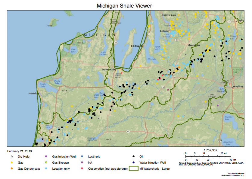
The “Save as PDF” tool in the the Export Menu creates as landscape oriented 8.5″ x 11″ document, complete with title, scale bar, and legend. The legend contains only those map icons that are displayed in the view of the PDF.
Please note that if you wish to make multiple PDF files from the same map, it is currently required to refresh the webpage containing the map, or it will continue to produce the same map.
In the coming weeks, this functionality will be added to the other FracMapper entries that have already been published. We are also hoping to roll out additional functionality in the near future.
Matt, great work. I too am developing a map using the same data at the URL: http://www.respectmyplanet.org. I can understand your excitement to get data into a visualized state. I love your work. I really love how you have overlays and watershed info. You have a great map and some really cool features.