Hydraulic Fracturing Offshore Wells on the California Coast
By Kyle Ferrar, CA Program Coordinator, FracTracker Alliance
 On October 16th, the Environmental Defense Center released a report focused on the use of hydraulic fracturing by offshore oil drilling platforms off the coast of California.1 The full report can be found on the EDC’s website. I was asked to assist in creating the report’s GIS maps, the results of which are described partially in the article below and are shown on the right. An interactive map of this data, overlaid with additional data layers including oil spills and offshore wells is below.
Regulation of Offshore Drilling
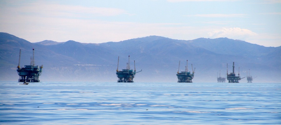
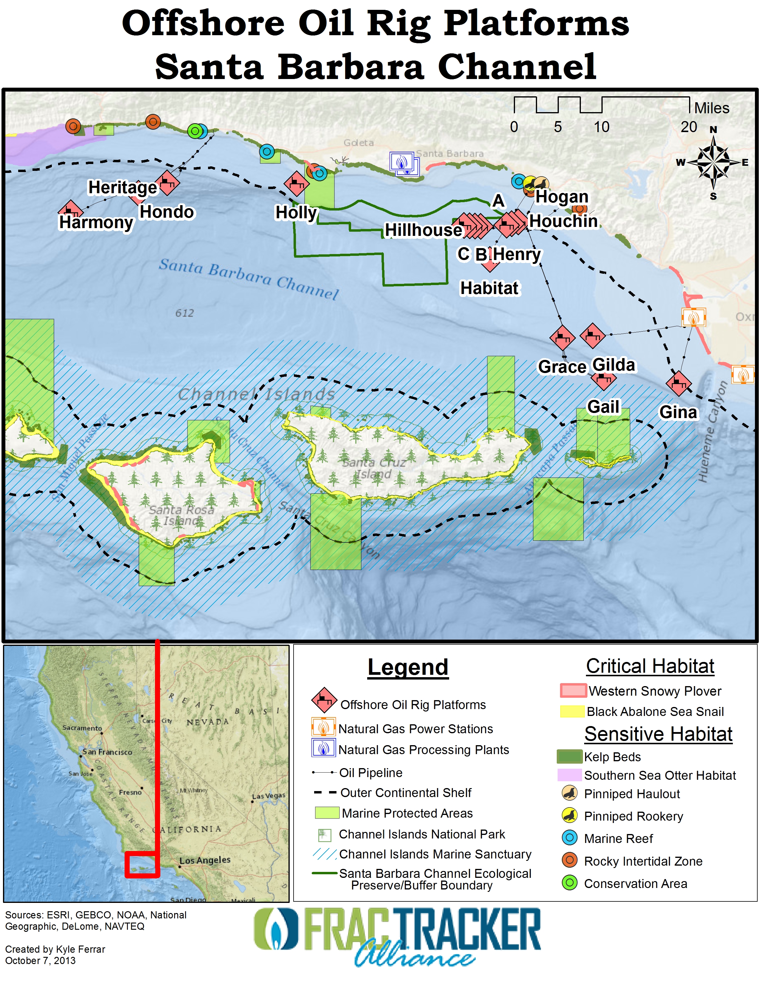
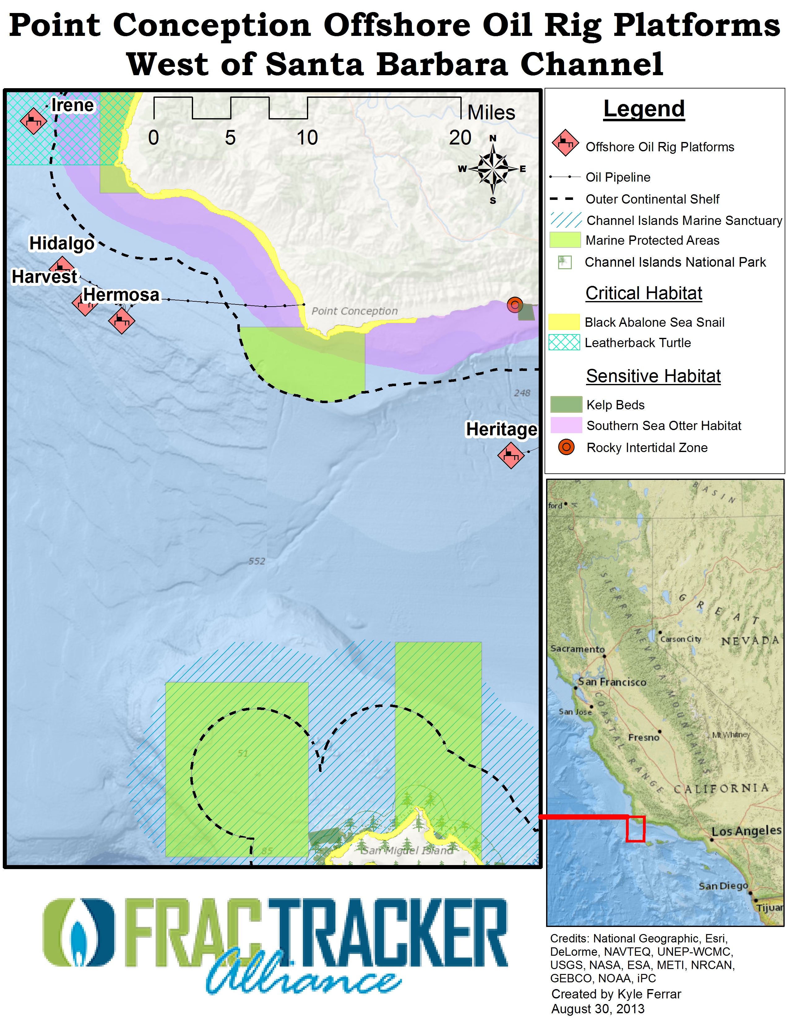
California has 24 offshore oil rigs, with only one of them located, and therefore regulated, in state waters. In the map below, the regulated platform is labeled as “Holly.” The rest of the platforms, including platform “A” which was responsible for the Santa Barbara oil spill of 1969, are located in federal waters beyond the “outer continental shelf” (OCS) boundary, shown in the map with a dashed line.
International, federal, and state laws are interrelated legal regimes that impact development of offshore oil, gas and other mineral resources in the US. Governance is bifurcated between state and federal law. States have authority in the “three-geographical-mile” area extending from their coasts. Federal regulatory regime governs minerals located under federal waters that extend out past state boundaries at least 200nautical miles from shore. This is known as the “exclusive economic zone,” for which coastal nations have the sovereign right to explore, exploit, conserve, and manage marine resources. The basis for most federal regulations is the Outer Continental Shelf Lands Act (OCSLA), which provides the system for offshore oil and gas exploration, leasing, and ultimate development. Regulations range from health, safety, resource conservation and environmental standards to requirements for production-based royalties and in some cases royalty relief and other development incentives. The moratoria on offshore leasing on many areas of the outer continental shelf were lifted in 2008 by President Bush and the 110th congress. Prior to that, several areas were made available for leasing in 2006 including the Aleutians and the Gulf. Recent changes to authorities regulating offshore development resulted after the Mineral Management Service was implicated in numerous scandals, including uncollected royalties estimated to amount to $160 million in 2006 alone.2 Offshore resource extraction is now regulated by the Bureau of Ocean Energy Management (BOEM) and the Bureau of Safety and Environmental Enforcement, both agencies of the Department of the Interior.
Investigating Hydraulic Fracturing
A recent freedom of information act request filed by the Environmental Defense Center (the group was formed in response to the 1969 Santa Barbara oil spill) identified 15 offshore drilling operations that used hydraulic fracturing. (Update: recent information from the FOIA shows 203 frac’ing operations from 6 different rig platforms!)4. This number is most likely a vast underestimation, as the Bureau of Safety and Environmental Enforcement (BSEE) estimates 12% of offshore operations in the Gulf use hydraulic fracturing. These “frac” operations were conducted without notifying the necessary regulatory agencies. The majority of this activity was conducted from the platforms Gilda and Gail, both labeled in the maps. While these offshore energy resources may be oil-rich, the fossil fuel resources pale in comparison to the biodiversity and ecological productivity of the Santa Barbara Channel and the California Channel Islands. The geography of the Channel Islands was formed by the cold-water swells of Northern California meeting with the warm-water swells of Southern California. This convergence resulted in a plethora of ecological microcosms in addition to the critical and sensitive habitats of endangered and threatened species shown in the maps.
Recently, the Department of the Interior approved four more hydraulic fracturing operations at these offshore platforms. Take note of the many ecological preserves and areas of protected/sensitive habitat in the midst of the many offshore wells and platforms. The map layer showing historic oil spills deserves special attention, with focus on the spills at platforms Gail and Gilda. Seeing this, it is alarming that the proposals were not required to conduct environmental impact assessments, and were instead granted “categorical exemptions” from the environmental analyses and public transparency actions strictly required by the National Environmental Policy Act. These actions (or lack thereof) in such an ecologically complex environment, especially considering it is the historical site of the US’s third largest oil spill, raises serious questions of compliance with other federal laws including the Clean Water Act, Endangered Species Act, Marine Mammal Protection Act, and Coastal Zone Management Act.3
Policy Recommendations
Additionally, the EDC report makes several policy recommendations:
- Place a moratorium on offshore hydraulic fracturing, or “fracking,” and other forms of well stimulation unless and until such technologies are proven safe through a public and transparent comprehensive scientific review
- Prohibit the use of categorical exclusions to authorize offshore fracking and other forms of well stimulation
- Formally evaluate offshore fracking and other forms of well stimulation through a Programmatic Environmental Impact Statement
- Initiate consistency reviews with the California Coastal Commission for all exploration plans, development plans, drilling or modification proposals involving fracking
- Ensure that all fracking proposals comply with the Endangered Species Act and Marine Mammal Protection Act
- Review and revise the Clean Water Act permit governing offshore oil platforms to directly address chemicals in frac flowback and other wastewater, either establishing effluent limitations for those chemicals or denying discharge altogether
References
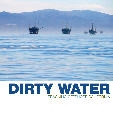
- Environmental Defense Center. 2013. Dirty Water: Fracking offshore California. Retrieved 10/16/13.
- Daniel Whitten. September 16, 2010. Oil, Gas Royalty-In-Kind Program to End, Salazar Says. Bloomberg. Retrieved 10/15/2013.
- Environmental Defense Center. October 16, 2013. EDC Provides Fracking Details. Retrieved 10/16/13.
- ALICIA CHANG and JASON DEAREN. October 19, 2013. California Offshore Fracking More Widespread than Anyone Believed. Huffington Post. Retrieved 10/22/13.
The EDF report and the “update” are for two separate geographic areas. Reference 4 is a report on the Long Beach area.
Hi Linda,
Yes, that is right. The well pads off the coast of Long Beach in the San Pedro Channel are just Southeast of the Santa Barbara Channel. If you use the embedded map to scroll South, you will see them just about 90 miles Southeast from Platform Gina. Several are actually man-made islands with multiple oil well pads. The “Dirty Water” report by the Environmental Defense Center (EDC, not EDF – two fundamentally different organizations) was focused on offshore oil and gas development, where the use of hydraulic fracturing has not been monitored. To retrieve information on these sites requires diligent reviews of drilling logs and records, so stay tuned as this story continues to develop!
Thanks for your comment and clarification Linda!