MAP RESOURCES
Follow a manual added link
Oil and Gas Wells Data Portal
Explore millions of U.S. well records by type and status
➜
Follow a manual added link
Data Library
FracTracker’s datasets and data sources
➜
Follow a manual added link
FAQ
Get help with our tools in our FAQ section
➜
Follow a manual added link
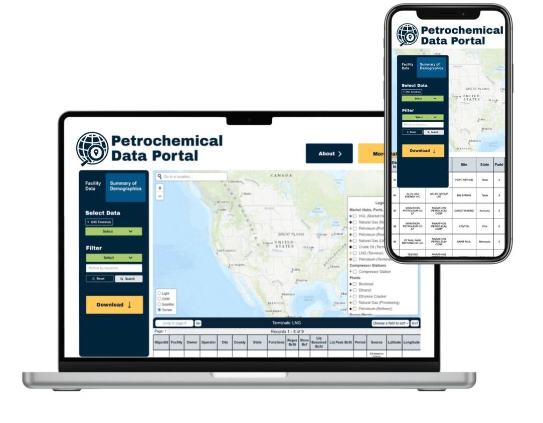
Petrochemical Data Portal
Explore and download data for petrochemical sites and facilities nationwide
➜
FracTracker Web App National Map
Learn how oil and gas development is impacting communities across the United States and browse user-generated submissions. You can customize the map by selecting which types of development you’d like to show (wells, pipelines, compressor stations, and processing stations) and what types of user reports appear (noise complaints, smells, etc.).
National Energy and Petrochemical Map
FracTracker’s most comprehensive map, which includes oil and gas infrastructure, pipelines, fossil fuel and clean energy power plants, ethane crackers and chemical plants, and more.

Recent National Maps
On this page you can learn more about oil and gas drilling issues that cross state boundaries. Also included are national maps, such as the location of all active oil and gas wells in the U.S.


Download Data
US Abandoned and Orphaned Wells – updated in August, 2021. See accompanying methodology document for more details on the datasets used.
All FracTracker national datasets, including: upstream and midstream oil, gas, and petrochemical data; Coal mines; Renewable energy; Federal lands (BLM, FWS, Indian Reservations, USFS, etc); and more.
Recent Articles
 https://fractracker.org/wp-content/uploads/2016/05/ChieftainSands_Chetek_WI_Processing3.jpg
3000
4496
FracTracker Alliance
https://fractracker.org/wp-content/uploads/2025/09/2025-Wordmark-Logo.png
FracTracker Alliance2025-09-03 15:51:572025-09-03 15:53:53Docket No. PHMSA-2025-0050: Comment Opposing LNG by Rail Transport
https://fractracker.org/wp-content/uploads/2016/05/ChieftainSands_Chetek_WI_Processing3.jpg
3000
4496
FracTracker Alliance
https://fractracker.org/wp-content/uploads/2025/09/2025-Wordmark-Logo.png
FracTracker Alliance2025-09-03 15:51:572025-09-03 15:53:53Docket No. PHMSA-2025-0050: Comment Opposing LNG by Rail Transport Photo by David Becker
https://fractracker.org/wp-content/uploads/2025/08/david-becker-crs2vlkSe98-unsplash.jpg
996
1500
FracTracker Alliance
https://fractracker.org/wp-content/uploads/2025/09/2025-Wordmark-Logo.png
FracTracker Alliance2025-08-22 11:22:272025-08-26 15:47:09FracTracker Launches Oil, Gas, and Petrochemical Data Portals
Photo by David Becker
https://fractracker.org/wp-content/uploads/2025/08/david-becker-crs2vlkSe98-unsplash.jpg
996
1500
FracTracker Alliance
https://fractracker.org/wp-content/uploads/2025/09/2025-Wordmark-Logo.png
FracTracker Alliance2025-08-22 11:22:272025-08-26 15:47:09FracTracker Launches Oil, Gas, and Petrochemical Data Portals Photo by Scott Rodgerson on Unsplash
https://fractracker.org/wp-content/uploads/2025/07/scott-rodgerson-PSpf_XgOM5w-unsplash.jpg
1000
1500
FracTracker Alliance
https://fractracker.org/wp-content/uploads/2025/09/2025-Wordmark-Logo.png
FracTracker Alliance2025-07-29 15:35:032026-05-06 18:10:30Tracking Data Centers: Energy Demand, Pollution, and Public Impact
Photo by Scott Rodgerson on Unsplash
https://fractracker.org/wp-content/uploads/2025/07/scott-rodgerson-PSpf_XgOM5w-unsplash.jpg
1000
1500
FracTracker Alliance
https://fractracker.org/wp-content/uploads/2025/09/2025-Wordmark-Logo.png
FracTracker Alliance2025-07-29 15:35:032026-05-06 18:10:30Tracking Data Centers: Energy Demand, Pollution, and Public Impact https://fractracker.org/wp-content/uploads/2019/03/IdleWellsHathaway_resize.jpg
400
900
FracTracker Alliance
https://fractracker.org/wp-content/uploads/2025/09/2025-Wordmark-Logo.png
FracTracker Alliance2025-07-03 13:40:552025-07-03 15:42:15Methane Matters, but Make Polluters Pay: FracTracker’s Response to Carl Pope
https://fractracker.org/wp-content/uploads/2019/03/IdleWellsHathaway_resize.jpg
400
900
FracTracker Alliance
https://fractracker.org/wp-content/uploads/2025/09/2025-Wordmark-Logo.png
FracTracker Alliance2025-07-03 13:40:552025-07-03 15:42:15Methane Matters, but Make Polluters Pay: FracTracker’s Response to Carl Pope https://fractracker.org/wp-content/uploads/2024/10/2024-Sentinel-Award-Web-Header-Image.jpg
844
1500
FracTracker Alliance
https://fractracker.org/wp-content/uploads/2025/09/2025-Wordmark-Logo.png
FracTracker Alliance2025-05-07 12:13:162025-05-08 11:54:26Celebrating 10 Years of Environmental Stewardship: Highlights from the 2024 Community Sentinel Awards
https://fractracker.org/wp-content/uploads/2024/10/2024-Sentinel-Award-Web-Header-Image.jpg
844
1500
FracTracker Alliance
https://fractracker.org/wp-content/uploads/2025/09/2025-Wordmark-Logo.png
FracTracker Alliance2025-05-07 12:13:162025-05-08 11:54:26Celebrating 10 Years of Environmental Stewardship: Highlights from the 2024 Community Sentinel Awards https://fractracker.org/wp-content/uploads/2021/04/49770601811_6cc7e18996_k.jpg
716
1500
Matt Kelso, BA
https://fractracker.org/wp-content/uploads/2025/09/2025-Wordmark-Logo.png
Matt Kelso, BA2025-04-07 15:42:272025-04-07 15:42:27Pipeline Incidents Are a Daily Occurrence
https://fractracker.org/wp-content/uploads/2021/04/49770601811_6cc7e18996_k.jpg
716
1500
Matt Kelso, BA
https://fractracker.org/wp-content/uploads/2025/09/2025-Wordmark-Logo.png
Matt Kelso, BA2025-04-07 15:42:272025-04-07 15:42:27Pipeline Incidents Are a Daily Occurrence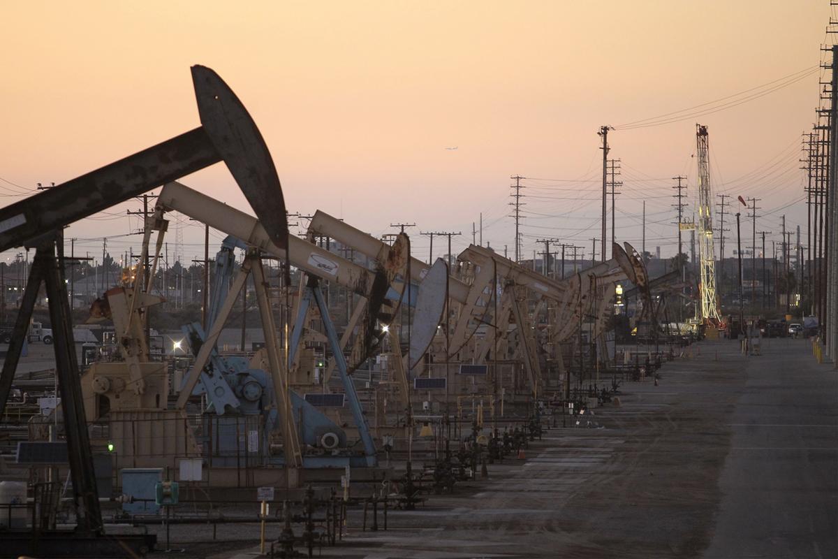 https://fractracker.org/wp-content/uploads/2020/11/Oil-rig-pumpjacks-Long-Beach-CA.jpg
800
1200
Sarah Carballo
https://fractracker.org/wp-content/uploads/2025/09/2025-Wordmark-Logo.png
Sarah Carballo2025-03-14 10:53:102025-09-09 15:31:20Fossil Fuel Subsidies: The $760 Billion Lie About ‘Free Market’ Energy
https://fractracker.org/wp-content/uploads/2020/11/Oil-rig-pumpjacks-Long-Beach-CA.jpg
800
1200
Sarah Carballo
https://fractracker.org/wp-content/uploads/2025/09/2025-Wordmark-Logo.png
Sarah Carballo2025-03-14 10:53:102025-09-09 15:31:20Fossil Fuel Subsidies: The $760 Billion Lie About ‘Free Market’ EnergyOlder National / Multi-State Maps


![]()
216 Franklin St, Suite 400, Johnstown, PA 15901
Phone: +1 (717) 303-0403 | info@fractracker.org
FracTracker Alliance is a 501(c)3 non-profit: Tax identification number: 80-0844297