Pipelines
Learn about oil and gas pipeline impacts through FracTracker articles, maps, and imagery.
Learn about oil and gas pipeline impacts through FracTracker articles, maps, and imagery.
North America consists of a vast network of inter- and intrastate pipelines that transport products ranging from water to hazardous liquids to raw materials. The U.S. oil and gas pipeline network delivers trillions of cubic feet of natural gas and hundreds of billions of tons of liquid petroleum products each year. The infrastructure’s main environmental health and safety risks include land use and forest fragmentation, compressor station emissions, erosion and sedimentation, spills and leaks, and explosions.
Explore our site’s various articles about oil and gas pipeline issues below, listed in descending order by date.
In the summer of 2018, FracTracker released a detailed environmental impact assessment (EIA), including digital maps, of the Falcon Ethane Pipeline
 https://www.fractracker.org/a5ej20sjfwe/wp-content/uploads/2021/03/Falcon-Ohio-River-Crossing-Feature-A.LauschkeLightHawk-scaled.jpg
667
1500
Erica Jackson
https://www.fractracker.org/a5ej20sjfwe/wp-content/uploads/2025/09/2025-Wordmark-Logo.png
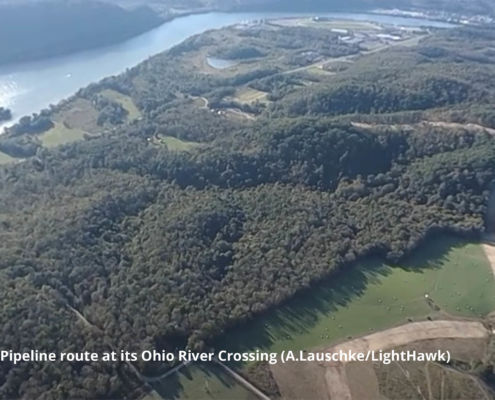
Erica Jackson2021-03-17 08:48:432021-04-15 15:11:21Shell’s Falcon Pipeline Under Investigation for Serious Public Safety Threats
https://www.fractracker.org/a5ej20sjfwe/wp-content/uploads/2021/03/Falcon-Ohio-River-Crossing-Feature-A.LauschkeLightHawk-scaled.jpg
667
1500
Erica Jackson
https://www.fractracker.org/a5ej20sjfwe/wp-content/uploads/2025/09/2025-Wordmark-Logo.png
Erica Jackson2021-03-17 08:48:432021-04-15 15:11:21Shell’s Falcon Pipeline Under Investigation for Serious Public Safety Threats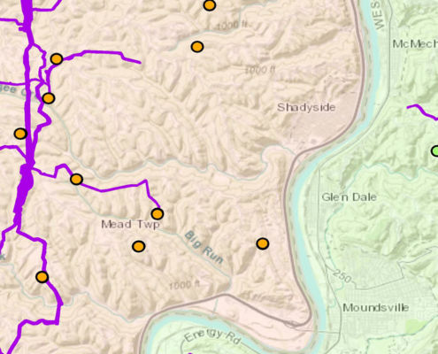 https://www.fractracker.org/a5ej20sjfwe/wp-content/uploads/2020/07/Mapping-gathering-lines-in-OH-and-WV-feature.jpg
833
1875
Intern FracTracker
https://www.fractracker.org/a5ej20sjfwe/wp-content/uploads/2025/09/2025-Wordmark-Logo.png
Intern FracTracker2020-07-02 12:09:192025-05-02 14:45:00Mapping Gathering Lines in Ohio and West Virginia
https://www.fractracker.org/a5ej20sjfwe/wp-content/uploads/2020/07/Mapping-gathering-lines-in-OH-and-WV-feature.jpg
833
1875
Intern FracTracker
https://www.fractracker.org/a5ej20sjfwe/wp-content/uploads/2025/09/2025-Wordmark-Logo.png
Intern FracTracker2020-07-02 12:09:192025-05-02 14:45:00Mapping Gathering Lines in Ohio and West Virginia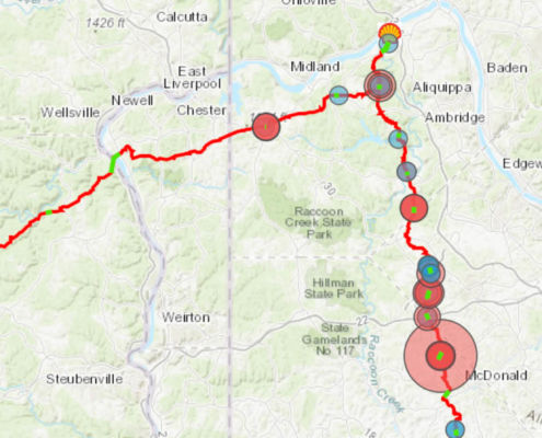 https://www.fractracker.org/a5ej20sjfwe/wp-content/uploads/2020/06/FalconPipelineFrontPage-scaled.jpg
430
1500
Erica Jackson
https://www.fractracker.org/a5ej20sjfwe/wp-content/uploads/2025/09/2025-Wordmark-Logo.png
Erica Jackson2020-06-16 11:47:062021-04-15 14:16:44Falcon Pipeline Construction Releases over 250,000 Gallons of Drilling Fluid in Pennsylvania and Ohio
https://www.fractracker.org/a5ej20sjfwe/wp-content/uploads/2020/06/FalconPipelineFrontPage-scaled.jpg
430
1500
Erica Jackson
https://www.fractracker.org/a5ej20sjfwe/wp-content/uploads/2025/09/2025-Wordmark-Logo.png
Erica Jackson2020-06-16 11:47:062021-04-15 14:16:44Falcon Pipeline Construction Releases over 250,000 Gallons of Drilling Fluid in Pennsylvania and Ohio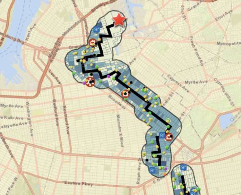 https://www.fractracker.org/a5ej20sjfwe/wp-content/uploads/2020/05/North-Brooklyn-Pipeline-demographics_1.jpg
914
2242
Guest Author
https://www.fractracker.org/a5ej20sjfwe/wp-content/uploads/2025/09/2025-Wordmark-Logo.png
Guest Author2020-05-18 09:00:212021-04-15 14:16:48New Yorkers mount resistance against North Brooklyn Pipeline
https://www.fractracker.org/a5ej20sjfwe/wp-content/uploads/2020/05/North-Brooklyn-Pipeline-demographics_1.jpg
914
2242
Guest Author
https://www.fractracker.org/a5ej20sjfwe/wp-content/uploads/2025/09/2025-Wordmark-Logo.png
Guest Author2020-05-18 09:00:212021-04-15 14:16:48New Yorkers mount resistance against North Brooklyn Pipeline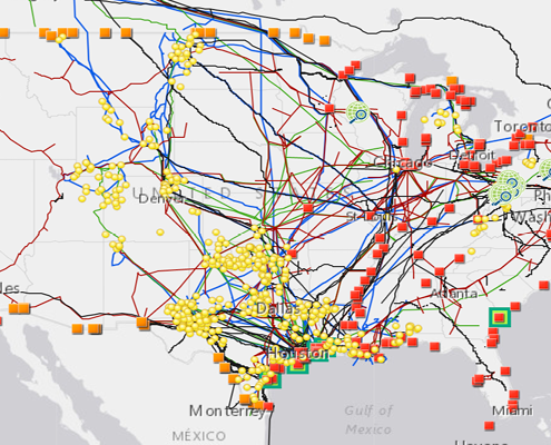 https://www.fractracker.org/a5ej20sjfwe/wp-content/uploads/2020/02/National-map-feature-3.png
400
900
Erica Jackson
https://www.fractracker.org/a5ej20sjfwe/wp-content/uploads/2025/09/2025-Wordmark-Logo.png
Erica Jackson2020-02-28 17:35:142022-05-02 15:21:42National Energy and Petrochemical Map
https://www.fractracker.org/a5ej20sjfwe/wp-content/uploads/2020/02/National-map-feature-3.png
400
900
Erica Jackson
https://www.fractracker.org/a5ej20sjfwe/wp-content/uploads/2025/09/2025-Wordmark-Logo.png
Erica Jackson2020-02-28 17:35:142022-05-02 15:21:42National Energy and Petrochemical Map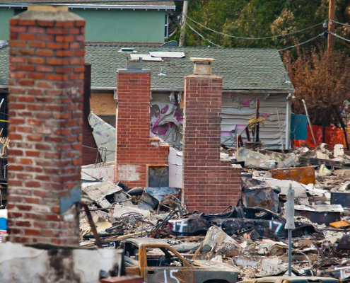 https://www.fractracker.org/a5ej20sjfwe/wp-content/uploads/2019/02/San-Bruno-Aftermath-feature-image.png
400
900
Matt Kelso, BA
https://www.fractracker.org/a5ej20sjfwe/wp-content/uploads/2025/09/2025-Wordmark-Logo.png
Matt Kelso, BA2020-02-21 16:13:542021-04-15 14:55:30Pipelines Continue to Catch Fire and Explode
https://www.fractracker.org/a5ej20sjfwe/wp-content/uploads/2019/02/San-Bruno-Aftermath-feature-image.png
400
900
Matt Kelso, BA
https://www.fractracker.org/a5ej20sjfwe/wp-content/uploads/2025/09/2025-Wordmark-Logo.png
Matt Kelso, BA2020-02-21 16:13:542021-04-15 14:55:30Pipelines Continue to Catch Fire and ExplodeLooking for a map of US pipelines that you can access from your phone? Download our free mobile app.

![]()
216 Franklin St, Suite 400, Johnstown, PA 15901
Phone: +1 (717) 303-0403 | info@fractracker.org
FracTracker Alliance is a 501(c)3 non-profit: Tax identification number: 80-0844297

