Indiana
As of 2017, 3.5% of all wells in Indiana used hydraulic fracturing.
As of 2017, 3.5% of all wells in Indiana used hydraulic fracturing.
FracTracker provides state-specific data on issues such as:
The data folders may also contain information on other energy generation locations, data from different years, and data on violations committed by oil and gas facilities. Amount of information and types of information will vary by state. Get data.
Indiana Department of Natural Resources provides data on all oil and gas wells in Indiana.
 https://fractracker.org/wp-content/uploads/2023/04/EatonTwnshp_Zoning_CommissionMeeting_Capacity_March_22_2023.jpg
1129
1500
Ted Auch, PhD
https://fractracker.org/wp-content/uploads/2025/09/2025-Wordmark-Logo.png
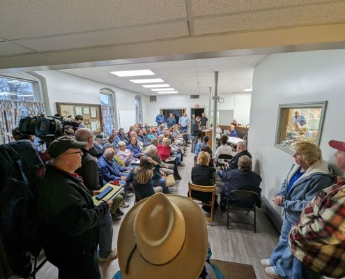
Ted Auch, PhD2023-04-03 13:49:182023-04-25 13:22:55East Palestine Train Derailment Waste: Community Impacts
https://fractracker.org/wp-content/uploads/2023/04/EatonTwnshp_Zoning_CommissionMeeting_Capacity_March_22_2023.jpg
1129
1500
Ted Auch, PhD
https://fractracker.org/wp-content/uploads/2025/09/2025-Wordmark-Logo.png
Ted Auch, PhD2023-04-03 13:49:182023-04-25 13:22:55East Palestine Train Derailment Waste: Community Impacts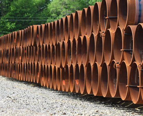 https://fractracker.org/wp-content/uploads/2021/03/TAuch_Transportation-RoverPipeline_Construction-EnergyTransferPartners-Woodsfield_OH_May2017.jpg
576
1500
Karen Edelstein
https://fractracker.org/wp-content/uploads/2025/09/2025-Wordmark-Logo.png
Karen Edelstein2022-11-30 17:50:122024-01-22 16:03:23A Contentious Landscape of Pipeline Build-outs in the Eastern US
https://fractracker.org/wp-content/uploads/2021/03/TAuch_Transportation-RoverPipeline_Construction-EnergyTransferPartners-Woodsfield_OH_May2017.jpg
576
1500
Karen Edelstein
https://fractracker.org/wp-content/uploads/2025/09/2025-Wordmark-Logo.png
Karen Edelstein2022-11-30 17:50:122024-01-22 16:03:23A Contentious Landscape of Pipeline Build-outs in the Eastern US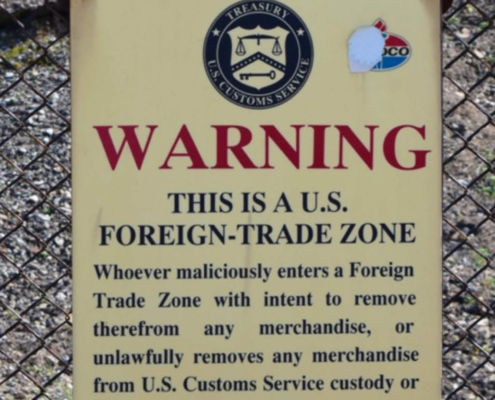 https://fractracker.org/wp-content/uploads/2020/07/Foreign-Trade-Zone-Sign-Feature.jpg
833
1875
FracTracker Alliance
https://fractracker.org/wp-content/uploads/2025/09/2025-Wordmark-Logo.png
FracTracker Alliance2020-07-09 09:12:212021-04-15 14:16:12Industry Targets Peaceful Protest via “Critical Infrastructure” Legislation
https://fractracker.org/wp-content/uploads/2020/07/Foreign-Trade-Zone-Sign-Feature.jpg
833
1875
FracTracker Alliance
https://fractracker.org/wp-content/uploads/2025/09/2025-Wordmark-Logo.png
FracTracker Alliance2020-07-09 09:12:212021-04-15 14:16:12Industry Targets Peaceful Protest via “Critical Infrastructure” Legislation https://fractracker.org/wp-content/uploads/2020/02/National-map-feature-3.png
400
900
Erica Jackson
https://fractracker.org/wp-content/uploads/2025/09/2025-Wordmark-Logo.png
Erica Jackson2020-02-28 17:35:142022-05-02 15:21:42National Energy and Petrochemical Map
https://fractracker.org/wp-content/uploads/2020/02/National-map-feature-3.png
400
900
Erica Jackson
https://fractracker.org/wp-content/uploads/2025/09/2025-Wordmark-Logo.png
Erica Jackson2020-02-28 17:35:142022-05-02 15:21:42National Energy and Petrochemical Map![]()
216 Franklin St, Suite 400, Johnstown, PA 15901
Phone: +1 (717) 303-0403 | info@fractracker.org
FracTracker Alliance is a 501(c)3 non-profit: Tax identification number: 80-0844297


