Documenting Oil and Gas Industry Damage in North Dakota
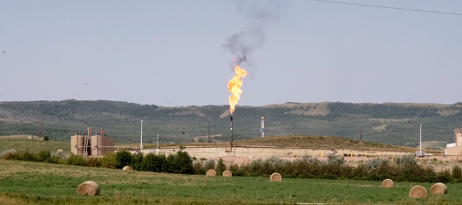
North Dakota is now in its third oil boom due to the drilling technologies of horizontal drilling and hydraulic fracturing that have made once-inaccessible oil accessible. The Bakken formation covers western North Dakota, eastern Montana, and parts of Manitoba and Saskatchewan. At the height of the boom in 2014, just under 12,000 wells were active across the west, extracting 1.1 million barrels (bbl) of oil per day and flaring at 32%. The boom has bumped North Dakota to the second largest oil and gas producing state, second only to Texas.
Dakota Resource Council (DRC) is a member-led, grassroots organization that has been working in extraction-impacted communities in North Dakota since 1978. DRC’s members work on oil and gas campaigns that aim to eliminate impacts to land, air, water, and livelihoods of the citizens of North Dakota. Campaign issues on oil and gas industry damage include: flaring, pipelines, radioactive/oilfield waste, state accountability, and oil-by-rail.
The following photos from DRC show impacts of current and legacy oil and gas extraction in western North Dakota – an area in the heart of the Bakken that is historically a rich agricultural and ranching region. The vast contrast between the two industries are not complementary.
Bear Den Bay Incident
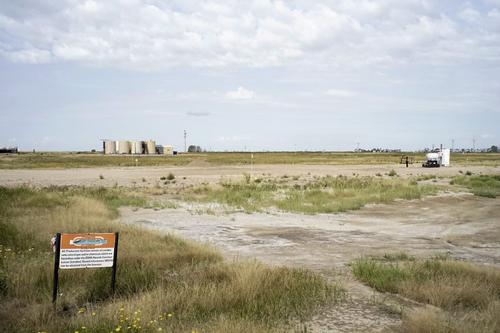
Fort Berthold Indian Reservation is the epicenter of fracking in the Bakken. On July 8, 2014 a wastewater pipeline rupture was accidentally discovered in rural Mandaree on the reservation. The pipeline is owned by Crestwood Midstream, LLC – a Texas-based company.
An estimated 1 million gallons of toxic saltwater ran down a ravine, ending up in the tributary of Bear Den Bay, which is located ¼ mile from the city of Mandaree’s water intake. The spill was contained, but the state doesn’t know exactly how much waste went into the bay. Tribal administration released a statement that beaver dams prevented the fluids from reaching the lake.
Weeks after the incident Crestwood released a statement saying:
… while assessment of the effect is ongoing, examination and testing to date show that an area of grass, brush and trees about 200 yards long sustained damage. Some produced water ran down a ravine into natural pools in a small stream at the bottom, but it appears that the produced water stopped there… The impact on fish and wildlife appears to have been minimal, in fact beavers, turtles, frogs, deer and pelicans have been seen returning to and re-inhabiting the impacted area.
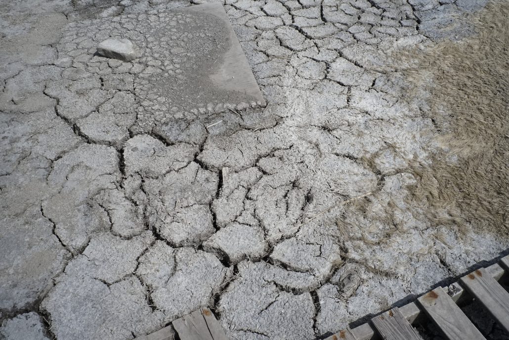
To date, there has been no penalty for the damage that has been done to the land and reclamation is ongoing. Below are photos documenting the incident’s effects:


The Legacy of North Dakota Oil Booms
Western North Dakota has weathered through two previous oil booms in the early 1950’s and 1980’s. Previous booms left behind infrastructure that sits abandoned today. Due to hydraulic fracking technology, once-inaccessible oil is now accessible. These pre-existing wells are called legacy wells, that produce roughly 5% of North Dakota’s 1.2 million barrels per day.
Much of these wells contain infrastructure that has been in place for over 60 years. Pipelines have not been mapped or regulated in North Dakota until recently. Farmers are finding underground tanks and pipelines filled with toxic sludge. Just like previous oil booms, North Dakota was not prepared for the cost of extraction. Scroll through the following gallery showing a variety of legacy sites in ND.


By Nicole Donaghy, Dakota Resource Council