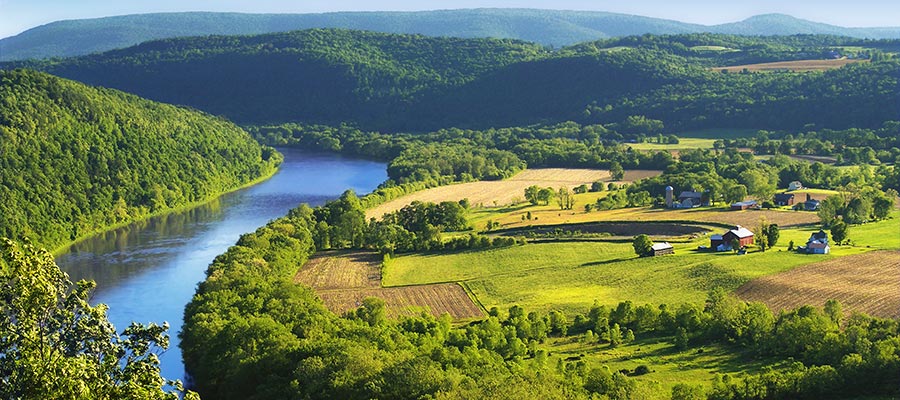
An Introduction to the Susquehanna River Basin Impacts Project
By the FracTracker Alliance
In partnership with the Pennsylvania Chapter of the Sierra Club
and Clean Water Action
Looking at a map of Pennsylvania, three major rivers span the Commonwealth — the Ohio River in the West, the Susquehanna River in the middle of PA, and the Delaware River in the East. The Delaware River Watershed benefits from the active oversight and management of the Delaware River Basin Commission (DRBC) and the Ohio is managed by Ohio River Valley Water Sanitation Commission (ORSANCO). The multi-state effort to protect the Susquehanna River is known as the Susquehanna River Basin Commission (SRBC).
These agencies differ greatly in how they oversee protections of their respective watersheds, particularly in the context of oil and gas development. For instance, the DRBC engages in a range of activities related to water quantity protection (like water supply allocation and water conservation), water quality, regulatory review and permitting, watershed-wide planning, flood mitigation and drought management, and recreational activities. Meanwhile, ORSANCO and the SRBC interpret their responsibilities very narrowly, primarily focusing on managing issues related to discharge standards in the case of ORSANCO, and water quantity in the case of the SRBC.

In this new series of articles, FracTracker Alliance, in partnership with the Sierra Club Pennsylvania Chapter and Clean Water Action, takes a closer look at the Susquehanna River Watershed and its many challenges related to industrial development, including deforestation and sedimentation issues, nutrient loading from poor agricultural practices, sewer and stormwater runoff. A significant component of Susquehanna River Basin impacts can be attributed to expanding oil and gas development. How will the Susquehanna River Watershed withstand future impacts from the oil and gas industry given the SRBC’s limited oversight? A first step in understanding the problem is to look at the state of the watershed today.
Oil & Gas in the Susquehanna River Watershed
As part of the ongoing Marcellus Shale oil and gas boom, nearly 5,500 unconventional wells on roughly 2,000 well pads have been drilled in the Susquehanna River Watershed since 2007. According to the Nature Conservancy, shale gas companies could drill 27,600 additional wells in the Susquehanna River basin by 2030, which would result in approximately 6,900 well pads (assuming four wells per pad, a relatively conservative number given recent trends where up to a dozen wells are being drilled on a single pad). These additional 4,900 well pads represent 31,850 acres of disturbed lands for the pads and access roads alone. Overall, the Nature Conservancy believes that up to 110,000 acres of forested land could be cleared in the Susquehanna River Watershed by 2030. In addition to well pads and access roads, one must also account for the impacts of associated pipelines. Estimates suggest that 12-15 acres of gathering line are installed per acre of well pad.
This explosive growth of the shale drilling industry, combined with declining resources for regulatory oversight, would complicate regional watershed management strategies. A growing body of evidence suggests that watersheds near hydraulic fracturing operations can be impacted by improper waste disposal, trucking accidents, migration of drilling fluids, as well as problems related to land disturbance such as pipeline and access road stream crossings, sedimentation and runoff (needs a reference). And while there are two major water monitoring programs operating in the Susquehanna River, one run by the Pennsylvania Department of Environmental Protection (PA DEP) and the other operated by the SRBC, significant questions remain about their ability to assess the Susquehanna River’s water quality. These concerns primarily stem from the infrequent and patchwork-like coverage of their sampling regimes, as well as inconsistencies in indicators measured at different sites.
Existing Water Monitoring Efforts
Watershed testing is key to understanding how industrial development affects water quality. It also significantly informs mitigation strategies. In this first map of the series (below), we have put together several layers to help illustrate the state of water testing in the Susquehanna River Basin. This map can be used to obtain summary information about unconventional oil and gas activity and monitoring efforts at the watershed level by clicking on individual features.
Note that there are two separate layers on this map depicting summary data — one outlined in dark green and one in light green, both at HUC-08 level. The dark green outlines are in PA only and contain oil and gas summaries of wells and violations. The light green outlines show agency-based monitoring activity, and are not restricted to PA boundaries. The reason for the two layers is that states classify oil and gas wells differently and so cannot be combined easily.
View map fullscreen | How FracTracker maps work
The Susquehanna River Basin has over 49,000 miles of waterways, according to the SRBC. While it may not be possible to fully document the impacts that the oil and gas industry has on the basin, there are some efforts underway to chronicle changes to the river system. In this map, we look at the efforts of governmental and quasi-governmental agencies to test the waters throughout the region, which range from periodic grab samples to automated data loggers that constantly evaluate several measures of water quality. There are advantages to both methods, as data loggers can capture short term spikes in conductivity, for example, that monthly sampling would likely miss altogether. However, grab sampling allows for a more in-depth analysis of the water in a laboratory than what the data loggers can provide.
While oil and gas is the focus of the map, it is not the only concern of the SRBC. Thus, considerable testing occurs in areas that are not seeing drilling activity. The drilling regions are shown on the map as a great orange arc, extending from Indiana County in the west-central part of Pennsylvania all the way to Susquehanna county in the Northern Tier. If you zoom in on this region, data for individual unconventional wells will become visible, along with permits for wells that have yet to be been drilled, and violations that have been issued by DEP.
Clusters of Development and Oversight
In some regions of the Susquehanna basin, there are significant clusters of oil and gas activity without a corresponding governmental monitoring regimen. Other areas have significant monitoring coverage. In many cases, periodic grab samples are taken from the same sites as data loggers – and may therefore appear twice on our map – to capture both aspects of monitoring activity. Our map can be used to find quick summary data for a given watershed. For example, the Upper Susquehanna-Tunkhannock watershed is being monitored with 53 testing sites and nine data loggers. The same region has 2,178 wells, and 2,347 violations associated with these wells.
We can also use the map to focus on concerns at different scales. The cluster of drilling activity in Ulysses Township, seen below, resulted in a number of violations (shown in yellow). Due to historical impact of the oil and gas industry in this sub-watershed, additional monitoring locations might be called for.

While we think that it is important to protect all the Susquehanna’s waters, certain areas are more fragile than others. For instance, headwater streams that are designated as high quality (HQ) or exceptional value (EV) are vital to the overall health of the river system and their protection is required by Pennsylvania law. However, many headwaters streams have no monitoring despite heavy oil and gas drilling, as can be seen in the below map. We have included HQ/EV designated streams on the map, although due to the large amount of data these streams are not displayed by default. They can be seen by activating the layer.

Broader Implications
The Susquehanna River provides drinking water to 4.1 million people, including residents in New York, Pennsylvania, and Maryland. In addition, through water that is diverted to areas outside the watershed, it is estimated that the Susquehanna also serves as a drinking water supply for 2 million people in more populated areas such as Baltimore, MD and Chester County, PA. With clean drinking water hanging in the balance, and the potential build-out of thousands more natural gas well pads in the watershed, it is more important than ever to understand how oil and gas activity could affect the watershed.
The Pennsylvania Constitution reminds us of our right to clean air, pure water, and the preservation of the environment. Prior to the adoption of the Environmental Rights Amendment — 80 years ago this year — and long before the federal Clean Water Act, the Pennsylvania legislature passed the state level Clean Streams Law in recognition of the need to protect the integrity of our valuable aquatic resources. In the spirit of this tradition to lead on clean water issues, the SRBC, Pennsylvania, and surrounding states must commit to putting the protection and preservation of the Susquehanna River watershed at the forefront of decision-making within the basin.
In future installments of this series, we seek to reveal gaps in watershed and land management plans in order to evaluate what these risks mean for the people and environments of the Susquehanna River Basin. The mapping and analysis provided in this series will be used to frame a series of conversations throughout the Basin with the goal of encouraging concerned residents to become more involved in public discussions about watershed management planning. Further, this project will result in recommendations for tangible solutions to filling oversight and management gaps and communicate these findings to relevant agencies. Only with adequate information can the public ensure strong protections for this life-sustaining waterway. Recognizing the important work that the SRBC has done in recent years, we also hope to identify areas where the Commission can direct additional resources to analyzing the cumulative impacts of shale gas development and expand their oversight strategies.
Top: fair use image by Nicholas A. Tonelli