California’s Oil Fields Add Fuel to the Fire
Never has the saying “adding fuel to the fire” been so literal.
California wildfires have been growing at unheard of rates over the last five years, causing record breaking destruction and loss of life. Now that we’ve had a little rain and perhaps a reprieve from this nightmare wildfire season, it is important to consider the factors influencing the risk and severity of fires across the state.
Oil and gas extraction and consumption are major contributors to climate change, the underlying factor in the recent frequent and intense wildfires. A lesser-known fact, however, is that many wildfires have actually burned in oil fields in California – a dangerous circumstance that also accelerates greenhouse gas emissions. Our analysis shows where this situation has occurred, as well as the oil fields most likely to be burned in the future.
First, we looked at where wildfires are currently burning across the state, shown below in Map 1. This map is from CAL FIRE and is continuously updated.
Map 1. The CAL FIRE 2018 Statewide Incidents Map
CAL FIRE map showing the locations and perimeters of California wildfires
California’s recent fire seasons
The two largest wildfires in California recorded history occurred last year. The Mendocino Complex Fire burned almost a half million acres (1,857 square kilometers) in Mendocino National Forest. The Thomas Fire in the southern California counties of Ventura and Santa Barbara burned nearly 282,000 acres (1,140 square kilometers). A brutal 2017 fire season, however is now overshadowed by the ravages of 2018’s fires.
With the effects of climate change increasing the severity of California’s multi-year drought, each fire season seems to get worse. The Woolsey Fire in Southern California caused a record amount of property damage in the hills of Santa Monica and Ventura County. The Camp Fire in the historical mining town of Paradise resulted in a death toll that, as of early December, has more than tripled any other wildfire. And many people are still missing.
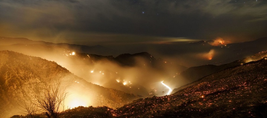
The Thomas Fire
A most precarious situation erupts when a wildfire spreads to an oil field. Besides having a surplus of their super flammable namesake liquid, oil fields are also storage sites for various other hazardous and volatile chemicals. The Thomas Fire was such a scenario.
The Thomas fire burned through the steep foothills of the coastal Los Padres mountains into the oil fields. When in the oil fields, the oil pumped to the surface for production and the stores of flammable chemicals provided explosive fuel to the wildfire. While firefighters were able to get the majority of the fire “contained,” the oil fields were too dangerous to access. According to the community, oil fires remained burning for weeks before they were able to be extinguished.
The Ventura office of the Division of Oil Gas and Geothermal Resources (DOGGR) reported that the Thomas Fire burned through the Taylor Ranch oil fields and a half dozen other oil fields including the Ventura, San Miguelito, Rincon, Ojai, Timbe Canyon, Newhall-Portrero, Honor Rancho and Wayside Canyon. DOGGR Ventura officials said Newhall-Potrero was “half burned over.” Thomas also burned within a 1/3 mile of the Sespe oil field. Schools and other institutions closed down throughout the Los Angeles Basin, but DOGGR said there was no impact on oil and gas operations that far south. The fire spurred an evacuation of the Las Flores Canyon Exxon oil storage facility but thankfully was contained before reaching the facility.
Wildfire threat for oil fields
Map 2. California Wildfires in Oil Fields
View map fullscreen | How FracTracker maps work
The Thomas Fire was not the first time or the last time an oil field burned in a California wildfire. Map 2 above shows state wildfires from the last 20 years overlaid with maps of California oil fields, oil wells, and high threat wildfire zones. The map shows just the oil fields and oil and gas wells in California that have been burned by a wildfire.
We found that 160 of California’s 517 oil fields (31%) have been burned by encroaching wildfires, affecting more than 10,000 oil and gas well heads.
An ominous finding: the state’s highest threat zones for wildfires are located close to and within oil and gas fields.
The map shows that wildfire risk is greatest in Southern California in Ventura and Los Angeles counties due to the arid environment and high population density. Over half the oil fields that have burned in California are in this small region.
Who is at fault?
Reports show that climate change has become the greatest factor in creating the types of conditions conducive to uncontrollable wildfires in California. Climate scientists explain that climate change has altered the natural path of the Pacific jet stream, the high-altitude winds that bring precipitation from the South Pacific to North America.
In a recent study, researchers from the University of Idaho and Columbia University found that the impact of global warming is growing exponentially. Their analysis shows that since 2000, human-caused climate change prompted 75% more aridity — causing peak fire season to expand every year by an average of nine days. The Fourth National Climate Assessment details the relationship between climate change and wildfire prevalence, and comes to the same conclusion: impacts are increasing.
On the cause of wildfires, the report explains:
Compound extremes can include simultaneous heat and drought such as during the 2011–2017 California drought, when 2014, 2015, and 2016 were also the warmest years on record for the state; conditions conducive to the very large wildfires, that have already increased in frequency across the western United States and Alaska since the 1980s.
Both 2017 and 2018 have continued the trend of warmest years on record, and so California’s drought has only gotten worse. The report goes on to discuss the threat climate change poses to the degradation of utilities’ infrastructure. Stress from climate change-induced heat and drought will require more resources dedicated to maintaining utility infrastructure.
The role of public utilities
The timing of this report could not be more ironic considering the role that utilities have played in starting wildfires in California. Incidents such as transformer explosions and the degradation of power line infrastructure have been implicated as the causes of multiple recent wildfires, including the Thomas Fire and the most recent Woolsey and Camp wildfires – three of the most devastating wildfires in state history. As public traded corporations, these utilities have investors that profit from their contribution to climate change which, in turn, has created the current conditions that allow these massive wildfires to spread. On the other hand, utilities in California may be the least reliant on fossil fuels. Southern California Edison allows customers to pay a surcharge for 100% renewable service, and Pacific Gas and Electric sources just 20% of their electricity from natural gas.
As a result of the fire cases, each of which might be attributed to negligence, stock prices for the two utilities plummeted but eventually rebounded after the California Public Utilities Commission (CPUC) assured investors that the utilities would be “bailed out” in the case of a possible financial failure to the reproach of the general public. The CPUC assured that the state could bail out utilities if they were forced to finance recovery for the fires they may have caused.
CPUC President, Michael Picker, stated:
The CPUC is one of the government agencies tasked with ensuring that investor-owned utilities operate a safe and reliable grid… An essential component of providing safe electrical service is the financial wherewithal to carry out safety measures.
Along with regulation and oversight, part of the agency’s work involves ensuring utilities are financially solvent enough to carry out safety measures.
Conclusion
January 1, 2019 will mark the seventh year of drought in California. Each fall brings anxiety and dread for state residents, particularly those that live in the driest, most arid forests and chaparral zones. Data show that the wildfires continue to increase in terms of intensity and frequency as the state goes deeper into drought induced by climate change.
While California firefighters have been incredibly resourceful, over 70% of California forest land is managed by the federal government whose 2019 USDA Forest Service budget reduces overall funding for the National Forest System by more than $170 million. Moving forward, more resources must be invested in supporting the health of forests to prevent fires with an ecological approach, rather than the current strategy which has focused predominantly on the unsustainable practice of fuel reduction and the risky tactics of “fire borrowing”. And of course, the most important piece of the puzzle will be addressing climate change.
For information on protecting your home from wildfires, see this Military Home Search’s Guide.
By Kyle Ferrar, Western Program Coordinator, FracTracker Alliance
Feature image by Marcus Yam, LA Times