
PRIZIO INCREASES TRANSPARENCY IN OIL & GAS DATA IN ALLEGHENY COUNTY
/
A positive move towards increased oil & gas data transparency in Allegheny County
Read the full press release here.
In the age of industrial-scaled oil and gas operations, leasing data is critical for communities and residents to understand what impacts might be coming their way, and where they are likely to occur. While this data is public, it is not easily accessible to the public.
For this reason, in 2016, the FracTracker Alliance worked with West Arete on the Allegheny County Lease Mapping Project, where we obtained oil and gas lease data from the Allegheny County Recorder of Deeds and matched them with parcel data.
This led to the discovery of more than 22,000 lease actions in 117 different municipalities around the county. However, it soon became clear that we would not be able to map most of the lease documents after 2010, because the county’s Recorder of Deeds website lacked the essential data point for tying these lease agreements to a specific location – the parcel’s unique lot and block number.
While we were able to match some of these missing records through other linked documents, it became very clear that there were huge gaps in the lease data that started during the peak years of the Marcellus Shale development boom– the data of greatest significance and importance.
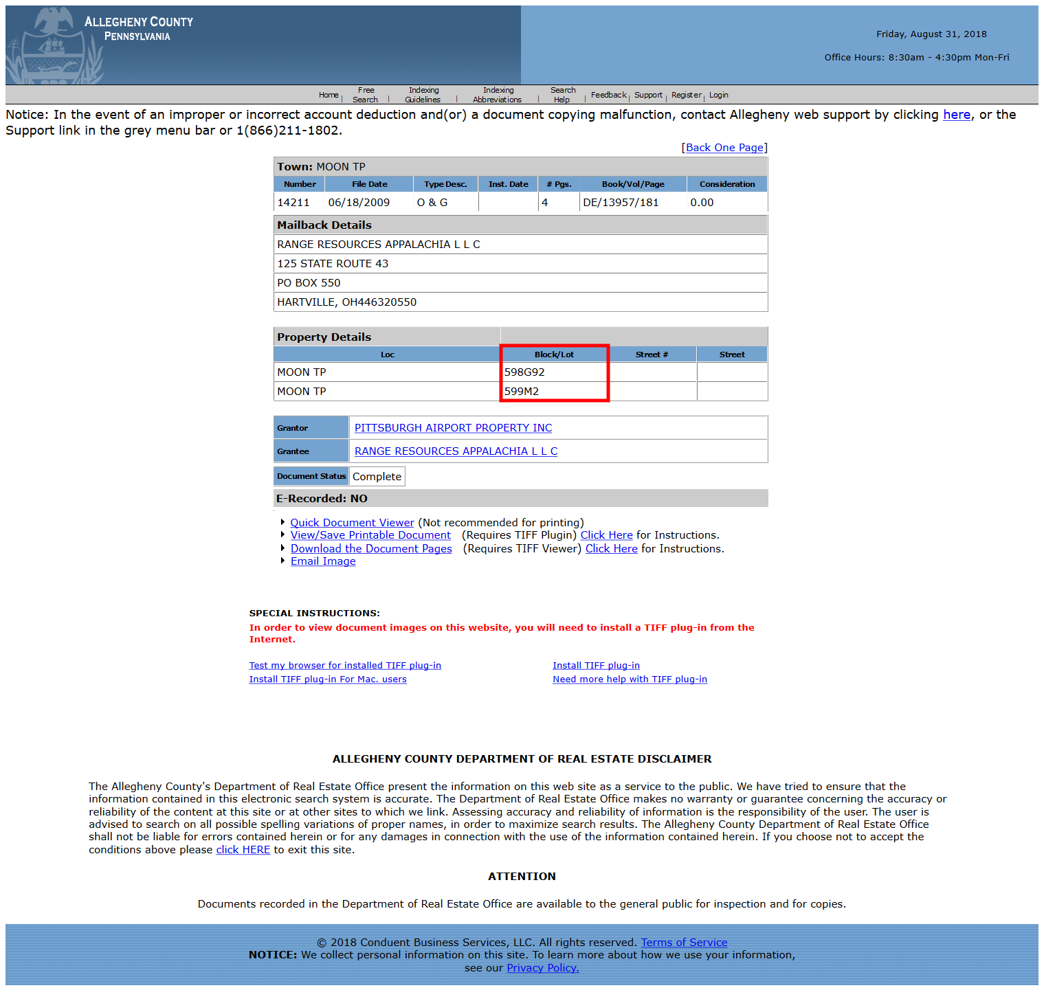
Record from 2009 showing the block & lot number. Click image for larger view.
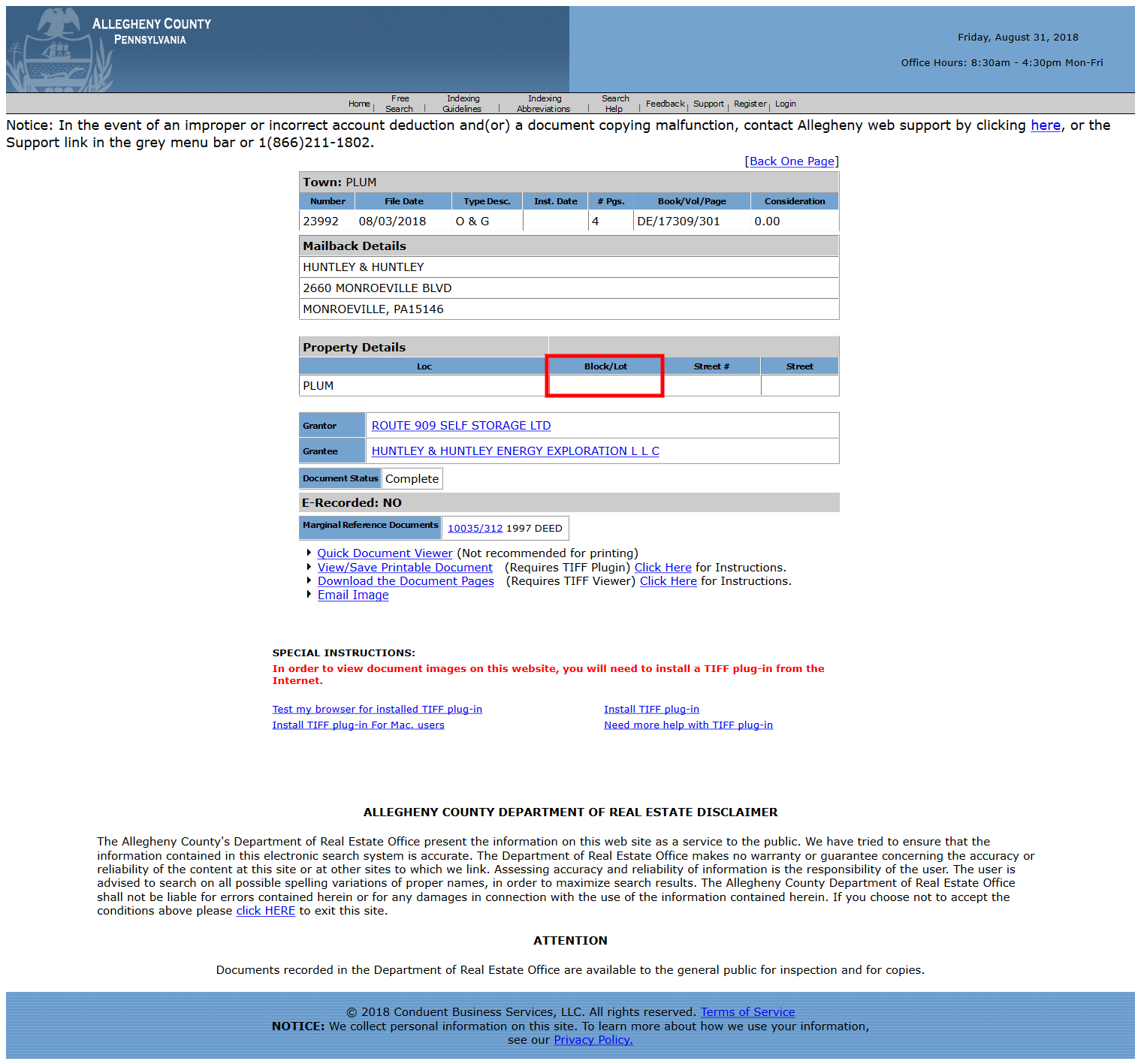
Record from 2018, highlighting missing block & lot number. Click image for larger view.
As more and more communities became impacted, County Council Member Anita Prizio became aware of the situation, and wondered if there was a way for the county to fix the data gaps. We thought that the easiest solution would be to create a lease registry, where oil and gas companies doing business in the county would be required to submit their leased parcels to a publicly available database hosted by the county. While that solution remains ideal in terms of transparency and usability, the county announced today that it will fill in the missing data at the Recorder of Deeds website, a move which the FracTracker Alliance applauds. Once this data is complete, it will be possible for those with advanced skills and resources to use the Recorder of Deeds website to determine where the oil and gas industry has leased land and therefore understand what the future impacts to the county from these operations are likely to be.
By Matt Kelso, Manager of Data & Technology