
Channels of Life: The Gulf Coast Buildout in Texas
It’s been a little over a year since I visited the Texas Gulf Coast to document the oil, gas, and petrochemical landscape with our partners at LightHawk and Scott Humphries, an amazing pilot and Houston native.
Much has happened since then – in regard to and because of – the Gulf Coast’s petrochemical industry.
The fossil fuel landscape along the Gulf Coast is broad, and its impact is heavy.
The area has seen a massive build out over the last five years. New plastics and steel manufacturing facilities and pipelines from the Permian Basin that transport crude to ever-expanding tank farms and marine terminals – all with the blessings of local economic development groups and local government, despite known present and potential hazards.
As these developments continue, communities and workers pay the price. An incident in early December, 2020 left workers injured after a condensate fire at a Citgo tank farm in Corpus Christi. Before that, a pipeline explosion on August 20th in the Corpus Christi Ship Channel resulted in four deaths, with only two of those bodies recovered.
Channels of Life, below, is a short video looking at what is already on the ground, and what is on the horizon. Whether you are pleasure-boating in the channels or driving down the highway, you only see the edge of industrial sprawl that already exists. The depth of the incursion is not visible from the ground. Further down in an interactive Story Map, we give you a rare look from above, while pinpointing various incidents and facilities of concern. Partnering with LightHawk, we flew from Port Aransas, up the La Quinta Channel to the Nueces Delta, and ending at Refinery Row, giving you a bird’s-eye view of the sprawling fossil fuel landscape.
How much more industrial saturation can the Coastal Bend’s public health and ecosystem withstand before it is all sacrificed?
Is it destined to become a sacrifice zone for increasing corporate wealth and prestige?
Channels of Life
In many parts of Texas – as well as in Louisiana and New Mexico – oil, gas, and petrochemical facilities abut schools, backyards, and playgrounds. The Gulf Coast contains 95% of the country’s ethylene capacity and roughly half of the country’s petroleum refining and natural gas processing capacity. This development has propelled a new wave of petroleum and petrochemical infrastructure in recent years. There are 129 planned or recently completed petrochemical facilities in TX and LA alone.
This buildout has enormous consequences for the country’s greenhouse gas emissions, including intensifying climate change; increasing production of (often radioactive) waste and the need for its disposal; and discharging dangerous pollution into frontline communities where health has already been compromised by industry activities.
As the sacrifice builds and the losses mount, economic development corporations advertise the area as prime real estate for more facilities and infrastructure – even as markets steadily move away from fossil fuels. Exports are a tenuous lifeline for an industry drowning in an oversupply of oil and gas, but advocates like the Port of Corpus Christi Authority insist on proposing, financing, and constructing new crude oil and liquefied natural gas (LNG) export terminals along the Gulf Coast, including the BlueWater and GulfLink terminals.
Even with access to global markets, the outlook for this Gulf Coast petrochemical expansion doesn’t look great. Countries that planned to import the US’ fossil fuels are withdrawing interest, citing climate concerns. Major projects are being abandoned, like the petrochemical facility Project Falcon that SABIC had planned to build near Aransas Pass. Frontline communities that have suffered devastating health impacts from the industry for too long are calling out environmental racism and causing major delays for new facilities.
These Texan sites are further captured in the Story Map below, as are the footprints of countless other existing and proposed petrochemical infrastructure sites, from the frac sand mines south of San Antonio down into Corpus Christi Bay, the mushrooming industry along the La Quinta Channel, up the Gulf Coast to Freeport, and finally along the always hectic Houston Ship Channel that empties out into Galveston Bay.
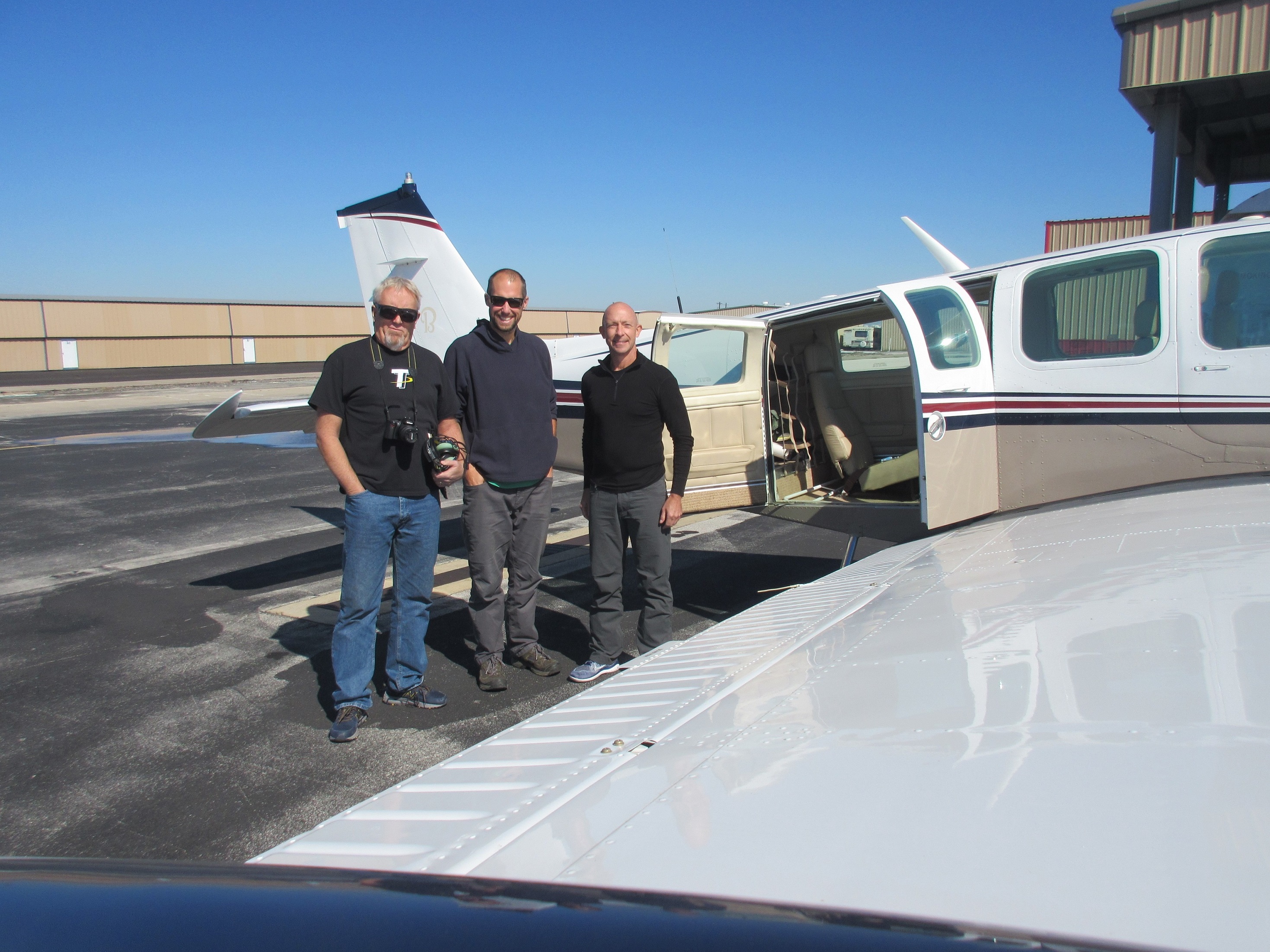
Left to Right: Corpus Christi native and Coastal Alliance to Protect Our Environment (CAPE) member Dewey Magee, FracTracker Alliance’s Ted Auch, and LightHawk pilot Scott Humphries stand outside Scott’s Beechcraft Bonanza A-36 at McCampbell-Porter Airport in Aransas Pass, TX, November 11th, 2019. Photo by Errol Summerlin

The View of Corpus Christi’s Petrochemical Corridor along La Quinta Channel and Tule Lake Shipping Channel from 200’ above McCampbell-Porter Airport in Aransas Pass, TX, November 11th, 2019. Photo by Ted Auch, FracTracker Alliance
I reached out to pilot and native Houstonian Scott Humphries for his thoughts on what he expected and what he gleaned from our flight. He wrote the following:
Question #1: What about our proposed flight interested you as a Texan and/or Houstonian – or just more generally – what interested you about this mission?
I’ve always tried to be environmentally conscious, and always try to have, “think globally, act locally” rummaging around in my head, but this mission (and affiliating with LightHawk generally) presented an opportunity for me to try to (hopefully) have a little more impact than just personally recycling, outlawing Styrofoam cups at our office, etc. Separately, as a longtime Houstonian, I’ve always been proud to live and work in what many refer to as the “Energy Capital of the World.” This mission seemed a useful way to do some small part to help make sure that title continues to be held responsibly.
Question #2: After conducting the flights, or as they were happening, did you learn anything, or have any thoughts that surprised you or realizations about anything particular?
I have flown along the Gulf Coast (including to/from Houston/Corpus Christi) many, many times, and if you’d asked me before this mission, I would have said, ‘Sure, there’s a decent amount of industry along that part of the coast.’ What surprised me while we were flying was two things: (1) there’s not just a decent amount of industry along that part of the coast; rather, along that route, even flying low, you’re rarely – if ever – out of sight of a significant facility of some kind, and (2) the size of the facilities – in other circumstances I’d have been flying much higher and wouldn’t get a good sense of the size of the pads. Flying as we were at just over 1000′, it was striking how massive the various plants were, both in Corpus Christi Bay and along the coast.
Another perspective on this flight and the area we flew over comes from Kevin Sims, Aransas Bay Birding Charters Operator whose Whooping Crane and Pink Spoonbill photos we feature in the story map below. Kevin has been plying the waters in and around Aransas Wildlife Refuge since 1972, and when I contacted him about using some of his photos, he told me the following:
“We need the desalination plants, but the planned discharge points are going to cripple our ecology and the business that rely on it for tourism. They could’ve discharged offshore, but instead they are discharging into the bay, and if it gets too salty the crab populations will plummet, and everything around here depends on crabs and shrimp. If we have a constant influx of brine it could really cripple us. I went to a fantastic meeting from Texas A&M, and their science told them that if red fish larvae migrated into the [Aransas Pass] shipping channel and hit a wall of salty water, they wouldn’t go further, and their population would crash. But despite these facts, they’ve chosen to discharge into the La Quinta Channel, and that is bad news! They were having fairly regular meetings on all of these proposals prior to COVID, but once COVID hit, they went all remote, and less people knew when the meetings were, and the meeting details weren’t widely disseminated … So, the next thing we knew, everything was passed, and they’re gonna [sic] go ahead and do [all of] it.
My perspective comes from a lifetime of fishing and observing the Whooping Crane, and watching them progress from 157 eighteen years ago, to 507 at the present time. Well, I feel this will threaten an endangered species that they’ve been trying to bring back from the brink of extinction since the 1940s. I can remember my dad showing me the cranes in the mid-70s, and there were only 52-55. All of the projects you are mapping have the potential to decimate all the progress made, not to mention money spent on Whooping Crane recovery. From my perspective, it’s a catch-22, ‘cause [sic] the big cities take the water out of the river, and they don’t have the inflows into the bays that they did in the past. We also don’t have the rains that we used to have. The desalination plants would relieve some of that pressure if they would just put that brine offshore. The other species of concern to my industry is the Pink Spoonbills, but the Whooping Crane is the main draw.”
Channels of Life: The Gulf Coast Buildout in TX
A Story Map
This Story Map illustrates the impacts of oil and gas infrastructure from San Antonio down to Corpus Christi, and then up the Gulf Coast to Houston.
The map displays aerial photographs of infrastructure, from frac sand mines and refineries, to chemical plants and offshore drill rig construction sites. This map includes CO2 emissions from oil and gas infrastructure from 2010 – 2018 (weighted by total CO2 during this period in orange), and/or oil refineries and their myriad products (weighted by capacity in black [barrels/day oil equivalents]).
The Story Map also presents detailed information and locations for proposed petrochemical infrastructure in the Corpus Christi Bay region, courtesy of Errol Summerlin and our partners at Coastal Alliance to Protect Our Environment (CAPE). These proposals include dredging projects needed to accommodate more traffic from larger tanker ships, as well as desalination facilities that would collectively intake 758 million gallons of Corpus Christi Bay water each day, and discharge 507 million gallons of brine per day, with an average of 95 and 64 million gallons of desalinated water produced daily, respectively.
The perforated yellow line is the flight path we took with our LightHawk partners. When the viewer scrolls into any given region, they will see SkyTruth incident alerts within five miles of our flight path. The two examples cited at the beginning of this article are just a couple of the nearly 760 such incidents in just the Corpus Christi Shipping Channel since 2011, according to data provided by SkyTruth.
The most recent data in this map is Whooping Crane locations and number counts in TX as of November 2020, courtesy of The Cornell Lab of Ornithology’s eBird data portal. This data speaks to the concerns of Mr. Sims and many of his colleagues who rely on the Whooping Crane’s attraction to birders internationally, and it also highlights that the projects photographed and in the works across Corpus Christi Bay will not just negatively affect the human communities, but will have far reaching impacts on the ecosystems of the western Gulf, and the industries that have relied on these ecosystems for all manner of ecosystems services.
We recommend viewing this map in full screen
Looking forward
Decades of oil and gas development have created a dependency on extractive industries, which has in turn hindered community health and stability.
The Port of Corpus Christi’s controversial dock expansion and Harbor Bridge replacement project at the southern end of Refinery Row has taken over community land and eclipsed their fight to protect their neighborhoods and their public health. Even after an environmental review, the preferred route cuts through these neighborhoods that are surrounded by industry, interstates, and waste treatment facilities – isolated from other residences, and subjected to heavy pollution, noise, and constant hazard.
But with interest and investments declining in the fossil fuel industry and overproduction keeping prices low, the future of the Gulf Coast, its people, environment, and industrial landscape is uncertain – but resistance to extractive industry is strong.
Several activists and environmental coalitions are fighting this project and the industrial onslaught for the health of their communities. For more information on how to support their vision, visit our friends at Coastal Alliance to Protect our Environment (CAPE) and Texas Environmental Justice Advocacy Services (TEJAS).
Thank You
This video, Story Map and article were produced with much gratitude and appreciation for our partners at LightHawk, as well as the support and resources of Scott Humphries, Kevin Sims, and Errol Summerlin.