Unveiling FracMapper, FracTracker’s new mapping system!
Transition to FracMapper
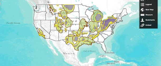
These are exciting times for those of us at FracTracker – now officially the FracTracker Alliance. One of the many changes that we have been working on over the last few months is a new mapping utility for website visitors who want an easy-to-use point and click tool – what we are affectionately calling FracMapper.
FracMapper runs on an Esri-based platform called ArcGIS Online. As those in the GIS world may know, Esri is the largest company in the world that specializes in helping people make maps with GIS technologies. You don’t need to be registered to use FracMapper, although we do highly encourage you to sign up for our monthly e-newsletter, which keeps recipients up-to-date with FracTracker news and information about shale gas.
There are a lot intuitive features available on the new tool as of today’s launch. See the list below for just a few of them. We are also in the process of developing a few more features, including the ability to store and share the data behind the maps. All of this is coming to you this fall as we slowly phase out our existing data/mapping platform (Data.FracTracker.org).
Current FracMapper Features
- Maps by state: PA, WV, OH, NY, etc. and US-wide
- Layers as available by state (permits, violations, drilled wells, etc)
- Search by location
- Save a location and return to it later
- Choose which layers you want to show on the map
- View/hide the legend
- Zoom or pan the map
- Variety of base maps available
- Click on a point or area for more information
- Read text and brief metadata in the “About” section
- Scale bar
- Distance, area, and location measurement tools
- File downloads
- Shape file (polygon/lines)
- CSV – comma-separated values files (points)
- And many more…
Features in Development
- Map exporting and printing (added February 2013)
- Data search (e.g. by permit number)
- Sticky notes
- Clip and ship – Will allow for a targeted download of data from a self-designated an area of interest (e.g. Allegheny County)
- Charting, including within the popup boxes
- Data storage
- Additional states, countries, and map layers
Don’t worry! The data focus of FracTracker.org is only going to grow with the implementation of FracMapper. We are designing the new platform to include the capacity to store and share your data. We are hoping to roll out that feature by spring 2013. Contact us with questions: Info@FracTracker.org.
[survey form below closed]