Portage County, OH Mountaineer Keystone Proposal
Ohio has seen its share of unconventional natural gas extraction in recent years. Now, the state is facing an influx of pipeline infrastructure to manage and distribute the extracted gas. In Portage County, OH, Mountaineer Keystone is of particular interest. FracTracker Alliance and Concerned Citizens Ohio have worked together to better understand the nature and extent of this activity.
Proposal Details
By Gwen Fischer and Trish Harness, Concerned Citizens Ohio, Portage County; Map by Ted Auch
Mt. Keystone will not invest in pipeline easements unless they believe their Return On Investment (ROI) will be great, so we expect them to drill intensively in the areas with many parcels leased and to link those parcels with pipelines wherever they have easements. They may also be seeking new pipeline easements.
Leases and easements are legal documents, and the details (how deep, placement, etc.) are critical to understanding what the industry is allowed to do on the land. Drilling companies don’t always go door to door to get a new lease. Door-to-door “landsmen” need only approach previously unleased properties. If the old lease was open-ended, a drilling company may be able to obtain a permit to drill a deeper well without negotiating new terms. If the lease was restrictive, the drilling company may need to negotiate to put a deep shale well pad or other “surface disturbance” changes not specified earlier. Without examining each lease individually, the map below cannot tell us what exactly is permitted, or where on the property. In addition, landowners should know that (depending on the terms of the lease) leases can be purchased without the owner’s knowledge. Thus, the owner may think they know the drilling company or the oil/gas production company they are dealing with, when in fact the ownership of the drilling or production well has changed.
Another item that the public should be aware of is that obtaining leases for mineral rights does not automatically grant rights for pipeline easements, but the leases could be written so as to allow for both drilling and pipelines.
The easements with Mt. Keystone are for water and waste flowback – but (given some pipeline easements we’ve seen with other companies) it is possible the pipelines could (will) be “re-purposed” for production from shale wells on the leased lands, once the wells are drilled. Even more open-ended options are possible.
About the Map
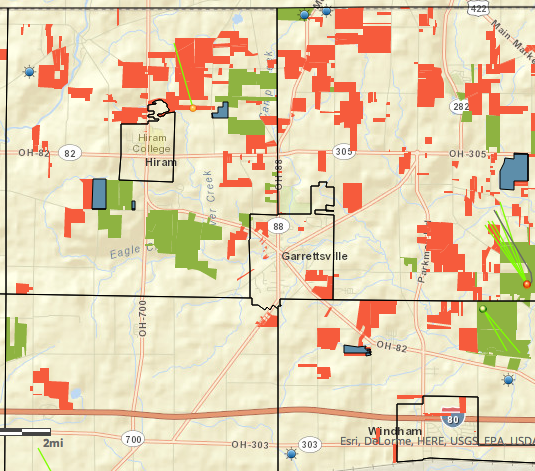
This map shows land parcels with publicly recorded mineral rights leases (for drilling) and Right of Way (ROW) easements for pipelines registered under Mountaineer Keystone’s name. No other company that might hold easements or leases is included. The map was created using public records, available on the Portage County Recorder’s and the Portage County Auditor’s websites. We utilized the raw and updated Portage County parcel shapefile and identified parcels using dummy variables with -1 identifying Mt. Keystone’s leases (825 parcels, 6,455 total acres, average 8 acres), 1 representing Mt. Keystone Right of Ways (ROWs) for pipelines (132 parcels, 2,837 total acres, average 22 acres), and 0 representing neither. Additionally, 14 of these parcels fall under those that have leases and ROWs (353 acres, average 25 acres)**.
Click on the arrows in the upper right hand corner of the map for the legend and to view the map fullscreen.
Well information comes from ODNR (Ohio Department of Natural Resources) data on their website . All of Portage county was checked for leases or easements, and this represents all of the townships and about half of the actual leases.
New mineral rights leases are parcels where a high volume, horizontal shale (HVHS) production well may be drilled, or the horizontal “laterals”may be drilled under the land. The three existing HVHS wells and their laterals are shown. ROW easements are for pipelines. A few parcels have both easements and leased mineral rights. Since permits for future wells have not yet been applied for, we cannot know exactly where on any parcel a well pad or the laterals will be drilled. Properties with leases for wells already drilled are included. Without examining individual easements, we cannot know exactly where on a parcel pipelines will be laid.
** Recently we added 103 parcels from Geauga County parcels that Mountaineer Keystone purchased from Excalibur Oil within the proposed ROW. These parcels total 1,843 acres with a range of 0.45 to 117 acres and a mean of 18 acres to date.
Is this the cause of the explosions we have experienced over the past several months that shake the floor and rattle the windows? Not sure how often they occur as we both work outside the area during the week. We tend to hear AND feel them on Saturday late afternoon or evening when we are home. The one that occurred yesterday, 8/23 around 8:15 pm really startled us. The entire house shook. I am located in the NE corner of Geauga County, 4 miles north of the Portgage County line.
Probably not Paula but what you are experiencing is likely seismic testing. What we are illustrating here is simply properties that have leased to Mountaineer Keystone for pipeline consideration.