A Fresh Look at Oil and Gas Drilling from Europe

By Ted Auch, Kyle Ferrar, and Samantha Rubright with Max Gruenig

Fourteen days is not nearly enough time to fully understand the complex differences between oil and gas drilling issues and policies in the United States and several European Union countries. The EU’s drilling policies, geography, and the industry’s level of activity are quite distinct from those of the States in some cases. Still, as part of the Our Energy Solutions project, four staff from FracTracker Alliance and Ecologic Institute attempted to understand and share as many lessons-learned in Europe as we could in the first two weeks of September. Our interest covered all aspects of oil and gas development, but focused on those relating to the use of stimulation techniques (hydraulic fracturing – fracking) in unconventional reservoirs. Even with significant differences between the US and EU, there is still much to be gleaned in sharing our regulatory approaches, community concerns, and environmental challenges.

“Chaos is merely order waiting to be deciphered” ― José Saramago, The Double 

London, England Meetings

The House of Commons meeting was held in Parliament, just below London's Big Ben

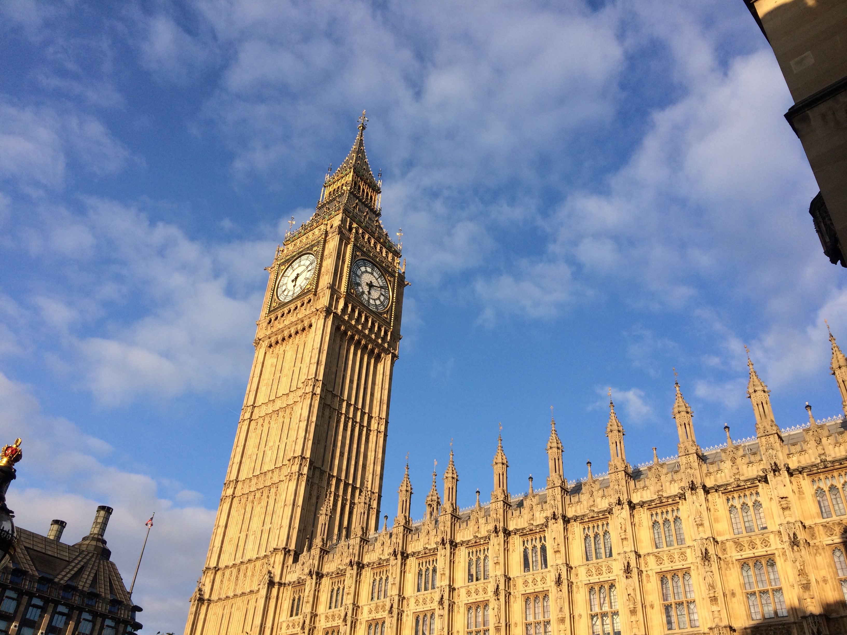
The House of Commons meeting was held in Parliament, just below London’s Big Ben. Photo by Sam Rubright

Our European tour started in London with Ecologic Institute’s Max Gruenig. The first stop was a meeting with University of Salford Professor of Regeneration and Sustainable Development Erik Bichard outside of The Palace of Westminster. Erik has worked extensively to understand and chronicle common threads that weave together community response(s) to hydraulic fracturing (fracking) proposals. Much of Erik’s research in the UK has focused on the efforts of the leading shale gas extraction company in the EU, Cuadrilla Resources, to employ hydraulic fracturing technologies, as well as local oppositions to this development. The major points of contention are in Lancashire County, Northwest England and Balcombe in West Sussex. Erik pointed to the fact that Cuadrilla admitted their claims that the 4% decline in UK energy cost was a result of Lancashire oil and gas exploitation were significantly overstated. Such manipulative statements appear to be cut directly from North American energy’s playbook.

House of Commons meeting, London

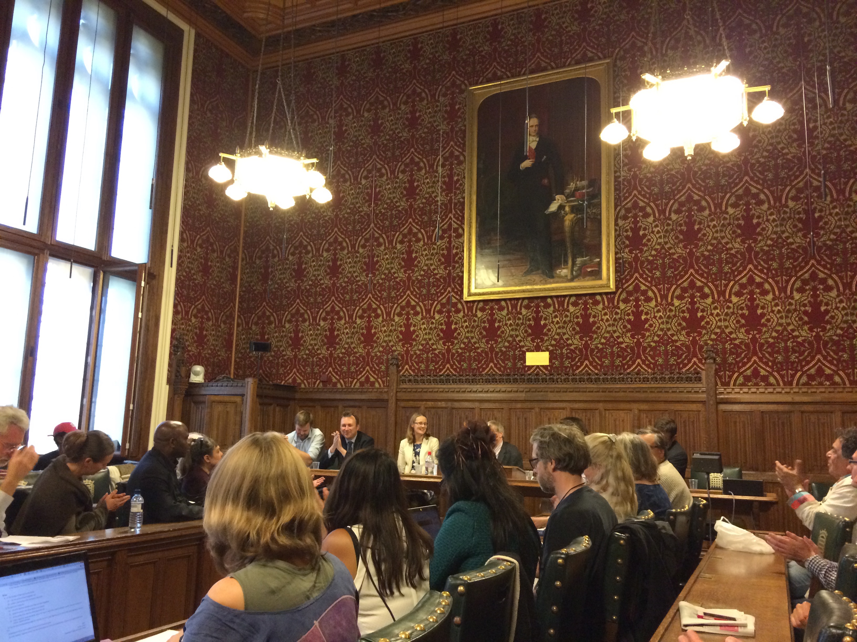
House of Commons meeting, London. Photo by Sam Rubright

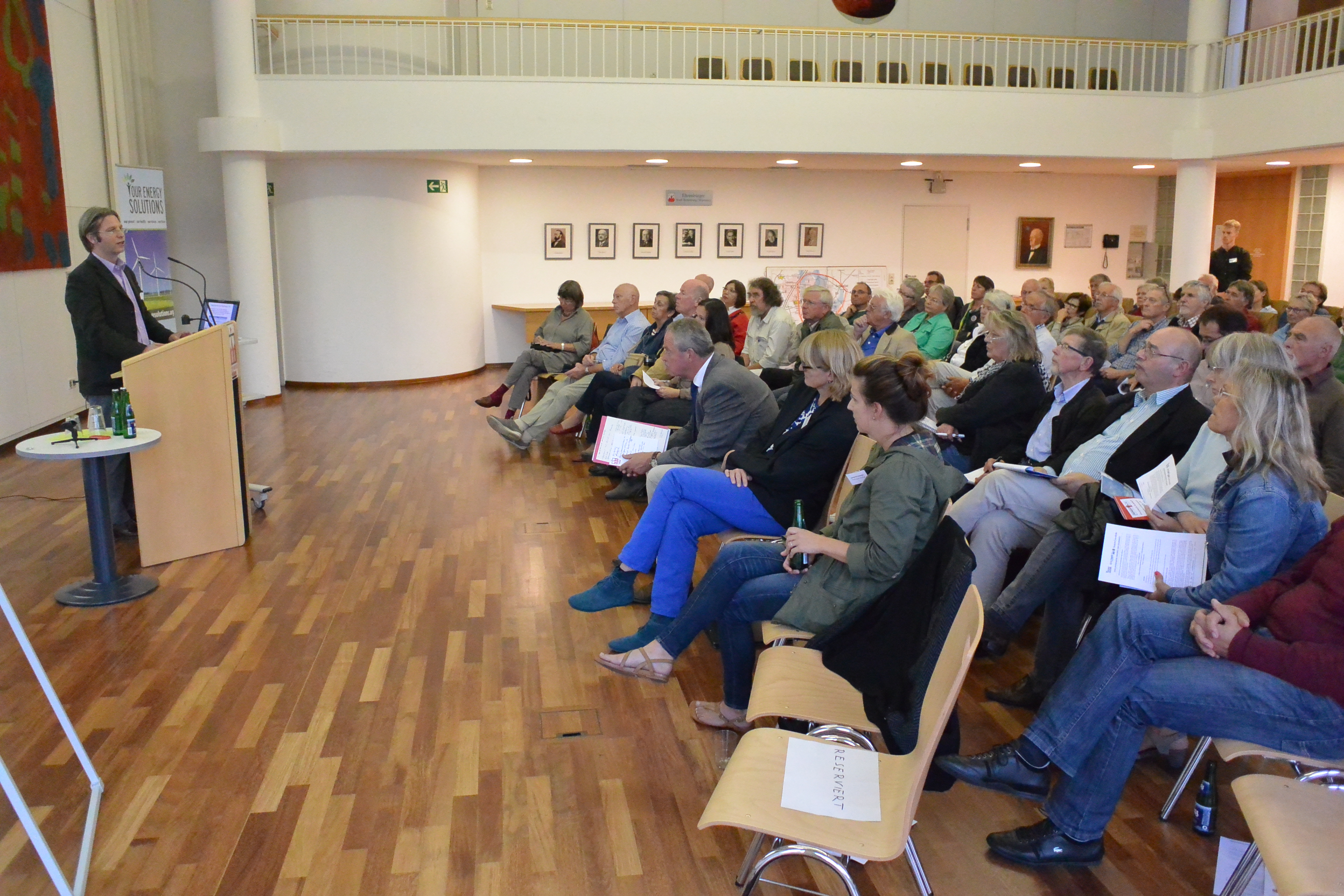
We then attended a spirited Fracking with Nature Meeting at The House of Commons hosted by 21st Century Network and convened by MP Cat Smith (photo right). Many, if not all, of the attendees were concerned about the negative impacts of fracking and oil and gas development in general, but perhaps the event’s purpose self-selected for those attendees. We found the conversations to be very advanced considering that the UK has not seen nearly the same level of oil and gas activity as the US. Most questions centered on the potential for fracking to negatively impact ground water, followed by the induction of earthquakes. Air quality was not discussed as often, despite the serious risks that oil and gas air pollutants pose to health, and the frequency and severity of ambient degradation reported in the US. With the UK’s move to cut subsidies for renewables and a push toward fracking, these concerns may soon become a reality.

We later met with one of the speakers at the House of Commons meeting, Damien Short LLB, MA, PhD, Director of the University of London’s Human Rights Consortium[1] and the Extreme Energy Initiative.[2] NGO’s, we learned, are on the forefront of the issue, debating the need to prioritize community health over corporate profits. They have had quite a lot of success on this front, despite Tory projections.[3] The past state of UK politics under the direction of PM David Cameron, was supportive of extractive industries and corporate interests, blocking any attempt to introduce regulations. Even with the defeat of David Cameron’s administration, new “fast-tracking” rules to accelerate permits for fracking passed in August.[4] The overwhelming victory of democratic socialist Jeremy Corbyn as the leader of the opposition Labour Party – means that the tenure of the current fracking moratoria in North Yorkshire, as well as in Scotland, Wales, and Northern Ireland[5] could be brief.

Our time in London was filled with several other meetings, including one with Greenpeace UK’s new fracking coordinator, Hannah Martin. During our meeting she indicated that while Greenpeace was sympathetic to the views and tactics of Mr. Corbyn, they were concerned that his election would further divide Labour. In her opinion this change could allow the oil and gas sympathetic – and united – Tories to expedite their vision for fracking in the UK.

Regardless of the similarities between community concerns and industry tactics, however, one difference between the UK and US was crystal clear; no matter their view on the use of fracking, Brits support a substantial Petroleum Revenue Tax (PRT) rate to the tune of 50-60%. The PRT will fall to 35% in January, 2016, however. This latter figure is a sizeable decrease but would still be 40% higher than the average in the US.  California for example, the fourth largest producing state, does not and has never levied a severance tax.[6] Unfortunately, the UK is seeing similar conflict of interest issues and deliberate attempts to de-democratize the rule-making around fracking, as demonstrated in a recent move to prevent a proper parliamentary debate about drilling under protected areas in the UK.

Brussels, Belgium Workshop and Meeting

After the European Commission meeting

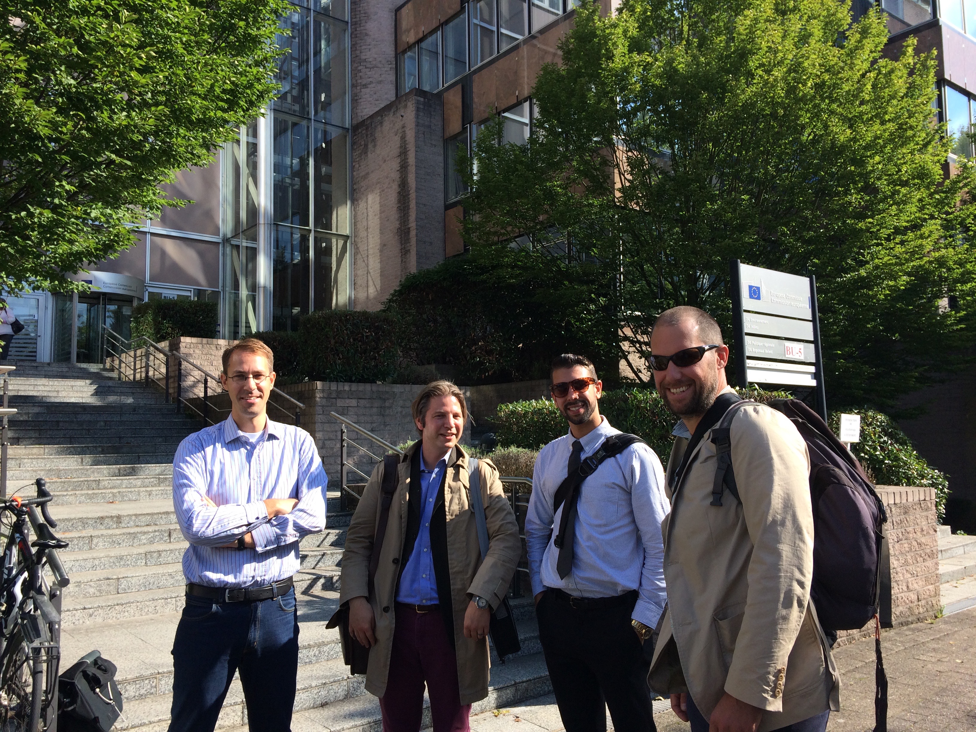
Geert, Max, Kyle, and Ted after our meeting with the European Commission in Brussels. Photo by Sam Rubright

The next phase of OES Europe took us to Brussels to host a community workshop and meet with members of the European Commission’s Directorate-General for Environment. Both events brought to light many concerns and questions about drilling’s safety.

The European Commission is currently drafting a best available techniques reference document (BREF) regarding hydrocarbon extraction for the European Union to consider in December 2015. The recommendations will build upon the “Minimum Principles,” published in January, 2014.[7] Representatives from the European Commission asked us about a variety of concerns that have arisen from drilling in the US, and how Europe might have similar or different experiences. The Commission was most interested in environmental health risks and research focused on exposure to air pollutants, as well as other degraded environmental media (drinking water, soil, etc.). We also shared figures about water consumption, land use, and waste management. It was immediately apparent that the lack of high quality publicly accessible data in the US is making it very difficult for the Commission to make well-informed decisions or policy recommendations. This meeting was arranged by Geert De Cock, of Food and Water Europe, and – interestingly – was one of the first times that the European Commission met with non-industry representatives. (Several major oil and gas players have offices near the European Commission’s in Brussels.)

Rotenburg (Wümme), Germany Workshop

Presentations during Rotenburg Germany workshop, Sept 2015. Photo by Kyle Ferrar

Max presenting during the Rotenburg Germany workshop, Sept 2015. Photo by Kyle Ferrar

Our next stop in Germany was Rotenburg. Lower Saxony also has a long lineage of drilling, with the first well drilled in 1953 and the majority of natural gas development dating back to the mid 1980’s. Currently, this is an area were unconventional oil and gas drilling (fracking) is being heavily proposed and lobbied.

This workshop was by far the most well attended event. A variety of groups and stakeholders, including the town’s mayor, were in attendance and extremely well informed about environmental and public health risks that drilling could pose. They’ve been dealing with a series of environmental health concerns for some time, including high mercury levels in drilling waste and cancer clusters of questionable origin. A systematic statistical analysis has even suggested that cases of Non-Hodgkin lymphoma are higher in an area heavy with oil and gas wells and development.

See maps below for more information about drilling in Germany and Europe at large.

Unconventional gas production, conventional gas drilling, fracking and test boring in Europe
Map by Gegen Gasbohren (Against Gas Drilling)

View Gegen Gasbohren’s map fullscreen

A dynamic map similar to the one above was created by us to show simply where unconventional drilling is occurring in the UK and Netherlands:
View FracTracker’s map fullscreen

Rotenburg Field Tour

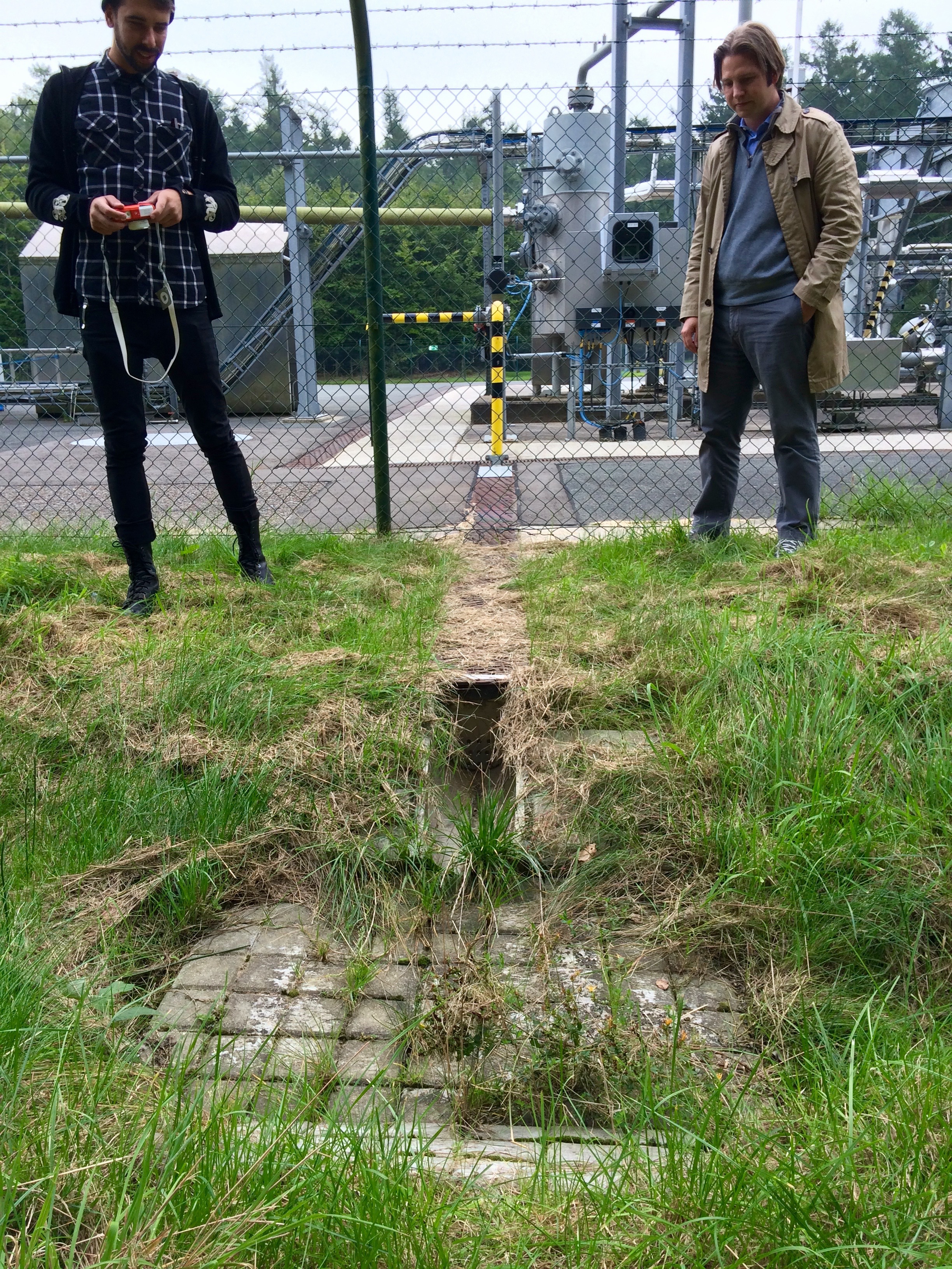
The following morning we set out with a local advocate, Andreas Rathjens, to tour over eight different oil and gas drilling sites and facilities in and around Rotenburg. This area is vey rural and a major agriculture hub, hosting 162k people, 200k cows, and 600k pigs according to our guide.

In recent years Germany has received very positive scores for its environmental policies and shift toward renewables. However, this tour highlighted some of the country’s lingering and poorly-regulated drilling history, which experienced a sharp increase in development here in the 1980’s. The pictures below will give you an idea of the issues that German residents are is still seeing from the country’s older oil and gas drilling operations. Click to enlarge the photos:

Rotenburg, Germany surface water runoff pond on a gas well pad in production

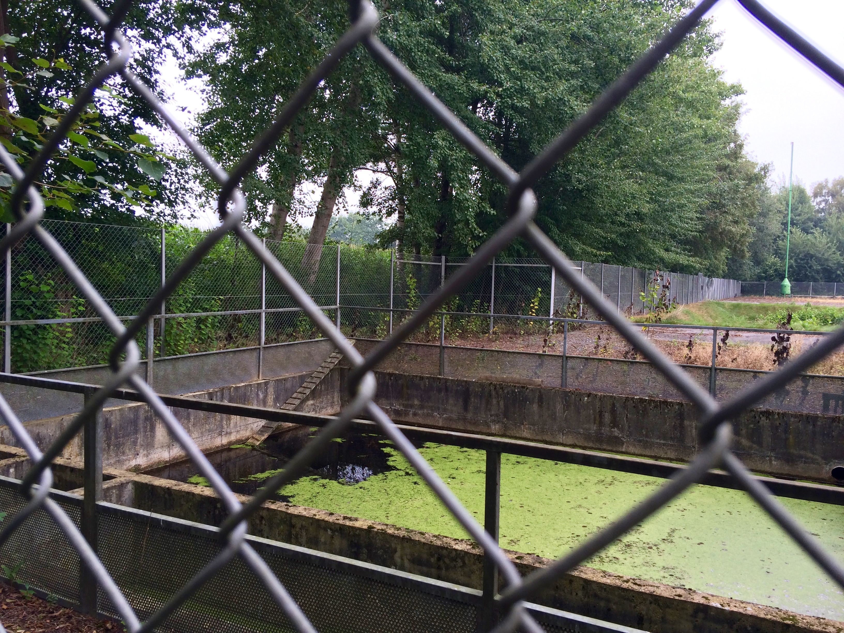
This pit is used to capture rainwater and runoff from the well pad. Since runoff from the pad will carry with it any contaminants spilled on the site, runoff must be quarantined for removal and proper disposal. Unfortunately, these tanks are rarely pumped and drained, and the runoff instead spills into local streams in small watersheds. Such is the case with this tank, with the spillway visible in the lower left corner of the photo.

IMG_0063

This site was recently renovated to improve the drainage off of the wellpad. The drainage leads to an excavated waste pit used as an overflow catchment.[8] In these types of waste pits pollutants evaporate into the air and percolate into groundwater sources. The waste from drilling in this region is known for its high levels of mercury.

Andreas showing us the site where he says 80,000 metric tonnes of solid waste from oil and gas drilling was mixed with residential waste and then disposed of in a field on top of a hill. Residents have tested the site and found troubling levels of arsenic and radioactive elements, but to Andreas’ knowledge no governmental or company testing has been done to-date.

Andreas showing us the site where he says 80,000 metric tonnes of solid  drilling waste was mixed with residential waste and then disposed of in a field on a hilltop. Residents have tested the site and found troubling levels of arsenic and radioactive elements, but to Andreas’ knowledge no governmental or company testing has been done to-date.

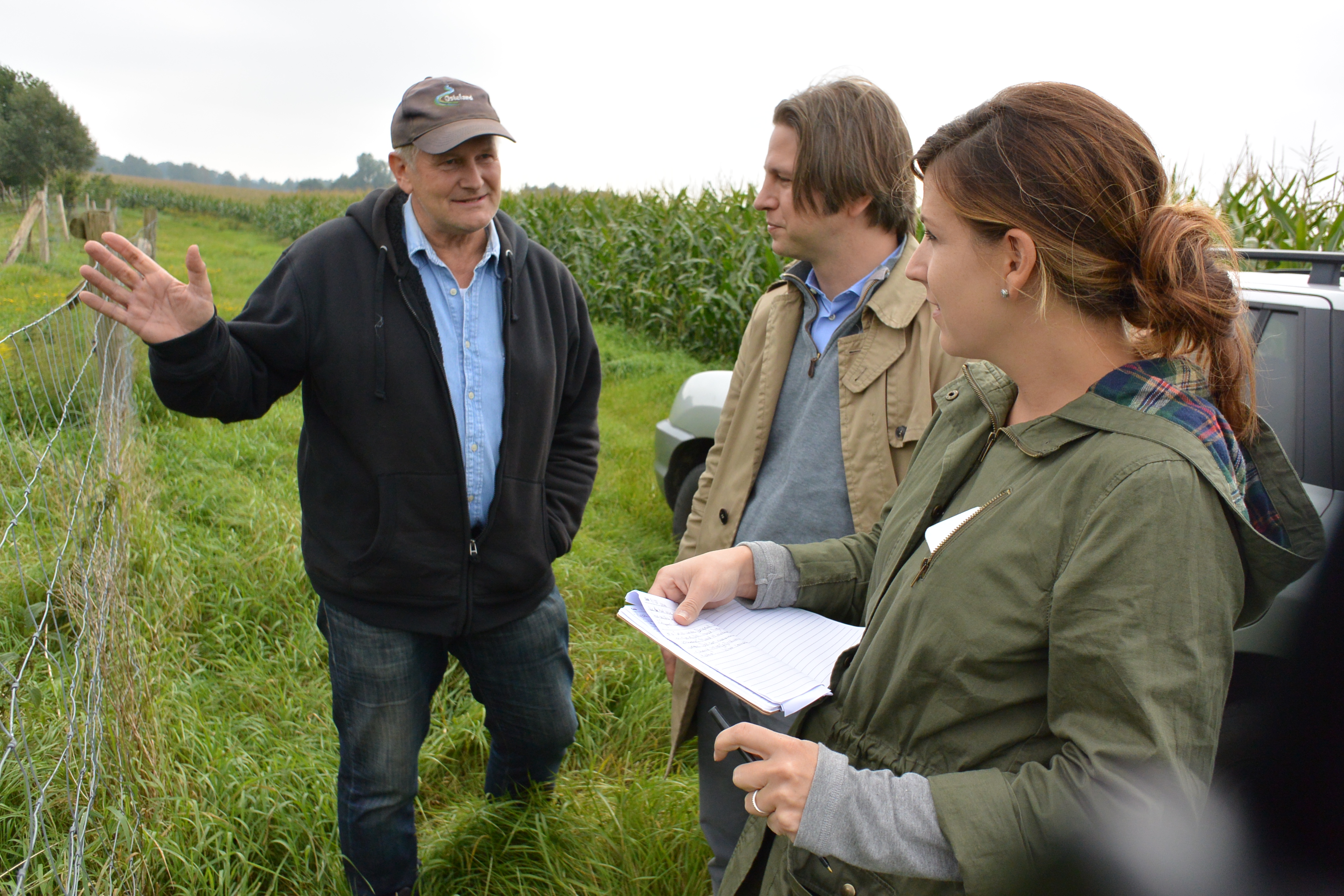
Andreas and community members all conveyed their support of domestic energy production but said they were disappointed in how the oil and gas industry has conducted itself historically in the region. They are very frustrated with how difficult it is to get their concerns heard, a sentiment echoed in many boomtowns across the US. One local politician even discussed the intentionally misleading statements made by the German state governments around environmental health issues. These residents are dedicated and driven despite the barriers, however. They are investigating and studying the problems directly at times, as well as searching for other technologies that can help improve their methods – such as the use of drones to measure air quality.

Badbergen, Lower Saxony, Germany Workshop

Fracking-freies Artland hosted our next workshop in Badbergen Germany. In addition to our presentation about drilling experiences in the US, these community gatekeepers led a presentation summarizing the work and struggles that have been occurring in their region due to both historic and modern drilling. The level of community engagement and activism here was quite impressive, mirroring that of NY State’s anti-drilling groups. These members help to inform the rest of the community about environmental and drilling issues, as Exxon is now considering fracking here again.[9]

Schoonebeek Tour, Netherlands

Our final border crossing brought us to the Schoonebeek region in the Netherlands. While the Groningen gas field is by far the largest of the fields in this Western European country, Schoonebeek is the only active field being drilled unconventionally in the Netherlands.

OES-Europe-Home

Interestingly, the entire field was recently shut down by NAM Shell/Exxon JV to fix this wastewater pipeline. It was discovered that the pipeline was leaking wastewater in nine places due to corrosion caused by the high sulfur content of the wastewater.

Upon starting our tour we were informed of the fact that the Dutch have an even higher extraction tax than the UK! The Netherlands retains a 50% State Profit Share for revenue and taxes the remaining production at a rate of 20% on the first $225,000 in revenue and “25% on the excess.” In comparison, the highest production tax rate on oil and gas drilling in the US is in Alaska at 35%. Most states have significantly lower severance taxes.[10]

Political support for higher taxes on the extractives industry may be explained by the fact that the state owns all subsurface mineral rights in these European countries. Regardless of other influences on perception, such high taxes disproves the notion here in the US that energy companies “won’t do business in a state [or country] with a newly-enacted punitive severance tax.” What do the states do with this extra revenue? The Netherlands and many Northern European countries have invested these monies for the rainy day when the oil and gas supply is depleted or extraction is no longer justifiable. The best examples are Norway’s $850 billion Government Pension Fund and Netherland’s $440 billion pension fund or $169,000 and $26,000 per capita, respectively.

Additional support for severance taxes is likely due to these countries’ history with oil and gas exploration. They are familiar with the boom-bust cycles that come with the initial expectations and long-term reality on the ground. When the music stops, Europeans are determined not to be the ones left standing.


About the Our Energy Solutions Project

This trip to Europe and our previous expeditions to Florida, North Carolina, Argentina, and Uruguay are part of a larger, collaborative project with Ecologic Institute US called Our Energy Solutions. OES is creating an informed global community of engaged citizens, organizations, businesses, governments, and stakeholders to develop ideas and solutions to keep our society moving forward while preserving our planet for the future. Learn more at: ourenergysolutions.org.

On a more personal note, our sincerest thanks goes out to the many groups and individuals that we met on our Europe tour, including those we did not directly mention in this article. We are forever indebted to all of the people with whom we met on these OES trips for sharing their time and knowledge with us.

Endnotes and References

  1. Dr. Short is currently advising local anti-fracking groups in the UK and county councils on the human rights implications of unconventional (extreme) energy extraction processes such as fracking.
  2. Dr. Short and collaborators were recently granted an opportunity to put fracking on trial at hearings to be held by The Permanent Peoples’ Tribunal (PPT) in the UK and the US.
  3. Much of the ammunition used by the anti- or undecided fracking community in the UK – and the EU writ large – is coming from proofs of concept in states like Pennsylvania, Ohio, New York, and North Dakota.
  4. Gosden, Emily. 8/13/15. Fracking: new powers for ministers to bypass local councils. The Telegraph. Accessed 10/25/15.
  5. Strachan, Peter. Russell, Alex. Gordon, Robert. 10/15/15. UK government’s delusional energy policy and implications for Scotland. OilVoice. Accessed 10/25/15.
  6. California, instead, imposes a statewide assessment fee.
  7. European Commission. 1/22/14. Fracking: minimum principles for the exploration and production of hydrocarbons using high-volume hydraulic fracturing. Eur-Lex. Accessed 10/26/15.
  8. A practice that is supposedly now being investigated for soil contamination issues.
  9. Exxon originally wrote in the local/regional paper that there was to be no unconventional shale drilling (fracking), but now the company is reconsidering.
  10. Please note that the cited article was last updated in 2012. Some tax rates have changed since the time that the article was published, but the table still adequately represents an estimation of production taxes by state.
Frac

Interview with Dorina Hippauf – Sentinel Award Winner

Kirk Jalbert, FracTracker’s Manager of Community Based Research & Engagement, interviews Dorina Hippauf, one of FracTracker’s 2015 Community Sentinels Award Winners.

dorina_hippauf

Dorina Hippauf is the Chair of the Research Committee for the Gas Drilling Awareness Coalition (GDAC) of Luzerne County, Pennsylvania, and a contributing member of the Shale Justice Coalition. When a landman came knocking on her door in 2010, offering riches in exchange for a gas lease, Dory took the old saying of “if it sounds too good to be true, it probably isn’t” to heart. This was the starting point that led to her dedicated exploration of the industry’s practices and the creation of the Shale Players project, which now contains over 10,000 entries of who is connected to who in the industry. Dorina is one of three recipients of the 2015 FracTracker Community Sentinels Award. Here we talk with Dory about her work to connect the dots between board rooms, lobbyists, PR firms, astroturf organizations, and government agencies that promote the agendas of the gas industry.


Q: Dorina, perhaps we can begin by your telling me a bit about what brought you to advocacy work related to oil and gas development?

Dorina: What got me into the whole issue of gas drilling was, one, when I was driving to work, I would see flares on hillsides and I didn’t really understand what was going on.  You know, there were big, large flames and my first thought was, something is on fire. Then I realized that from the way it was flaming, it was contained. But I still didn’t know what was going on. And then we had a land man come knock on our door and start offering us a lease. And we only have three quarters of an acre. Originally he was offering $1,000 an acre and when we said we only have three quarters of an acre, he dropped the price to $750. Everything just didn’t sound right. So I started doing some online investigating. I came across the GDAC, which is a local grassroots group in our area. I started attending meetings and I got involved from there.

The big driller here that was signing everybody up was Encana, which is of course based out of Canada. They did three test wells in our area. All three came up dry. Basically we are right at the edge of the productive end of the Marcellus Shale. Encana, shortly after they finished up the last test well, released everybody from their leases and left town in 2011. But I remained active with GDAC because I realized they have to get the gas to market. We’re located along the Transcontinental Pipeline, an ideal place for them to connect to gas hubs for gathering lines. So I knew the whole issue of gas drilling wasn’t going to be over with just Encana leaving our area.


The Shale Players Project

Q: I know that one of the projects that you were instrumental in founding was the Shale Players project. Tell me more about that project, how it began, and what its status is presently?

A: I was at a GDAC meeting and somebody was talking about Encana and the question was asked, who is Encana? So I started Googling them and getting some information and this lead to other connections and I realized that just jotting things down on a piece of paper wasn’t going to give the whole picture. A lot of these companies are all interconnected one way or the other. I created this spreadsheet that grew into the Shale Players project. I have lists of the executives that work at these companies, the Board of Directors, politicians that are connected to them, other front groups, trade agencies, Astroturf, PR firms, and lobbying groups. It has grown to over 10,000 entries now.

Dorina explains Shale Players in her video “Connecting the Dots”

Q: How have you disseminated your findings and what are some of the results that you have seen come from this research?

A: Anyone who wants it, I give it to them. It’s also online on Google Docs. What I hope to do eventually is find someone that is able to put this into a format so it’s searchable online. So that when you type in somebody’s name or a company, it shows all of those connections. I update the online version every three or four months. As for what we’ve done with the results, the Public Accountability Initiative used it when they did their expose on Pennsylvania and gas drilling. Walter Brasch also cited a lot of my work in his book Fracking Pennsylvania. Other groups are using it because they go looking for information on a company that they may be dealing with.

Q: You also do a fair amount of blogging too, correct?

A: Yes, my blog is Frackorporation. When I blog, I usually try to show the connections to the genealogy of some of these organizations to give people a better idea of who they are really dealing with. So many people are looking for a single villain to blame. But it’s all interconnected. And that’s what I’m trying to show people, that this is more than just drilling and fracking and dealing with one company, it also extends to the whole issue of lobbying, the citizen united decision, and with unlimited donations to candidates. A lot of money gets passed around. Alec is involved, the Koch brothers are involved. A lot of big names.


We’re in for the long haul

Q: How do you think your work has made a difference in the public’s understanding of the political and economic landscape of the gas industry?

A: Well, to some extent, it discourages people because they see how large and involved it is. But on the other hand, it also makes them angry and they realize that you have to deal with this issue on a lot of different levels, both in terms of environmental impact, getting the community involved, and that its important to get involved politically. Also, it helps them to determine who to contact if they want to write a letter to a company. Too often we will just send it to the spokesperson who is just reading a script, but that is not whose attention you want to get. Also, the shareholders, they often don’t realize what the company is really doing. If you own one share of a company, you can go to their meetings and make a lot of noise.

Q: So this really is about building community and not just about collecting data. This relates to another project you are involved in called the Shale Justice Coalition. Can you tell me more about the Coalition?

A: The Shale Justice Coalition is a coalition of grassroots groups. Our overall objective is to stop the practice of fracking and to promote alternative energy as a better option. We have members in four or five in the states now as well as some from England and Ireland. Lots of information gets passed around as a result of the coalition — things that are going on in Ohio that we may not know about, things that are going on in New York — we try to share the information, get people interested and make them more aware of the bigger picture of the industry. Many of these groups will get a hold of me personally and ask me to write up a blog post about what is going on in their area. The media is not paying attention. With the Seneca Lake gas storage project there was some emails that were uncovered where Crestwood was telling its employees to boycott all businesses in the towns surrounding the lake that opposed the storage facility. Local groups had tried to get it to reporters who put it on the back burner and didn’t follow-up. I blogged about it, then it got picked up on social media, then the papers finally picked it up. Yeah, I mean, sometimes you have to rattle the cages.


Q: How has this work changed your perspective on the role of making information and data available to the public, in terms of making for better environmental protection?

A: It’s important to get this information out there, to make it readily accessible, easy for people to find and to use. I always thought when I first started this, that I could find one website where I could do a search on companies specifically for fracking and gas and oil drilling. But there wasn’t any. So in a way, with the Shale Players project, I’ve had to fill that niche. Also, a lot of the information I tend to find online I don’t know where they got their information. I take great pains to make sure whatever I put out there has the source link to it, so people can go and look for it themselves.

Q: So what is next for you Dory? What kind of new projects are you planning?

A: At the moment we are fighting the pipelines. I’ve been going around doing presentations at the request of organizations. Talking about what is going on with FERC and how the FERC process works. Letting people know what they need to be aware of the easement agreements and that they do have to negotiate. Just saying “no” to the easement and taking it to the point of imminent domain, if that is the course the company takes, isn’t enough. You have to show good faith and some attempt at negotiating an easement. Otherwise, when you go before the judge, he’s going to side with the company. Unfortunately, I think with these pipelines, unless we get more action from people, these pipelines are going to go through.


Q: Is there anything that you would communicate to other people and groups that are trying to get off the ground to deal with issues related to oil and gas?

A: Yes. One of the biggest things I keep hearing from people is that, when we have meetings or presentations or newspaper articles or whatever, we are only preaching to the choir. But what these groups have to realize is that the choir is growing. Every pipeline and every gas well sparks a new group of concerned people. So, the choir is growing and people are listening. It does get discouraging. It feels like you are losing at Whack-a-Mole. You are not going to get your cookies right now. And there is no one magic bullet that is going to fix everything. You have to deal with FERC, you have to deal with DEP, you have to deal with the government agencies that are involved. You have to consider who your legislators are. And you just can’t get discouraged. Take a break, stay off the computer for a week, recharge your batteries, and get back into it. You are in it for the long haul and you have to be able to make that commitment.

Q: Do you have any concluding thoughts for our readers?

A: People need to get local and be vocal. Tip O’Neil said, all politics are local and that is where it’s going to start. It’s like that movie, Groundswell. That’s grassroots. It starts from the bottom up to make real change. You can’t look at the federal government to fix it for you and the state government isn’t going to fix it either. You have to start locally and building the momentum there. And don’t give up.

About FracTracker Alliance [video]

Learn more about FracTracker Alliance and why we do what we do in this snazzy new video produced by Stony Creek Films.

Oil wastewater pit

Wastewater Pits Still Allowed in California

By Kyle Ferrar, Western Program Coordinator

Above-ground, unlined, open-air sumps/ponds

It is hard to believe, but disposing of hazardous oil and gas wastewaters in unlined, open-air pits – also known as sumps or ponds – is still a common practice in California. It is also permitted in other states such as Texas and West Virginia. Because these ponds are unlined and not enclosed, they contribute to degraded air quality, are a hazard for terrestrial animals and birds, and threaten groundwater quality. A 2014 report by Clean Water Action, entitled In the Pits provides a thorough summary of the issue in California. Since the report was released, new data has been made available by the Central Valley Regional Water Quality Review Board identifying additional locations of wastewater pits.

With the increase of oil and gas development in unconventional reservoirs, such as the Monterey Shale Play in California, the size of the resultant waste stream of drill cuttings, produced brines, and wastewater has skyrocketed. Operators now drill larger, deeper wells, requiring larger volumes of liquid required for enhanced oil recovery methods, such as steam injection, and stimulations such as hydraulic fracturing and acidizing. While California is the 4th largest oil-producing state, it is 2nd only to Texas in wastewater production. This boom of unconventional development, which may still in its infancy in California, has resulted in an annual waste stream of over 130 billion gallons across the state, 80 billion (62%) from Kern County alone.1

Results of the state mandated California Council on Science and Technology Report found that more than half of the California oil industries waste water is “disposed” in pits.2 As outlined by Clean Water Action, the massive waste-stream resulting from drilling, stimulation, and production is one of the most significant and threatening aspects of oil and gas operations in terms of potential impacts to public health and environmental resources.

Wastewater Facility Details

Last February, the LA Times reported on the pits, identifying a total of 933 in California.3 The most recent data from the Regional Water Quality Control Board of the Central Valley shows:

  • A total of 1,088 pits at 381 different facilities
  • 719 pits are listed as “Active.” 369 are “Idle.”
  • 444/939 (47.3%) ponds do not list a permit.
  • 462 pits are operated by Valley Water Management Corporation.

In Table 1, below, the counts of Active and Idle facilities and pits are broken down further to show the numbers of sites that are operating with or without permits. The same has been done for the operator with the most pits in Table 2, because Valley Wastewater operates nearly 9 times as many pits as the second largest operator, E & B Natural Resources Management Corporation. These two operators, along with California Resources Elk Hills LLC, all operate the same number of facilities (28). The other top 20 operators in Kern County are listed in Table 3, below.

Table 1. Wastewater Pit and Facility Counts by Category
Counts Active Idle
Facilities 180 201
Unpermitted Facilities 102 179
Facility Permitted prior to 1985 37 11
Individual Pits 719 369
Unpermitted Individual Pits 187 257
Pit Permitted prior to 1985 252 63


Table 2. Valley Water Wastewater Pit and Facility Counts by Category
Counts Active Inactive
Facilities 21 7
Unpermitted Facilities 2 2
Facility Permitted prior to 1985 9 1
Individual Pits 356 78
Unpermitted Individual Pits 5 9
Pit Permitted prior to 1985 166 35


Table 3. Top 20 Operators by Facility Count, with Pond Counts.
Rank Operator Pond Count Facility Count
1 Valley Water Management Company 462 28
2 E & B Natural Resources Management Corporation 53 28
3 California Resources Elk Hills, LLC 31 28
4 Aera Energy LLC 67 25
5 California Resources Corporation 31 23
6 Chevron U.S.A. Inc. 40 14
7 Pyramid Oil Company 21 12
8 Macpherson Oil Company 14 9
9 Schafer, Jim & Peggy 8 8
10 Crimson Resource Management 20 6
11 Bellaire Oil Company 11 6
12 Howard Caywood 11 6
13 LINN Energy 10 6
14 Seneca Resources Corporation 9 6
15 Holmes Western Oil Corporation 6 6
16 Hathaway, LLC 22 5
17 Central Resources, Inc. 15 5
18 Griffin Resources, LLC 13 5
19 KB Oil & Gas 8 5
20 Petro Resources, Inc. 6 5

Maps of the Pit Locations and Details


The following maps use the Water Authority data to show the locations details of the wastewater pits. The first map shows the number of pits housed at each facility. Larger markers represent more pits. Zoom in closer using the [+] to see the activity status of the facilities. Click the link below the map to open a new webpage. View the names of the facility operators by turning on the layer in the “Layers” menu at the top of the page. The second and third maps show the activity and permit status of each facility. The fourth map allows you to view both activity status and permit status simultaneously by toggling the layers on and off (Open the map in its own webpage, then use the layers menu at the top of the screen to change views).

Map 1. Facility Pit Counts with the top 10 operators identified as well as facility status

Map 1. To view the legend and map full screen, click here.

Map 2. Facility Activity Status

Map 2. To view the legend and map full screen, click here.

Map 3. Facility Permit Status

Map 3. To view the legend and map full screen, click here.

Map 4. Facilityhttps://maps.fractracker.org/lembed/?appid=7385605f018e437691731c94bb589f0a” width=”800″ height=”500″>
Map 4. To view the legend and map full screen, click here.

References

  1. USGS. 2014. Oil, Gas, and Groundwater Quality in California – a discussion of issues relevant to monitoring the effects of well stimulation at regional scales.. California Water Science Center. Accessed 10/1/15.
  2. CCST. 2015. Well Stimulation in California. California Council on Science and Technology. Accessed 9/1/15.
  3. Cart, Julie. 2/26/15. Hundreds of illicit oil wastewater pits found in Kern County . Los Angeles Times. Accessed 9/1/15.

Parked Oil Trains in Berks County, PA

By
Matt Kelso, Manager of Data & Technology
Kirk Jalbert, Manager of Community Based Research & Engagement

The Risks of Crude Oil Trains

As new oil fields boomed across North America in recent years, drillers looked for ways to get the product to refineries thousands of miles away. One solution was to use the nation’s rail infrastructure to ship hundreds of thousands of barrels of crude oil per day. The flow of oil was so great that thousands of additional tanker cars were ordered to get the oil to market. And yet, this solution of transporting crude by rail brought additional problems. Shipping large quantities of highly volatile and combustible crude oil on often antiquated rail lines has resulted in numerous accidents, at times spectacular in scale. In recent months, however, thousands of these oil tankers have been sitting idle on the tracks around the country, partially due to dropping oil prices, leading refineries to opt for cheaper imported oil and less expensive ways to get the domestic product to market such as through pipelines.

Communities Along the Tracks

The interactive story map below investigates a stretch of oil trains that have been parked for months in close proximity to homes, schools, and busy intersections in Berks County, Pennsylvania. Altogether, 30,494 people live in the seven communities through which the tracks in question pass. We began this project in response to concerns from residents who contacted FracTracker for assistance in understanding why these trains were located in their community, what hazards they might pose, and to help people bring this story to the public to foster meaningful discussions about the risks of parked oil trains.

Berks_staticmap


FracTracker has covered the risks of oil trains in a series of other articles. Click here to learn more.

Maps of Updated Central Penn Pipeline Emphasize Threats to Residents and Environment

By Sierra Shamer, Guest Author

The Atlantic Sunrise Project or Central Penn Line is a natural gas pipeline Williams Companies has proposed for construction through eight counties of Central Pennsylvania. Williams intends to connect the Atlantic Sunrise to their two Transco pipelines, which extend from the northeast to the Gulf of Mexico. FracTracker discussed and mapped this controversial project as part of a blog entry in June of 2014; since then, the Atlantic Sunrise Project has been, and continues to be, a focus of unprecedented opposition. While supporters of the pipeline stress how it may enhance energy independence, economic growth, and job opportunities, opponents cite Williams’ poor safety records, their threats of eminent domain, and environmental hazards. This article provides details and maps pertaining to these threats and concerns.

Atlantic Sunrise: Project Overview

The Atlantic Sunrise Project would add 183 miles of new pipeline through the construction of the Central Penn Line North and the Central Penn Line South. The proposed Central Penn Line North (CPLN) begins in Susquehanna County, continues through Wyoming and Luzerne counties, and meets with the Transco Pipeline in Columbia County. With a 30 inch in diameter, it would allow for a maximum pressure of 1,480 psi (pounds per square inch). The proposed Central Penn Line South (CPLS) begins at the Transco Pipeline in Columbia County, and continues through Northumberland, Schuylkill, and Lebanon counties, ending in Lancaster. It would be 42 inches in diameter with a maximum pressure of 1,480 psi. The Atlantic Sunrise project also involves the construction of two new compressor stations, one in Clinton Township, Wyoming County, and the other in Orange Township, Columbia County. Finally, to accommodate the daily 1.7 million dekatherms (1 dekatherm equals 1,000 cubic feet of gas or slightly more than 1 million BTUs in energy) of additional natural gas that would flow through the system, the project proposes the expansion of 10 existing compressor stations along the Transco Pipeline in Pennsylvania, Maryland, Virginia, and North Carolina. Although the Atlantic Sunrise Pipeline would be entirely within Pennsylvania, it is permitted and regulated by the Federal Energy Regulatory Committee (FERC) because through its connection to the Transco Pipeline, it transports natural gas over state lines.

Updated Central Penn Pipeline Route

On March 31, 2015, Williams filed their formal application to FERC docket #CP15-138. Along with the formal application came changes to the pre-filing route of the pipeline that was submitted in the spring of 2014. The route of the Central Penn Line North has been modified since then by 21%, while the Central Penn Line South has been rerouted by 57%.

Williams’ application comprised of hundreds of attached documents, including pipeline alignment sheets for the entire route. Here is one example: 

alignment_sheet_example

These alignment sheets show the extent of William’s biological investigation, the limits of disturbance, the occurrence of stream and wetland crossings, and any road or foreign pipeline crossings. Absent from the alignment sheets, however, is the area around the right-of-way that will be endangered by the presence of the pipeline. This is colloquially known as the “burn zone” or “hazard zone”.

What are “Hazard Zones”?

A natural gas pipeline moves flammable gas under extreme pressure, creating a risk of pipeline rupture and potential explosion. The “potential impact radius” or “hazard zone” is the approximate area within which there will be immediate damage in the case of an explosion. Should this occur, everything within the hazard zone would be incinerated and there would be virtually no chance of escape or survival. Based on pipeline diameter and pressure, the hazard zone can be calculated using the formula: potential impact radius = 0.69 * pipeline diameter * (√max pressure ).

Based on this formula, the hazard zone for the Central Penn Line North, with its diameter of 30 inches and maximum pressure of 1,480 psi, is approximately 796 feet (243 meters) on either side of the pipeline. The hazard zone for Central Penn Line South, with its diameter of 42 inches and maximum pressure of 1480 psi, is 1,115 feet (340 meters) on either side.

Many residents are unaware that their homes, workplaces, and schools are located within the hazard zone of the proposed Atlantic Sunrise Pipeline. Williams does not inform the public about this risk, primarily communicating with landowners along the right-of-way. The interactive, zoomable map (below) of the currently proposed route of the Atlantic Sunrise, Central Penn North and South pipelines depicts the pipeline right-of-way, as well as the hazard zones. The pipeline route was digitized using the alignments sheets included in Williams’ documents submitted to FERC. You can use this map to search home, work, and school addresses to see how the pipeline will affect residents’ lives and the lives of their communities.

Click in the upper right-hand corner of the map to expand to full-screen view, with a map legend.

Affected Communities

Landowners & Eminent Domain

Landowners along the right-of-way are among the most directly and most negatively impacted by the Atlantic Sunrise Pipeline, and other similar projects. Typically, people first become aware that a pipeline is intended to pass through their property when they receive a notice in the mail. Landowners faced with this news are on their own to negotiate with the company, navigate the FERC permitting and public comment process, and access unbiased and pertinent information. They face on-going stress, experiencing pressure from Williams to sign easement agreements, concern about the effects of construction on their property, and fear of living near explosive infrastructure. They must also consider costs of legal representation, decreases in property value, and limited options for mortgage and refinancing.

Sometimes, landowners in a pipeline’s right-of-way choose to not allow the company onto their property to conduct a survey. Landowners may also refuse to negotiate an agreement with the pipeline company. In response, the pipeline company can threaten to seize the property through the power of eminent domain, the federal power allowing private property to be taken if it is for the “public use.”

The law of eminent domain states that landowners whose properties are condemned must be fairly compensated for their loss. However, most landowners feel that in order to be fairly compensated by the company, they must hire their own land appraiser and attorney. This decision can be costly, however, and may not be an option for many people. The legitimacy of Williams’ intent to use eminent domain is contested by opponents of the project, who cite how “public use” of the property provides no positive local impacts. The Atlantic Sunrise Pipeline is intended to transport gas out of Pennsylvania through the Transco, so the landowners in its path will not benefit from it at all. Further, it connects to a network of pipelines leading to current export terminals in the Gulf of Mexico, as well as controversial planned export facilities like Cove Point, MD .

Throughout Pennsylvania, communities have responded to the expansion of pipelines, and to the threats of large companies like Williams. The need for landowner support has been addressed by organizations such as the Shalefield Organizing Committee, Energy Justice Network, the Clean Air Council, the Gas Drilling Awareness Coalition, and We Are Lancaster County. These organizations have worked to provide information, increase public awareness, engage with FERC, and develop resistance to the exploitation of Pennsylvania’s resources and residents. Director Scott Cannon of the Gas Drilling Awareness Coalition has documented firsthand the impacts of unconventional drilling in Pennsylvania through a short film series called the Marcellus Shale Reality Tour. The most recent in the series relates the stories of two landowners impacted by the Atlantic Sunrise Pipeline in the short film Atlantic Sunrise Surprise.

Environmental Review

Theoretically, environmental review of this proposed pipeline would be extensive. Primary decision-making on the future of the Atlantic Sunrise rests with FERC. Due to the National Environmental Policy Act of 1969 (NEPA), all projects overseen by federal agencies are required to prepare environmental assessments (EAs) or environmental impact assessments (EIAs). Because FERC regulates interstate pipelines, EA’s or EIA’s are required in their approval process. These assessments are conducted to accurately assess the environmental impacts of projects and to ensure that the proposals comply with federal environmental laws such as the Endangered Species Act, and the Clean Air and Water Acts. On the state level, the Pennsylvania Department of Environmental Protection (PA DEP) issues permits for wetlands and waterways crossings and for compressor stations on regional basis.

Core Habitats, Supporting Landscapes

The route of the Atlantic Sunrise Pipeline will disturb numerous areas of ecological importance, including many documented in the County Natural Heritage Inventory (CNHI). The PA Department of Conservation and Natural Resources conducted the inventory to be used as a planning, economic, and infrastructural development tool, intending to avoid the destruction of habitats and species of concern. The following four maps show the CNHI landscapes affected by the current route of the Atlantic Sunrise pipeline (Figures 1-4).

Figure 1

Figure 1. Columbia & Northumberland counties

Figure 3. Lebanon County

Figure 2. Lebanon & Lancaster counties

Figure 3. ddd

Figure 3. Threatened Core Habitats

Figure 4. Schuyklill

Figure 4. Schuyklill & Lebanon counties

The proposed pipeline would disrupt core habitats, supporting landscapes, and provisional species-of-concern sites. According to the Natural Heritage Inventory report, core habitats “contain plant or animal species of state or federal concern, exemplary natural communities, or exceptional native diversity.” The inventory notes that the species in these habitats will be significantly impacted by disturbance activities. Supporting landscapes are defined as areas that “maintain vital ecological processes or habitat for sensitive natural features.” Finally, the provisional species of concern sites are regions where species have been identified outside of core habitat and are in the process of being evaluated. The Atlantic Sunrise intersects 16 core habitats, 12 supporting landscapes, and 6 provisional sites.

Active Mine Fires

Map5-GlenBurn

Figure 5. Glen Burn Mine Fires

The current route of the Atlantic Sunrise intersects the Cameron/Glen Burn Colliery, considered to be the largest man-made mountain in the world and composed entirely of waste coal. This site also includes a network of abandoned mines, three of which are actively burning (Figure 5).

The pipeline right-of-way is roughly a half-mile from the closest burning mine, Hickory Swamp. These mine fire data were sourced from a 1988 report by GAI Consulting Inc. The time frame for the spread of the mine fires is unknown, and dependent on environmental factors. Mine subsidence — when voids in the earth created by mines cause the surface of the earth to collapse — is another issue of concern. Routing the pipeline through this unstable area adds to the risk of constructing the pipeline through the Glen Burn region.

Looking Ahead

The Atlantic Sunrise Project has received an unprecedented level of resistance that continues to grow as awareness and information about the threats and hazards develops. While Williams, FERC, and the PA DEP negotiate applications and permits, work is also being done by many non-profit, research, and grassroots organizations to investigate the environmental, cultural, and social costs of this pipeline. We will follow up with more information about this project as it becomes available.


This article was written by Sierra Shamer, an environmental mapper and activist. Sierra is a member of the Shalefield Organizing Committee and holds two degrees from the University of Maryland, Baltimore County: a B.A. in environmental studies and an M.S. in geography and environmental systems.