Risks from Colorado’s Natural Gas Storage and Transmission Systems
Worst Case Scenario
A house exploding from a natural gas leak sounds straight out of a 19th century period drama, but this tragedy just recently occurred in Firestone, Colorado. How could this happen in 2017? We have seen pictures and read reports of blowouts and explosions at well sites, and know of the fight against big oil and natural gas pipelines across the country. At the same time we take for granted the natural gas range that heats our food to feed our families. The risk of harm is seemingly far removed from our stove tops, although it may be much closer to home than we think – There are documented occupational hazards and compartmentalized risks in moving natural gas off site.
Natural gas is an explosive substance, yet the collection of the gas from well sites remains largely industry-regulated. Unfortunately, it has become clear that production states like Colorado are not able to provide oversight, much less know where small pipelines are even located. This is particularly dangerous, since the natural gas in its native state is ordorless, colorless, and tasteless. Flowing in the pipelines between well sites and processing stations, natural gas does not contain the mercaptan that gives commercial natural gas its tell-tale odor. In fact, much of the natural gas or “product” is merely lost to the atmosphere, or much worse, can collect in closed spaces and reach explosive levels. This means that high, potentially explosive levels of methane may go undetected until far too late.
Mapping Flow Lines
As a result of the house explosion in Firestone on April 17th CO regulators are now requiring oil and gas operators to report the location of their collection flow pipelines, as shown in Figure 1.
Figure 1. Map of Gathering Pipeline “Flowlines”
The locations of the collection of pipeline “flowlines”, like the uncapped pipeline that caused the house explosion in Firestone, have been mapped by FracTracker Alliance (above). The dataset is not complete, as not all operators complied with the reporting deadline set by the COGCC. For residents living in the midst of Colorado’s oil and gas production zones, addresses can be typed into the search bar in the upper left corner of the map. Users can see if their homes are located near or on top of these pipelines. The original mapping was done by Inside Energy’s Jordan Wirfs-Brock.
Underground Storage
When natural gas is mixed with mercaptan and ready for market, operators and utility companies store the product in UGS fields. (EDIT – Research shows that in most cases natural gas in UGS fields is not yet mixed with mercaptan. Therefore leaks may go undetected more easily. Aliso Canyon was a unique case where the gas was being stored AFTER being mixed with mercaptan. Odorization is not legally required until gas moves across state lines in an interstate pipeline or is piped into transmission lines for commercial distribution.) In August 2016, a natural gas storage well at the SoCal Gas Aliso Canyon natural gas storage field failed causing the largest methane leak in U.S. history. The Porter Ranch community experienced health impacts including nosebleeds, migraines, respiratory and other such symptoms. Thousands of residents were evacuated. While Aliso Canyon was the largest leak, it was by no means a unique case.
FracTracker has mapped the underground natural gas storage facilities in Colorado, and the wells that service the facilities. As can be seen below, there are 10 storage fields in Colorado, and an 11th one is planned. All the fields used for storage in Colorado are previously depleted oil and gas production fields. The majority of storage wells used to be production wells. All sites are shown in the map below (Figure 2).
Figure 2. Map of Natural Gas Underground Storage Facilities
View map fullscreen | How FracTracker maps work
Impacted Populations
Our analysis of Colorado natural gas storage facilities shows that 6,673 Colorado residents living in 2,607 households live within a 2.5 mile evacuation radius of a UGS well. The majority of those Coloradans (5,422) live in Morgan County, with 2,438 in or near the city of Fort Morgan. The city of Fort Morgan is surrounded by the Young Gas Storage Facility with a working capacity of 5,790,049 MCF and Colorado Interstate Gas Company with a working capacity of 8,496,000 MCF.
By comparison, the failure in Aliso Canyon leaked up to 5,659,000 MCF. A leak at either of these facilities could, therefore, result in a similar or larger release.
UGS Well Risk Assessment
A FracTracker co-founder and colleague at Harvard University recently completed a risk assessment of underground natural gas storage wells across the U.S. The analysis identified the storage wells shown in the map above (Figure 1) and defined a number of “design deficiencies” in wells, including “single-point-of-failure” designs that make the wells vulnerable to leaks and failures. Results showed that 2,715 of the total 14,138 active UGS wells across the country were constructed using similar techniques as the Aliso Canyon failed well.
Applying this assessment to the wells in Colorado, FracTracker finds the following:
- There are a total of 357 UGS wells in Colorado.
- 220 of which are currently active.
- Of those 220 UGS wells, they were all drilled between 1949 and 1970.
- 43 of the UGS wells are repurposed production wells.
- 40 of those repurposed wells are the highest risk single barrier wells.
Specifically focusing on the UGS fields surrounding the city of Fort Morgan:
- 21 single barrier wells are located in the Flank field 2.5 miles North of the city.
- 13 single barrier wells are located in the Fort Morgan field 2.5 miles South of the city.
We originally asked how something as terrible as Firestone could have occurred. Collectively we all want to believe this was an isolated incident. Sadly, the data suggest the risk is higher than originally thought: The fields with the largest number of “single-point-of-failure” high-risk UGS wells are also the two fields in Colorado nearest communities. While the incident in Firestone is certainly heartbreaking, we hope regulators and operators can use the information in this analysis to avoid future catastrophes.
By Kyle Ferrar, Western Program Coordinator, FracTracker Alliance
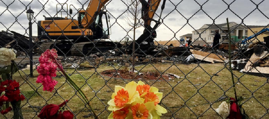
Feature Image: Heavy equipment moves debris from the site of a house explosion April 17, 2017 in Firestone, Colorado, which killed two people. (David Kelly / For The Times)
Trackbacks & Pingbacks
[…] 20, 2017/0 Comments/in Articles, Data and Analysis /by Kyle Ferrar, […]
Comments are closed.