
User Guide
This user guide is intended to help you navigate the various features found on our Allegheny Lease Mapping System. The interface we’ve developed offers a variety of functions that allow you to filter parcels shown on the map and see information for individual parcels. Other features include toggles for different basemaps, well permits, and drilled wells. Below we describe those features in more detail.
For more information on how we determined what data shows on the maps, see the Data Scraping & Mapping Methods page.
Toggling Features
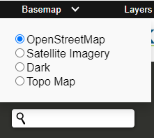
A number of features can be used to help provide some context to these mapped oil and gas agreements. Four basemaps are available:
- “OpenStreetMap” is useful to get a general lay of the land
- Switching to “Satellite Imagery” provides a more accurate depiction of what’s currently in that location
- “Dark” mode tones down the brightness
- “Topo Map” is useful for getting an idea of what lies both up and down stream
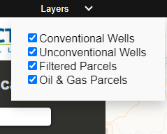
The other toggling feature is layers. In addition to the default “parcels” map layer as well as your filtered parcel layer, which shows properties in the database associated with some kind of oil and gas transaction, other layers show conventional and unconventional wells in the county.
Filtering Results
The purpose of the Allegheny Lease Mapping Project was to obtain and map all parcels found in the county to have some kind of oil and gas related transaction. By default, all parcels in the project database are shown when the map is launched. However, there are many reasons why one would want to view a subset of these parcels. A number of filters are provided to narrow down what shows on the map: date range, record type, company, municipalities, school districts, and zoning.
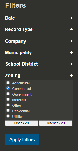
Within each filter category users can select individual options. A “Check All” and “Uncheck All” button are available to make the process convenient. A few details on these filters:
First, filter by company is limited to those with a substantial number of parcels in the database (over 50). Remaining companies are grouped under the “other” option. It is important to note that this filter does not show which companies own property leases at the present moment (or at a given date). The company filter only selects records in the database where the “grantee” matches the selected companies within the selected date range.
Second, these filter windows do not function independent of one another. For instance, if you were to select only “Churchill” from the list of municipalities and only “City of Pittsburgh” from the list of school districts, no parcels will appear on the map. This is because no parcels exist in Churchill that are also in the City of Pittsburgh school district.
Once you have set up the filters accordingly, clicking the “Apply Filters” button redraws the map using a subset of data matching the filters.
Viewing Parcel Details
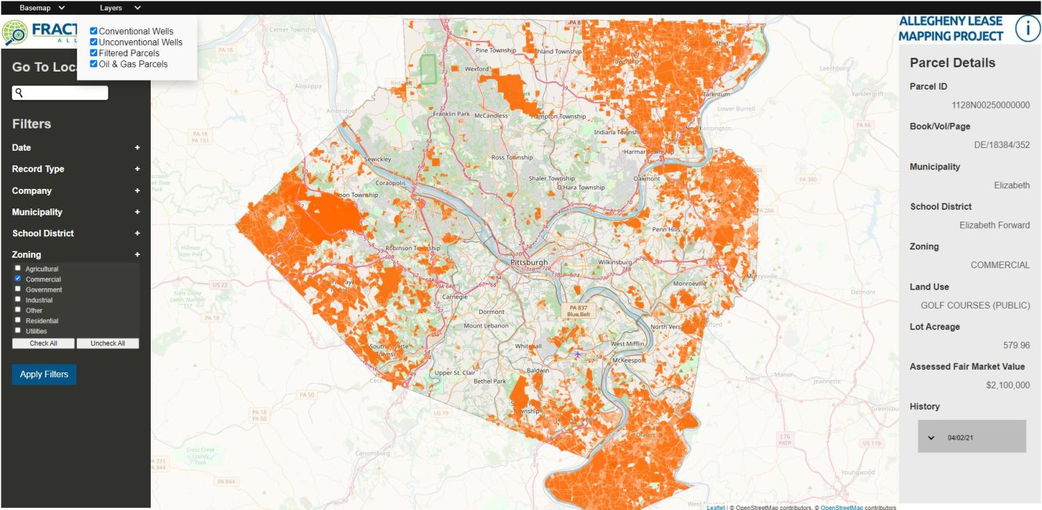
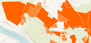
Each orange polygon on the map corresponds to a unique parcel of land. Darker orange shading denotes parcels with multiple oil and gas records in the database.
Clicking on a parcel populates the sidebar with the polygon’s information. This window contains all of the information that exists in our database for the particular parcel including:
- Parcel ID (also known as a Block/Lot)
- Book/Vol/Page
- Municipality
- School District
- Zoning
- Land Use (a zoning sub-category)
- Lot Acreage
- Its Assessed Fair Market Value
Also in this window is the history of transactions. This list contains all of the oil and gas related records we were able to obtain for the parcel. For more information on what these transactions mean, see the Understanding Oil & Gas Agreements page. Click on the date to reveal the grantor, grantee and link to each record to the original document on the Allegheny County’s Department of Real Estate Office website.
Viewing Wells
Similar to the Parcel Details sidebar, clicking on a drilled well or permit brings up a window with more details including:
- Well Name
- API Number (a unique identifier used by the state)
- Operator
- Permit Date (the date of permit issue) or Drilled Date (also known as SPUD)
- Well Type (gas or oil)
- Configuration (vertical or horizontal well)
- Unconventional (true or false)
We hope you have found this user guide helpful. If you feel like you are ready, explore the map. However, if after reviewing this user guide you still have questions about how to operate the Allegheny County Lease Map, just ask us: info@fractracker.org.