The majority of FracTracker’s posts are generally considered articles. These may include analysis around data, embedded maps, summaries of partner collaborations, highlights of a publication or project, guest posts, etc.
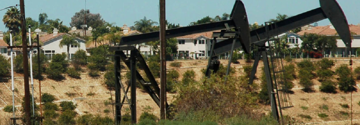
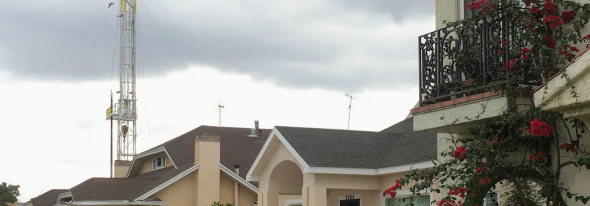
It’s Time to Stop Urban Oil Drilling in Los Angeles
Oil & gas wells in Los Angeles disproportionately impact marginalized communities, producing dangerous levels of invisible, toxic emissions.
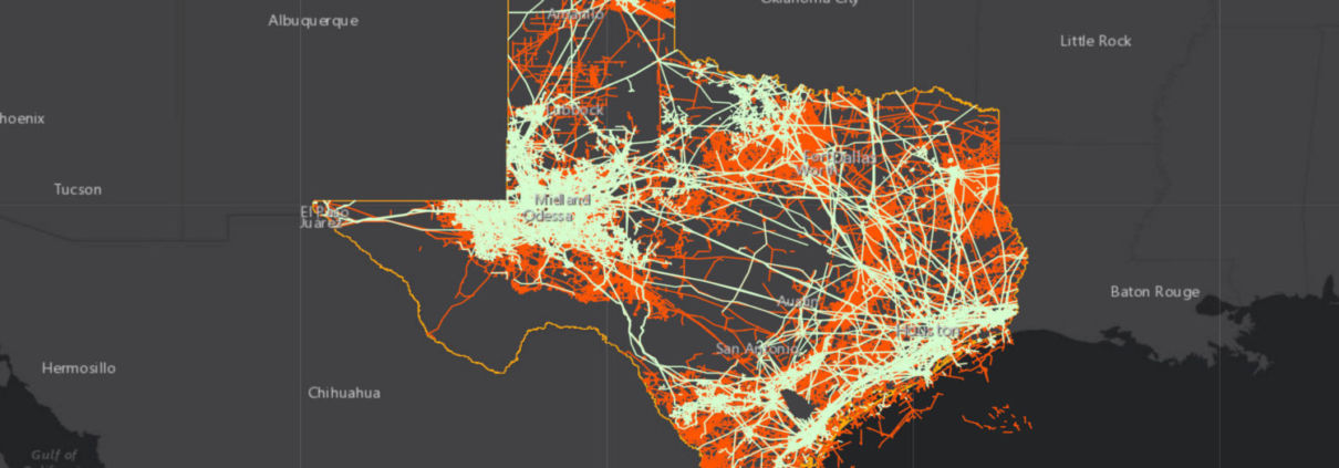
Infrastructure Networks in Texas
This map illustrates infrastructure networks in Texas and explores how these unseen webs connect us and improve lives, but also carry risks and burdens.
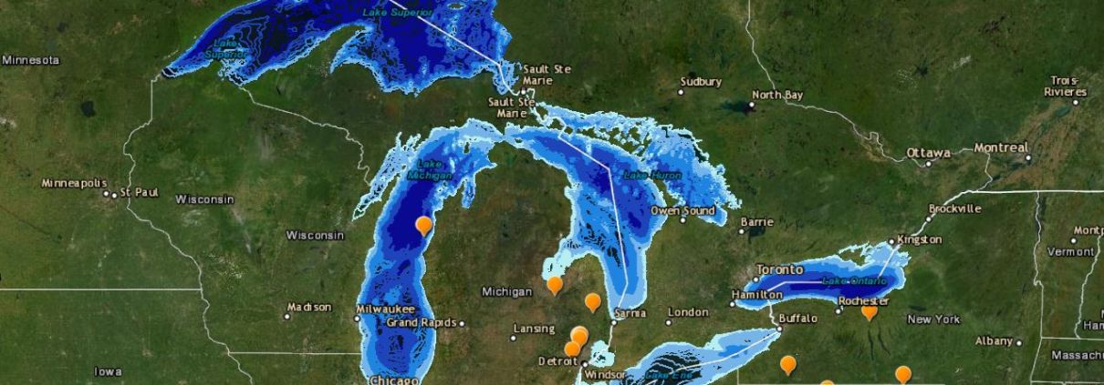
FracTracker in the Field 2021: the Great Lakes expedition
In this special one-day fundraiser event, the FracTracker team built a virtual map of energy infrastructure in states around the Great Lakes.

California Prisons are Within 2,500’ of Oil and Gas Extraction
California prisoners are on the frontlines of the environmental justice movement, thousands living within 2,500’ of operational O&G wells.
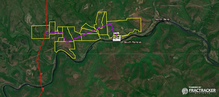
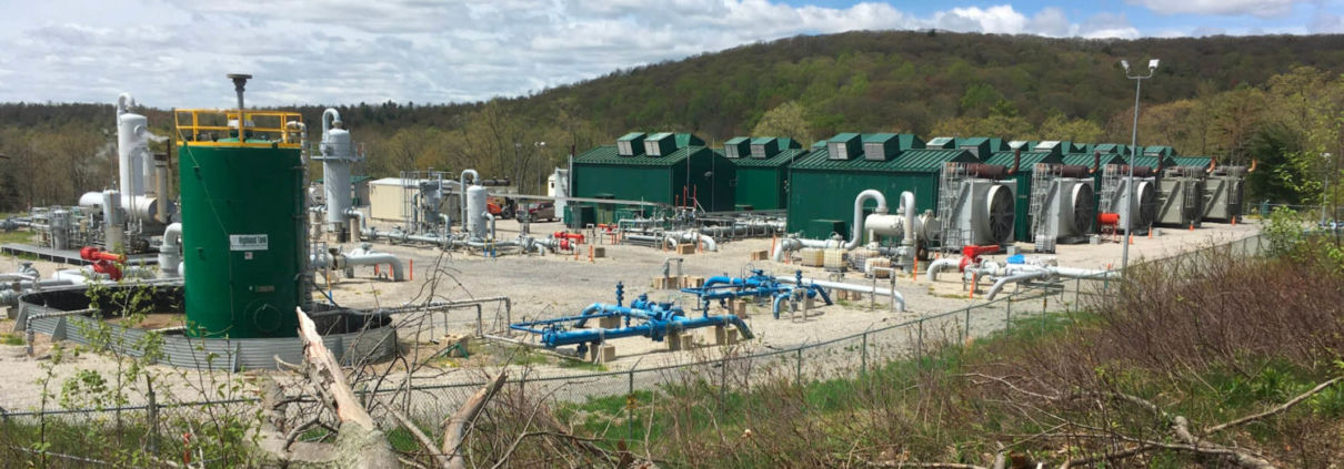
New power plant proposal called senseless and wasteful by climate groups
Residents and local advocacy groups are fighting a new power plant in Renovo, PA, planned to be constructed on an abandoned rail yard.
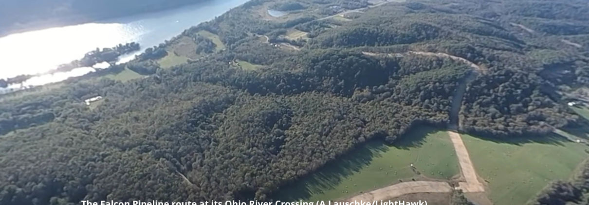
Ongoing Safety Concerns over Shell’s Falcon Pipeline
Ohio River Valley Groups react to a new safety warning issued by federal regulators to Shell regarding the troubled Falcon Pipeline
New Neighborhood Drilling Permits Issued While California Fails to Act on Public Health Rules
California drilling permits continue while Frontline communities and grassroots groups call for an immediate moratorium and 2,500′ setback.
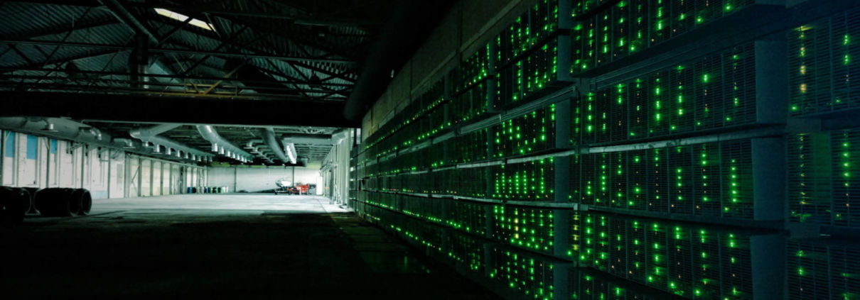
The world is watching as bitcoin battle brews in the US
If Gov. Cuomo wants to lead the nation on climate, he has to address the impacts of proof of work cryptocurrency mining industry in New York.
![]()
216 Franklin St, Suite 400, Johnstown, PA 15901
Phone: +1 (717) 303-0403 | info@fractracker.org
FracTracker Alliance is a 501(c)3 non-profit: Tax identification number: 80-0844297