Land
Learn about land impacts of the oil and gas industry through FracTracker articles, maps, and imagery.
Learn about land impacts of the oil and gas industry through FracTracker articles, maps, and imagery.
The articles and maps below deal in part with impacts of oil and gas development on land use including for agriculture, public land, watersheds, forests, private property, etc.
Explore our gallery of images related to energy exploration, extraction, and production.
 https://www.fractracker.org/a5ej20sjfwe/wp-content/uploads/2025/02/49727923413_5d7b7335a0_k.jpg
621
1500
Guest Author
https://www.fractracker.org/a5ej20sjfwe/wp-content/uploads/2021/04/2021-FracTracker-logo-horizontal.png
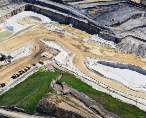
Guest Author2025-01-31 14:52:292025-02-03 15:59:13Regulatory Gaps and Resistance: The Battle Over Fracking in Southern Illinois
https://www.fractracker.org/a5ej20sjfwe/wp-content/uploads/2025/02/49727923413_5d7b7335a0_k.jpg
621
1500
Guest Author
https://www.fractracker.org/a5ej20sjfwe/wp-content/uploads/2021/04/2021-FracTracker-logo-horizontal.png
Guest Author2025-01-31 14:52:292025-02-03 15:59:13Regulatory Gaps and Resistance: The Battle Over Fracking in Southern Illinois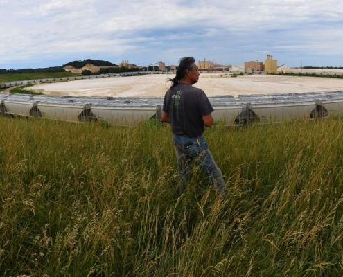 https://www.fractracker.org/a5ej20sjfwe/wp-content/uploads/2025/01/49781507018_31d2859e12_k.jpg
636
1500
Ted Auch, PhD
https://www.fractracker.org/a5ej20sjfwe/wp-content/uploads/2021/04/2021-FracTracker-logo-horizontal.png
Ted Auch, PhD2024-12-31 13:24:432025-01-07 19:18:11The Supreme Court’s Brackeen v. Haaland Ruling: Tribal Sovereignty, Resource Exploitation, and Future Challenges
https://www.fractracker.org/a5ej20sjfwe/wp-content/uploads/2025/01/49781507018_31d2859e12_k.jpg
636
1500
Ted Auch, PhD
https://www.fractracker.org/a5ej20sjfwe/wp-content/uploads/2021/04/2021-FracTracker-logo-horizontal.png
Ted Auch, PhD2024-12-31 13:24:432025-01-07 19:18:11The Supreme Court’s Brackeen v. Haaland Ruling: Tribal Sovereignty, Resource Exploitation, and Future Challenges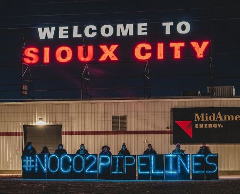 Great Plains Action Society
https://www.fractracker.org/a5ej20sjfwe/wp-content/uploads/2024/10/No-CO2-Ppelines-Sioux-City.jpg
672
1012
Gwen Klenke
https://www.fractracker.org/a5ej20sjfwe/wp-content/uploads/2021/04/2021-FracTracker-logo-horizontal.png
Gwen Klenke2024-10-22 11:55:082024-10-25 12:10:00Indigenous Communities’ Fight Against CO2 Pipelines in the Great Plains
Great Plains Action Society
https://www.fractracker.org/a5ej20sjfwe/wp-content/uploads/2024/10/No-CO2-Ppelines-Sioux-City.jpg
672
1012
Gwen Klenke
https://www.fractracker.org/a5ej20sjfwe/wp-content/uploads/2021/04/2021-FracTracker-logo-horizontal.png
Gwen Klenke2024-10-22 11:55:082024-10-25 12:10:00Indigenous Communities’ Fight Against CO2 Pipelines in the Great Plains https://www.fractracker.org/a5ej20sjfwe/wp-content/uploads/2016/10/Nix-Pix-050.jpg
3088
4629
FracTracker Alliance
https://www.fractracker.org/a5ej20sjfwe/wp-content/uploads/2021/04/2021-FracTracker-logo-horizontal.png
FracTracker Alliance2024-06-04 16:34:592025-05-02 14:53:36The Importance of Surveying Rural Landowners in North Dakota on Fracking
https://www.fractracker.org/a5ej20sjfwe/wp-content/uploads/2016/10/Nix-Pix-050.jpg
3088
4629
FracTracker Alliance
https://www.fractracker.org/a5ej20sjfwe/wp-content/uploads/2021/04/2021-FracTracker-logo-horizontal.png
FracTracker Alliance2024-06-04 16:34:592025-05-02 14:53:36The Importance of Surveying Rural Landowners in North Dakota on Fracking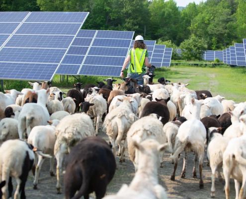 Photo Courtesy of American Solar Grazing Association
https://www.fractracker.org/a5ej20sjfwe/wp-content/uploads/2024/02/Lexie-Leading-Sheep.jpg
1000
1500
Guest Author
https://www.fractracker.org/a5ej20sjfwe/wp-content/uploads/2021/04/2021-FracTracker-logo-horizontal.png
Guest Author2024-02-01 15:49:482024-02-06 15:21:14Solar Grazing: Connecting Farming Communities and Solar Site Operators
Photo Courtesy of American Solar Grazing Association
https://www.fractracker.org/a5ej20sjfwe/wp-content/uploads/2024/02/Lexie-Leading-Sheep.jpg
1000
1500
Guest Author
https://www.fractracker.org/a5ej20sjfwe/wp-content/uploads/2021/04/2021-FracTracker-logo-horizontal.png
Guest Author2024-02-01 15:49:482024-02-06 15:21:14Solar Grazing: Connecting Farming Communities and Solar Site Operators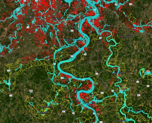 https://www.fractracker.org/a5ej20sjfwe/wp-content/uploads/2023/12/Figure-6-Rail-Population.jpg
801
1498
Matt Kelso, BA
https://www.fractracker.org/a5ej20sjfwe/wp-content/uploads/2021/04/2021-FracTracker-logo-horizontal.png
Matt Kelso, BA2023-12-14 16:26:372023-12-15 11:47:53On the Wrong Track: Risks to Residents of the Upper Ohio River Valley From Railroad Incidents
https://www.fractracker.org/a5ej20sjfwe/wp-content/uploads/2023/12/Figure-6-Rail-Population.jpg
801
1498
Matt Kelso, BA
https://www.fractracker.org/a5ej20sjfwe/wp-content/uploads/2021/04/2021-FracTracker-logo-horizontal.png
Matt Kelso, BA2023-12-14 16:26:372023-12-15 11:47:53On the Wrong Track: Risks to Residents of the Upper Ohio River Valley From Railroad Incidents![]()
216 Franklin St, Suite 400, Johnstown, PA 15901
Phone: +1 (717) 303-0403 | info@fractracker.org
FracTracker Alliance is a 501(c)3 non-profit: Tax identification number: 80-0844297