Loyalsock from the Sky
By Pete Stern, Aerial Photographer
When I met with John Dawes and Brook Lenker to discuss the possibilities of applying my aerial photography to environmental issues in Pennsylvania, I knew that my aerial photography career, which is really more a hobby, a passion and an avocation, was about to change. For years I’ve been taking aerial photographs, mainly focusing on the Pennsylvania Coal Region – purely as art – showing my work in galleries and universities, and self-publishing books. I refrained from expressing an opinion about PA coal mining, leaving it to the viewer to inform the images with their own knowledge of the environmental effects of mining.
As a guest speaker at the 2013 EPCAMR Conference at State College, I learned a great deal about the problem of mine water treatment, and soon had the opportunity to photograph a mine water treatment facility in the Panther Valley for Schuylkill County Headwaters. A friend had asked me for years why I don’t photograph the fracking activities in Pennsylvania, and my answer was that the fracking operations don’t lend themselves to the kind of artistic interpretation from the air as does the Coal Region. But when John mentioned photographing the Loyalsock State Forest fracking activity, I saw that I could use my aerial photography for a higher purpose.
I quickly began studying maps of the Clarence Moore Lands, in which Loyalsock is situated. I looked at images of Rock Run and many other places in the Forest, and then visited and hiked in the Forest. I saw that this was a place of great natural beauty and an ecological treasure. I learned that this precious forest is being threatened by fracking activity that is growing at an astounding rate throughout the forest. I knew I wanted to help document this environmental assault with my photography, and the question became how to most effectively and safely do this.
I have almost always taken my aerial photographs from my own small airplane, which is essentially an advanced ultralight. Flying and photographing at the same time has been the nexus of my art. Loyalsock is a large, rugged and remote area, however, with few airports or emergency landing fields nearby. After much consideration, I decided to hire a pilot to fly me to Loyalsock so that I could concentrate solely on taking photographs. I found a retired Air Force Colonel in Selinsgrove, now a flight instructor, who was eager to assist me in this project. He had been a B52 pilot in Vietnam and had participated in Operation Linebacker 2. It seemed to me that, perhaps, this mission was similar to what he may have done in his combat years, but now, for the good of saving the environment, rather than dropping bombs on it.
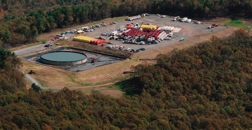
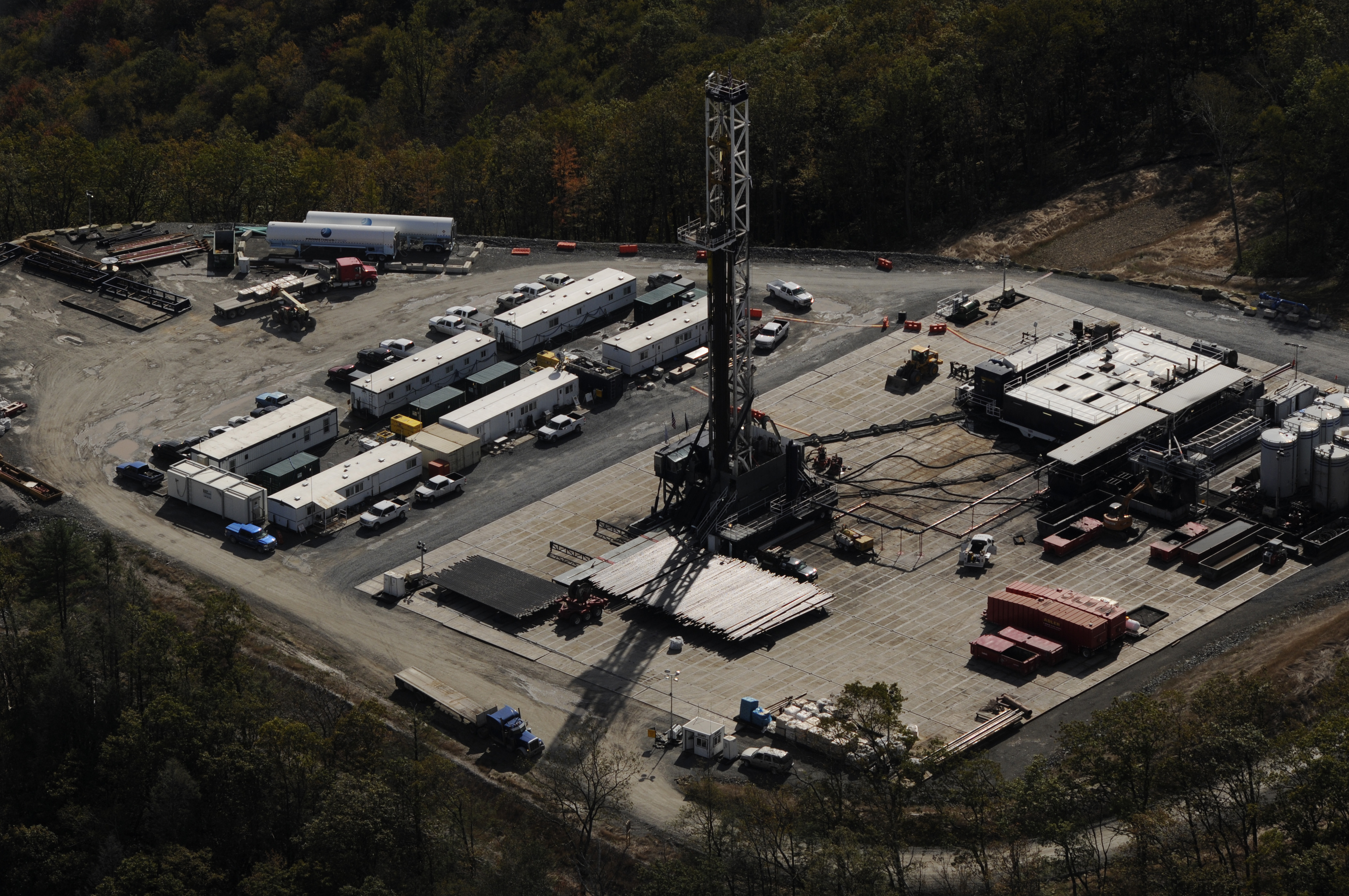
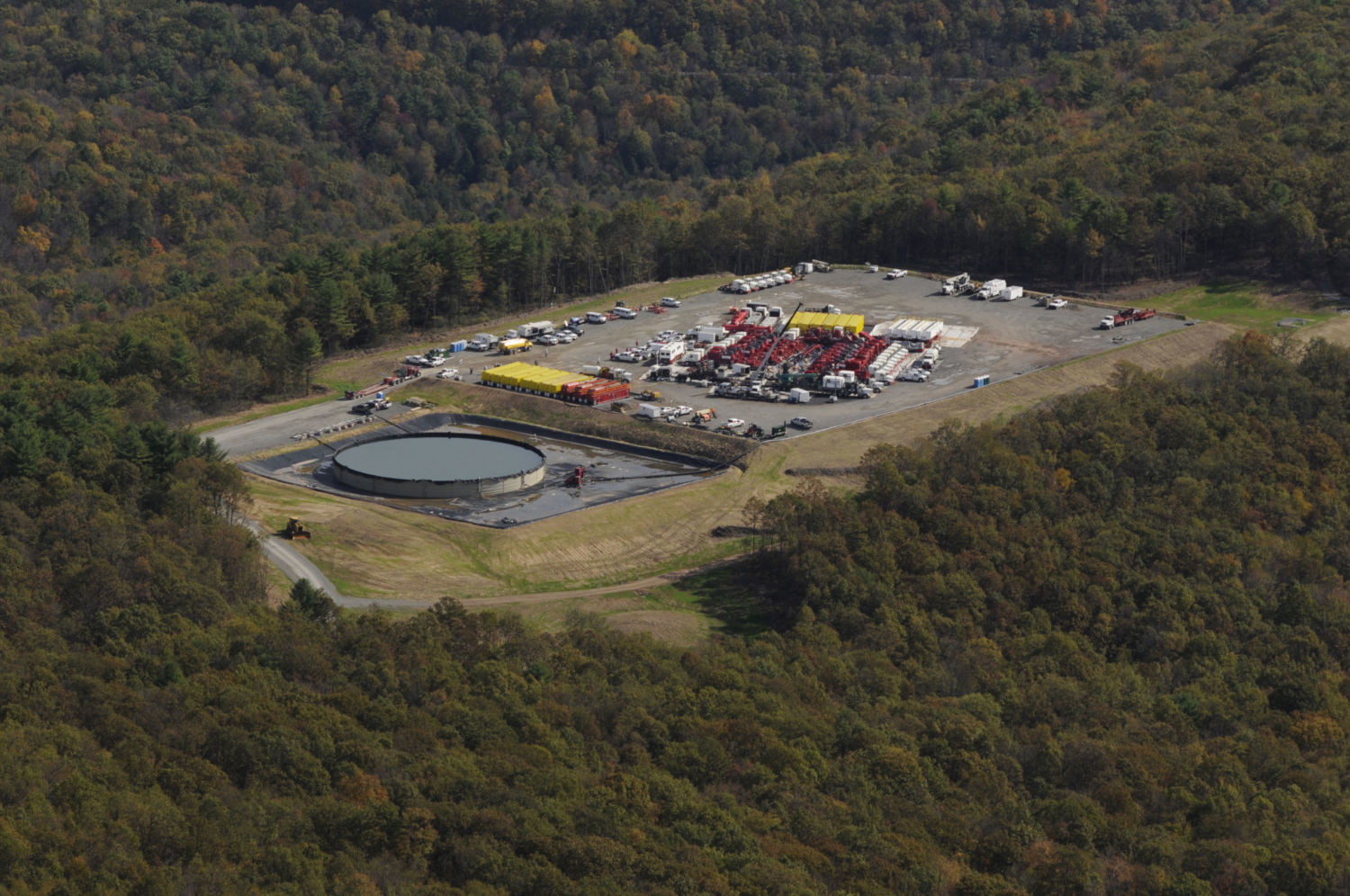
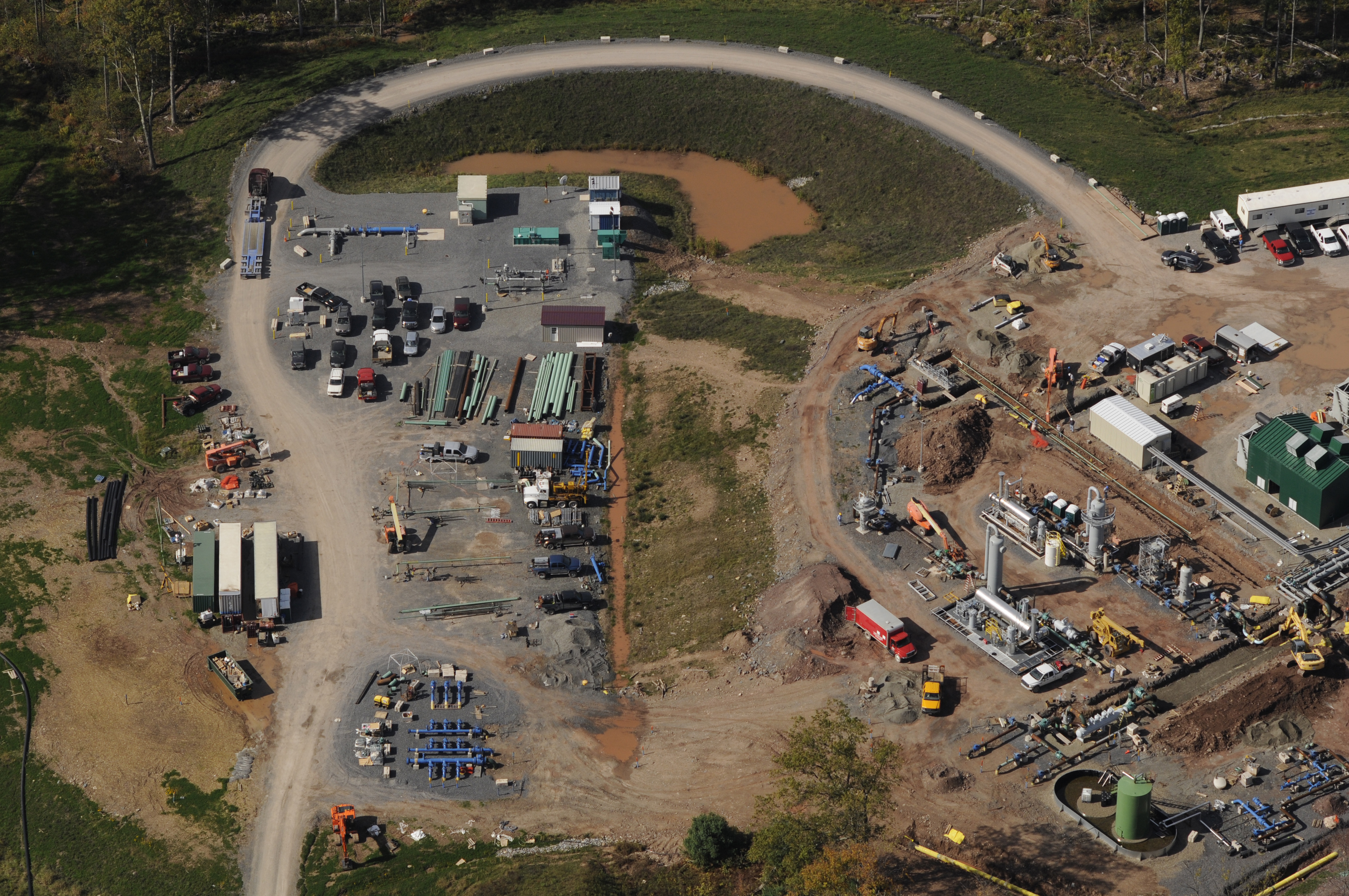
With the FracTracker Loyalsock map (below) and some coordinates in hand, we departed Selinsgrove in a Cessna 172 on October 9th. Starting with Bodine Mountain Northwest of Trout Run, we could see fracking operations covering nearly every hilltop. I opened the window of the 172 and started photographing, and as we flew Northeast over Loyalsock, we could see fracking operations everywhere. It was difficult to make out the exact boundaries of the Loyalsock State Forest from the air, and it appeared that the heart of the Forest is, for now, being spared from direct drilling. But I knew that it was just a matter of time before the Forest itself became the victim of unchecked exploitation, threatening the pristine native trout streams, polluting the air, and potentially driving endangered bird species from the area.
Drilled unconventional wells in Pennsylvania and control of mineral rights on state forest land. To access full controls, such as legends, layer controls, and layer descriptions, please click the expanding arrows in the top-right corner of the map.
Flying over the forest, I was very glad that I opted to hire a pilot for this work. It was tricky flying low over ridges and valleys trying to photograph every site. The gusty winds were knocking around the 172, which is much heavier than my aircraft. It was a very productive and successful flight, but also disheartening. Flying allows us views of the Earth that are unavailable from the ground. It has always seemed to me that, especially in Pennsylvania, if there is an unspoiled place of natural value, someone will find a way to destroy it. Loyalsock is a natural treasure which must be protected, but from the growing abundance of fracking operations that can be witnessed from the air, it appears that saving this Forest is an enormous challenge. Thanks to resources like groups like the Save the Loyalsock Coalition, at least the best effort is being made.
Pete Stern is an aerial photographer and artist. His work is featured on his website: www.psartwork.net.
Extraordinary photographs of a heartbreaking wound to a beautiful place.