West Virginia
As of February 1, 2025, there are records of 117,359 oil and gas wells (including both proposed and drilled) in West Virginia.
As of February 1, 2025, there are records of 117,359 oil and gas wells (including both proposed and drilled) in West Virginia.
-25")
Drilled horizontal wells as of September 2025

Wells fracked with trade secret chemicals between 2012 and 2022

Population within one mile of rail lines in West Virginia who are potentially at risk from major incidents as of July 2023
FracTracker provides state-specific data on issues such as:
The data folders may also contain information on other energy generation locations, data from different years, and data on violations committed by oil and gas facilities. Amount of information and types of information will vary by state. Get data.
WVDEP (West Virginia Department of Environmental Protection) provides data on oil and gas wells, as well as the horizontal laterals (under the ground) via their GIS server.
 https://www.fractracker.org/a5ej20sjfwe/wp-content/uploads/2025/05/51382261216_f8af819a45_o.jpg
1125
1500
Guest Author
https://www.fractracker.org/a5ej20sjfwe/wp-content/uploads/2025/09/2025-Wordmark-Logo.png
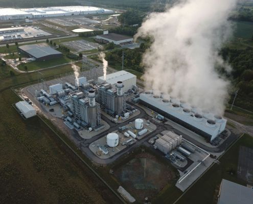
Guest Author2025-05-31 12:00:592026-03-13 12:05:07Power Plant Locations and Unemployment Rates
https://www.fractracker.org/a5ej20sjfwe/wp-content/uploads/2025/05/51382261216_f8af819a45_o.jpg
1125
1500
Guest Author
https://www.fractracker.org/a5ej20sjfwe/wp-content/uploads/2025/09/2025-Wordmark-Logo.png
Guest Author2025-05-31 12:00:592026-03-13 12:05:07Power Plant Locations and Unemployment Rates https://www.fractracker.org/a5ej20sjfwe/wp-content/uploads/2024/06/Hydrogen-molecule-feature.jpg
844
1500
FracTracker Alliance
https://www.fractracker.org/a5ej20sjfwe/wp-content/uploads/2025/09/2025-Wordmark-Logo.png
FracTracker Alliance2024-06-05 17:41:582024-06-06 09:18:40A Closer Look at Risks of the Appalachian Hydrogen Hub
https://www.fractracker.org/a5ej20sjfwe/wp-content/uploads/2024/06/Hydrogen-molecule-feature.jpg
844
1500
FracTracker Alliance
https://www.fractracker.org/a5ej20sjfwe/wp-content/uploads/2025/09/2025-Wordmark-Logo.png
FracTracker Alliance2024-06-05 17:41:582024-06-06 09:18:40A Closer Look at Risks of the Appalachian Hydrogen Hub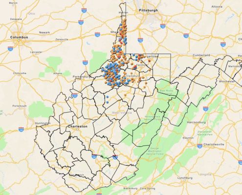 FracTracker Alliance, 2024
https://www.fractracker.org/a5ej20sjfwe/wp-content/uploads/2024/03/WV-PFAS-Map.jpeg
763
1500
Matt Kelso, BA
https://www.fractracker.org/a5ej20sjfwe/wp-content/uploads/2025/09/2025-Wordmark-Logo.png
Matt Kelso, BA2024-03-29 15:06:512024-03-29 15:42:29Mapping PFAS Chemicals Used in Fracking Operations in West Virginia
FracTracker Alliance, 2024
https://www.fractracker.org/a5ej20sjfwe/wp-content/uploads/2024/03/WV-PFAS-Map.jpeg
763
1500
Matt Kelso, BA
https://www.fractracker.org/a5ej20sjfwe/wp-content/uploads/2025/09/2025-Wordmark-Logo.png
Matt Kelso, BA2024-03-29 15:06:512024-03-29 15:42:29Mapping PFAS Chemicals Used in Fracking Operations in West Virginia https://www.fractracker.org/a5ej20sjfwe/wp-content/uploads/2022/02/Delaware-River-Feature.jpg
667
1500
FracTracker Alliance
https://www.fractracker.org/a5ej20sjfwe/wp-content/uploads/2025/09/2025-Wordmark-Logo.png
FracTracker Alliance2024-03-04 14:25:182024-03-04 14:25:18Staff Spotlight: Katie Jones
https://www.fractracker.org/a5ej20sjfwe/wp-content/uploads/2022/02/Delaware-River-Feature.jpg
667
1500
FracTracker Alliance
https://www.fractracker.org/a5ej20sjfwe/wp-content/uploads/2025/09/2025-Wordmark-Logo.png
FracTracker Alliance2024-03-04 14:25:182024-03-04 14:25:18Staff Spotlight: Katie Jones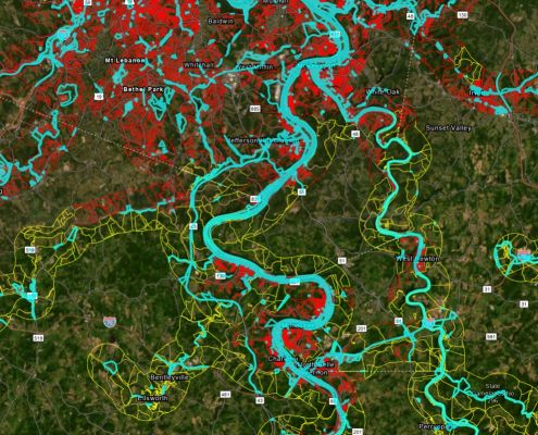 https://www.fractracker.org/a5ej20sjfwe/wp-content/uploads/2023/12/Figure-6-Rail-Population.jpg
801
1498
Matt Kelso, BA
https://www.fractracker.org/a5ej20sjfwe/wp-content/uploads/2025/09/2025-Wordmark-Logo.png
Matt Kelso, BA2023-12-14 16:26:372023-12-15 11:47:53On the Wrong Track: Risks to Residents of the Upper Ohio River Valley From Railroad Incidents
https://www.fractracker.org/a5ej20sjfwe/wp-content/uploads/2023/12/Figure-6-Rail-Population.jpg
801
1498
Matt Kelso, BA
https://www.fractracker.org/a5ej20sjfwe/wp-content/uploads/2025/09/2025-Wordmark-Logo.png
Matt Kelso, BA2023-12-14 16:26:372023-12-15 11:47:53On the Wrong Track: Risks to Residents of the Upper Ohio River Valley From Railroad Incidents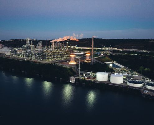 https://www.fractracker.org/a5ej20sjfwe/wp-content/uploads/2022/11/Fhn3YgeXkAI0QiX.jpg
675
1200
Erica Jackson
https://www.fractracker.org/a5ej20sjfwe/wp-content/uploads/2025/09/2025-Wordmark-Logo.png
Erica Jackson2022-11-17 16:43:392022-11-18 13:41:39Falcon Pipeline Online, Begins Operations Following Violations of Clean Streams Law
https://www.fractracker.org/a5ej20sjfwe/wp-content/uploads/2022/11/Fhn3YgeXkAI0QiX.jpg
675
1200
Erica Jackson
https://www.fractracker.org/a5ej20sjfwe/wp-content/uploads/2025/09/2025-Wordmark-Logo.png
Erica Jackson2022-11-17 16:43:392022-11-18 13:41:39Falcon Pipeline Online, Begins Operations Following Violations of Clean Streams Law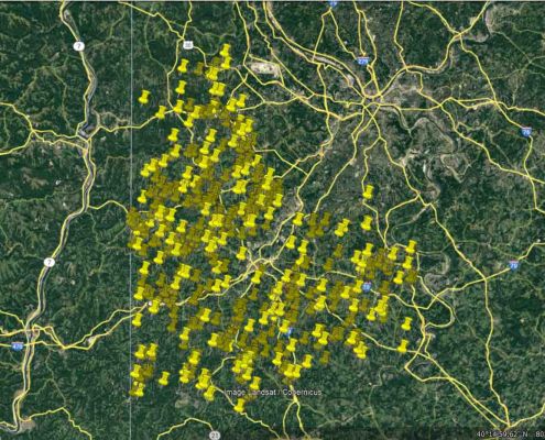 https://www.fractracker.org/a5ej20sjfwe/wp-content/uploads/2022/11/Washington-County-PA-2022-Google-Earth.jpg
933
1920
FracTracker Alliance
https://www.fractracker.org/a5ej20sjfwe/wp-content/uploads/2025/09/2025-Wordmark-Logo.png
FracTracker Alliance2022-11-04 12:55:532022-11-04 13:04:53FracTracker Receives Two Federal Grants to Support Community Air Monitoring Initiatives in the Ohio River Valley
https://www.fractracker.org/a5ej20sjfwe/wp-content/uploads/2022/11/Washington-County-PA-2022-Google-Earth.jpg
933
1920
FracTracker Alliance
https://www.fractracker.org/a5ej20sjfwe/wp-content/uploads/2025/09/2025-Wordmark-Logo.png
FracTracker Alliance2022-11-04 12:55:532022-11-04 13:04:53FracTracker Receives Two Federal Grants to Support Community Air Monitoring Initiatives in the Ohio River Valley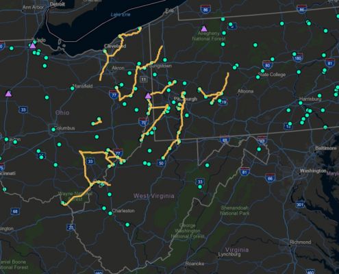 https://www.fractracker.org/a5ej20sjfwe/wp-content/uploads/2022/06/CCSHFeatureImage.jpg
667
1500
Guest Author
https://www.fractracker.org/a5ej20sjfwe/wp-content/uploads/2025/09/2025-Wordmark-Logo.png
Guest Author2022-06-23 15:29:312022-06-30 12:30:43An Insider Take on the Appalachian Hydrogen & CCUS Conference
https://www.fractracker.org/a5ej20sjfwe/wp-content/uploads/2022/06/CCSHFeatureImage.jpg
667
1500
Guest Author
https://www.fractracker.org/a5ej20sjfwe/wp-content/uploads/2025/09/2025-Wordmark-Logo.png
Guest Author2022-06-23 15:29:312022-06-30 12:30:43An Insider Take on the Appalachian Hydrogen & CCUS Conference https://www.fractracker.org/a5ej20sjfwe/wp-content/uploads/2021/09/Adobe-stock-beaver-cracker-feature.jpg
667
1500
Erica Jackson
https://www.fractracker.org/a5ej20sjfwe/wp-content/uploads/2025/09/2025-Wordmark-Logo.png
Erica Jackson2021-12-21 10:49:162022-01-03 11:35:03Petrochemical Toxics in the Ohio River Watershed
https://www.fractracker.org/a5ej20sjfwe/wp-content/uploads/2021/09/Adobe-stock-beaver-cracker-feature.jpg
667
1500
Erica Jackson
https://www.fractracker.org/a5ej20sjfwe/wp-content/uploads/2025/09/2025-Wordmark-Logo.png
Erica Jackson2021-12-21 10:49:162022-01-03 11:35:03Petrochemical Toxics in the Ohio River Watershed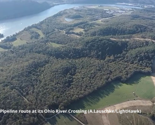 https://www.fractracker.org/a5ej20sjfwe/wp-content/uploads/2021/03/Falcon-Ohio-River-Crossing-Feature-A.LauschkeLightHawk-scaled.jpg
667
1500
Erica Jackson
https://www.fractracker.org/a5ej20sjfwe/wp-content/uploads/2025/09/2025-Wordmark-Logo.png
Erica Jackson2021-08-24 07:15:232021-08-23 17:30:12Ongoing Safety Concerns over Shell’s Falcon Pipeline
https://www.fractracker.org/a5ej20sjfwe/wp-content/uploads/2021/03/Falcon-Ohio-River-Crossing-Feature-A.LauschkeLightHawk-scaled.jpg
667
1500
Erica Jackson
https://www.fractracker.org/a5ej20sjfwe/wp-content/uploads/2025/09/2025-Wordmark-Logo.png
Erica Jackson2021-08-24 07:15:232021-08-23 17:30:12Ongoing Safety Concerns over Shell’s Falcon Pipeline https://www.fractracker.org/a5ej20sjfwe/wp-content/uploads/2021/06/TAuch_Infrastructure-Hopedale_Cryogenic_Plant-MarkWest_Energy-HarrisonCounty-OH_Nov2020-Feature.jpg
667
1500
Ted Auch, PhD
https://www.fractracker.org/a5ej20sjfwe/wp-content/uploads/2025/09/2025-Wordmark-Logo.png
Ted Auch, PhD2021-06-11 12:26:292021-07-01 11:12:42Ohio, West Virginia, Pennsylvania Fracking Story Map
https://www.fractracker.org/a5ej20sjfwe/wp-content/uploads/2021/03/Falcon-Ohio-River-Crossing-Feature-A.LauschkeLightHawk-scaled.jpg
667
1500
Erica Jackson
https://www.fractracker.org/a5ej20sjfwe/wp-content/uploads/2025/09/2025-Wordmark-Logo.png
Erica Jackson2021-03-17 08:48:432021-04-15 15:11:21Shell’s Falcon Pipeline Under Investigation for Serious Public Safety Threats
https://www.fractracker.org/a5ej20sjfwe/wp-content/uploads/2021/06/TAuch_Infrastructure-Hopedale_Cryogenic_Plant-MarkWest_Energy-HarrisonCounty-OH_Nov2020-Feature.jpg
667
1500
Ted Auch, PhD
https://www.fractracker.org/a5ej20sjfwe/wp-content/uploads/2025/09/2025-Wordmark-Logo.png
Ted Auch, PhD2021-06-11 12:26:292021-07-01 11:12:42Ohio, West Virginia, Pennsylvania Fracking Story Map
https://www.fractracker.org/a5ej20sjfwe/wp-content/uploads/2021/03/Falcon-Ohio-River-Crossing-Feature-A.LauschkeLightHawk-scaled.jpg
667
1500
Erica Jackson
https://www.fractracker.org/a5ej20sjfwe/wp-content/uploads/2025/09/2025-Wordmark-Logo.png
Erica Jackson2021-03-17 08:48:432021-04-15 15:11:21Shell’s Falcon Pipeline Under Investigation for Serious Public Safety Threats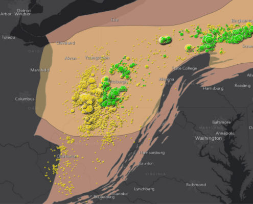 https://www.fractracker.org/a5ej20sjfwe/wp-content/uploads/2021/01/Utica-and-Marcellus-shale-plays-feature-scaled.jpg
667
1500
Erica Jackson
https://www.fractracker.org/a5ej20sjfwe/wp-content/uploads/2025/09/2025-Wordmark-Logo.png
Erica Jackson2021-01-15 17:36:502021-04-16 19:46:43Fracking Waste in the Appalachian Basin – A Story Map
https://www.fractracker.org/a5ej20sjfwe/wp-content/uploads/2021/01/Utica-and-Marcellus-shale-plays-feature-scaled.jpg
667
1500
Erica Jackson
https://www.fractracker.org/a5ej20sjfwe/wp-content/uploads/2025/09/2025-Wordmark-Logo.png
Erica Jackson2021-01-15 17:36:502021-04-16 19:46:43Fracking Waste in the Appalachian Basin – A Story Map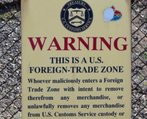 https://www.fractracker.org/a5ej20sjfwe/wp-content/uploads/2020/07/Foreign-Trade-Zone-Sign-Feature.jpg
833
1875
FracTracker Alliance
https://www.fractracker.org/a5ej20sjfwe/wp-content/uploads/2025/09/2025-Wordmark-Logo.png
FracTracker Alliance2020-07-09 09:12:212021-04-15 14:16:12Industry Targets Peaceful Protest via “Critical Infrastructure” Legislation
https://www.fractracker.org/a5ej20sjfwe/wp-content/uploads/2020/07/Foreign-Trade-Zone-Sign-Feature.jpg
833
1875
FracTracker Alliance
https://www.fractracker.org/a5ej20sjfwe/wp-content/uploads/2025/09/2025-Wordmark-Logo.png
FracTracker Alliance2020-07-09 09:12:212021-04-15 14:16:12Industry Targets Peaceful Protest via “Critical Infrastructure” Legislation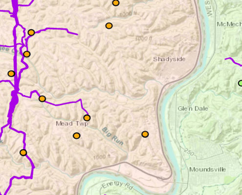 https://www.fractracker.org/a5ej20sjfwe/wp-content/uploads/2020/07/Mapping-gathering-lines-in-OH-and-WV-feature.jpg
833
1875
Intern FracTracker
https://www.fractracker.org/a5ej20sjfwe/wp-content/uploads/2025/09/2025-Wordmark-Logo.png
Intern FracTracker2020-07-02 12:09:192025-05-02 14:45:00Mapping Gathering Lines in Ohio and West Virginia
https://www.fractracker.org/a5ej20sjfwe/wp-content/uploads/2020/07/Mapping-gathering-lines-in-OH-and-WV-feature.jpg
833
1875
Intern FracTracker
https://www.fractracker.org/a5ej20sjfwe/wp-content/uploads/2025/09/2025-Wordmark-Logo.png
Intern FracTracker2020-07-02 12:09:192025-05-02 14:45:00Mapping Gathering Lines in Ohio and West Virginia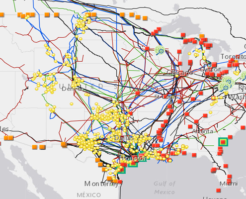 https://www.fractracker.org/a5ej20sjfwe/wp-content/uploads/2020/02/National-map-feature-3.png
400
900
Erica Jackson
https://www.fractracker.org/a5ej20sjfwe/wp-content/uploads/2025/09/2025-Wordmark-Logo.png
Erica Jackson2020-02-28 17:35:142022-05-02 15:21:42National Energy and Petrochemical Map
https://www.fractracker.org/a5ej20sjfwe/wp-content/uploads/2020/02/National-map-feature-3.png
400
900
Erica Jackson
https://www.fractracker.org/a5ej20sjfwe/wp-content/uploads/2025/09/2025-Wordmark-Logo.png
Erica Jackson2020-02-28 17:35:142022-05-02 15:21:42National Energy and Petrochemical Map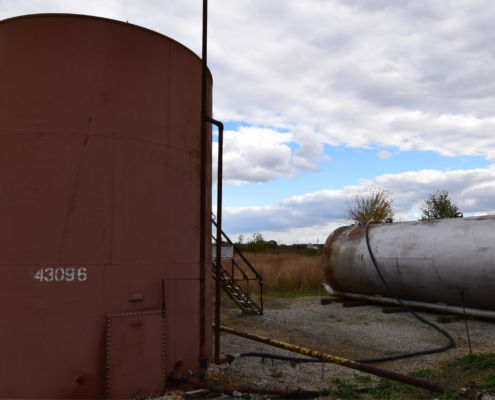 https://www.fractracker.org/a5ej20sjfwe/wp-content/uploads/2019/10/waste-disposal-site-feature-scaled.jpg
667
1500
Karen Edelstein
https://www.fractracker.org/a5ej20sjfwe/wp-content/uploads/2025/09/2025-Wordmark-Logo.png
Karen Edelstein2019-10-03 08:45:342021-04-15 14:55:39Want Not, Waste Not? Fossil Fuel Extraction’s Waste Disposal Challenges
https://www.fractracker.org/a5ej20sjfwe/wp-content/uploads/2019/10/waste-disposal-site-feature-scaled.jpg
667
1500
Karen Edelstein
https://www.fractracker.org/a5ej20sjfwe/wp-content/uploads/2025/09/2025-Wordmark-Logo.png
Karen Edelstein2019-10-03 08:45:342021-04-15 14:55:39Want Not, Waste Not? Fossil Fuel Extraction’s Waste Disposal Challenges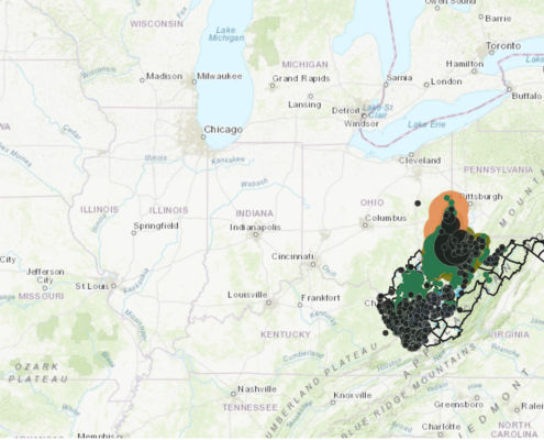 https://www.fractracker.org/a5ej20sjfwe/wp-content/uploads/2019/08/West-Virginia-Unconventional-Oil-Gas-and-Coal-production-scaled.jpg
667
1500
Ted Auch, PhD
https://www.fractracker.org/a5ej20sjfwe/wp-content/uploads/2025/09/2025-Wordmark-Logo.png
Ted Auch, PhD2019-08-27 10:28:402021-04-15 14:56:25The Mountaineer State: Where Politics, a Fossil Fuel Legacy, and Fracking Converge
https://www.fractracker.org/a5ej20sjfwe/wp-content/uploads/2019/08/West-Virginia-Unconventional-Oil-Gas-and-Coal-production-scaled.jpg
667
1500
Ted Auch, PhD
https://www.fractracker.org/a5ej20sjfwe/wp-content/uploads/2025/09/2025-Wordmark-Logo.png
Ted Auch, PhD2019-08-27 10:28:402021-04-15 14:56:25The Mountaineer State: Where Politics, a Fossil Fuel Legacy, and Fracking Converge![]()
216 Franklin St, Suite 400, Johnstown, PA 15901
Phone: +1 (717) 303-0403 | info@fractracker.org
FracTracker Alliance is a 501(c)3 non-profit: Tax identification number: 80-0844297


