Pipelines
Learn about oil and gas pipeline impacts through FracTracker articles, maps, and imagery.
Learn about oil and gas pipeline impacts through FracTracker articles, maps, and imagery.
North America consists of a vast network of inter- and intrastate pipelines that transport products ranging from water to hazardous liquids to raw materials. The U.S. oil and gas pipeline network delivers trillions of cubic feet of natural gas and hundreds of billions of tons of liquid petroleum products each year. The infrastructure’s main environmental health and safety risks include land use and forest fragmentation, compressor station emissions, erosion and sedimentation, spills and leaks, and explosions.
Explore our site’s various articles about oil and gas pipeline issues below, listed in descending order by date.
In the summer of 2018, FracTracker released a detailed environmental impact assessment (EIA), including digital maps, of the Falcon Ethane Pipeline
 https://www.fractracker.org/a5ej20sjfwe/wp-content/uploads/2022/04/Russia-Ukraine-Energy-feature.jpg
667
1500
FracTracker Alliance
https://www.fractracker.org/a5ej20sjfwe/wp-content/uploads/2025/09/2025-Wordmark-Logo.png
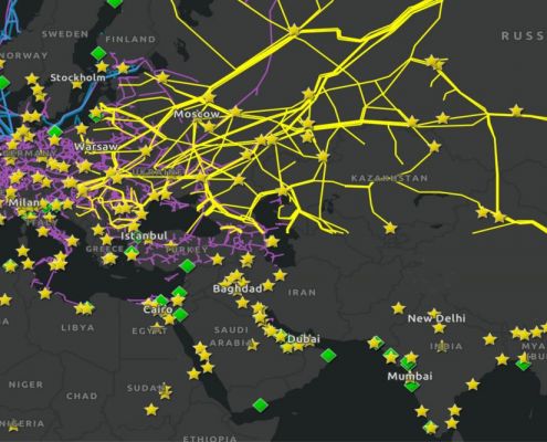
FracTracker Alliance2022-04-20 13:25:452022-04-20 17:23:17Mapping Energy Systems Impacted by the Russia-Ukraine War
https://www.fractracker.org/a5ej20sjfwe/wp-content/uploads/2022/04/Russia-Ukraine-Energy-feature.jpg
667
1500
FracTracker Alliance
https://www.fractracker.org/a5ej20sjfwe/wp-content/uploads/2025/09/2025-Wordmark-Logo.png
FracTracker Alliance2022-04-20 13:25:452022-04-20 17:23:17Mapping Energy Systems Impacted by the Russia-Ukraine War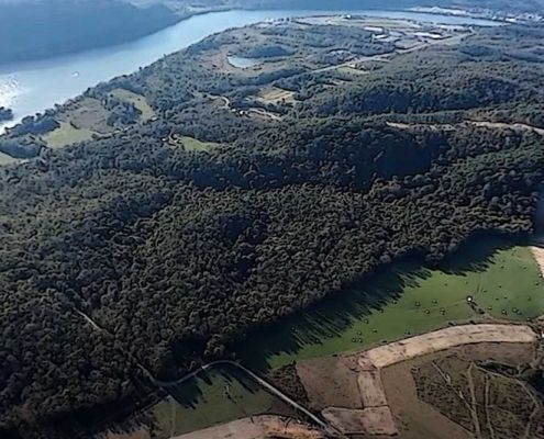 https://www.fractracker.org/a5ej20sjfwe/wp-content/uploads/2021/12/173695136_1422048161521006_7197500259062906334_n.jpg
667
1500
Erica Jackson
https://www.fractracker.org/a5ej20sjfwe/wp-content/uploads/2025/09/2025-Wordmark-Logo.png
Erica Jackson2021-12-01 15:27:402021-12-01 15:27:40New Letter from Federal Regulators Regarding how the Falcon has Been Investigated
https://www.fractracker.org/a5ej20sjfwe/wp-content/uploads/2021/12/173695136_1422048161521006_7197500259062906334_n.jpg
667
1500
Erica Jackson
https://www.fractracker.org/a5ej20sjfwe/wp-content/uploads/2025/09/2025-Wordmark-Logo.png
Erica Jackson2021-12-01 15:27:402021-12-01 15:27:40New Letter from Federal Regulators Regarding how the Falcon has Been Investigated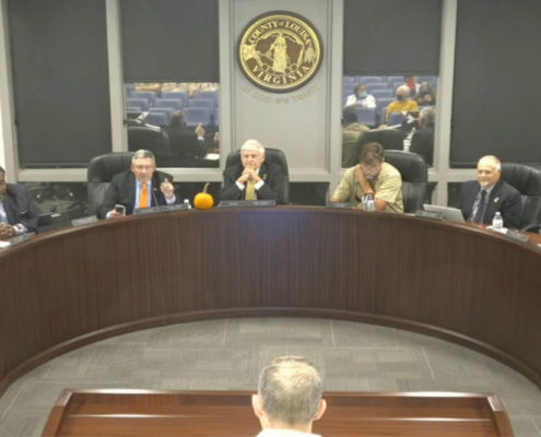 https://www.fractracker.org/a5ej20sjfwe/wp-content/uploads/2021/10/Chickahominy-feature.jpg
667
1500
Karen Edelstein
https://www.fractracker.org/a5ej20sjfwe/wp-content/uploads/2025/09/2025-Wordmark-Logo.png
Karen Edelstein2021-11-01 13:29:122021-12-17 11:53:41Chickahominy Pipeline project tries to exploit an apparent regulatory loophole
https://www.fractracker.org/a5ej20sjfwe/wp-content/uploads/2021/10/Chickahominy-feature.jpg
667
1500
Karen Edelstein
https://www.fractracker.org/a5ej20sjfwe/wp-content/uploads/2025/09/2025-Wordmark-Logo.png
Karen Edelstein2021-11-01 13:29:122021-12-17 11:53:41Chickahominy Pipeline project tries to exploit an apparent regulatory loophole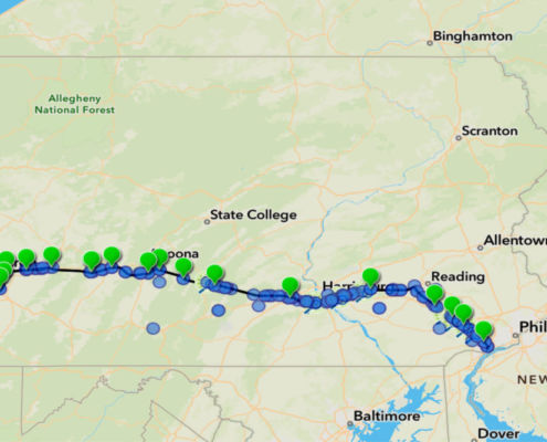 https://www.fractracker.org/a5ej20sjfwe/wp-content/uploads/2021/10/Mariner-East-2-feature.jpg
667
1500
Erica Jackson
https://www.fractracker.org/a5ej20sjfwe/wp-content/uploads/2025/09/2025-Wordmark-Logo.png
Erica Jackson2021-10-29 13:02:432021-11-01 12:17:20Map Update on Criminal Charges Facing Mariner East 2 Pipeline
https://www.fractracker.org/a5ej20sjfwe/wp-content/uploads/2021/10/Mariner-East-2-feature.jpg
667
1500
Erica Jackson
https://www.fractracker.org/a5ej20sjfwe/wp-content/uploads/2025/09/2025-Wordmark-Logo.png
Erica Jackson2021-10-29 13:02:432021-11-01 12:17:20Map Update on Criminal Charges Facing Mariner East 2 Pipeline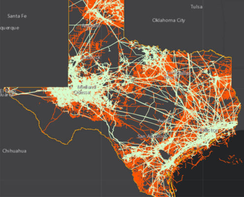 https://www.fractracker.org/a5ej20sjfwe/wp-content/uploads/2021/08/Texas-Infrastructure-Feature-.jpg
667
1500
Intern FracTracker
https://www.fractracker.org/a5ej20sjfwe/wp-content/uploads/2025/09/2025-Wordmark-Logo.png
Intern FracTracker2021-09-14 08:00:002022-01-24 17:49:20Infrastructure Networks in Texas
https://www.fractracker.org/a5ej20sjfwe/wp-content/uploads/2021/08/Texas-Infrastructure-Feature-.jpg
667
1500
Intern FracTracker
https://www.fractracker.org/a5ej20sjfwe/wp-content/uploads/2025/09/2025-Wordmark-Logo.png
Intern FracTracker2021-09-14 08:00:002022-01-24 17:49:20Infrastructure Networks in Texas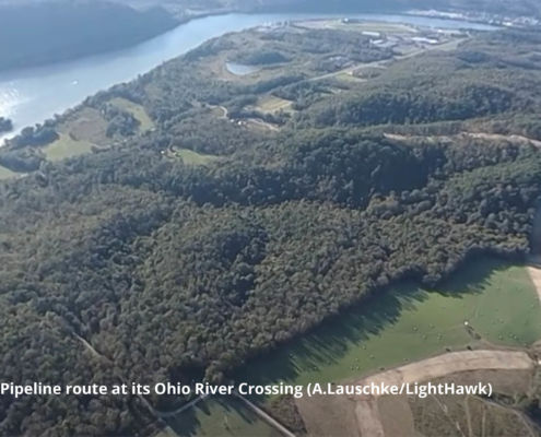 https://www.fractracker.org/a5ej20sjfwe/wp-content/uploads/2021/03/Falcon-Ohio-River-Crossing-Feature-A.LauschkeLightHawk-scaled.jpg
667
1500
Erica Jackson
https://www.fractracker.org/a5ej20sjfwe/wp-content/uploads/2025/09/2025-Wordmark-Logo.png
Erica Jackson2021-08-24 07:15:232021-08-23 17:30:12Ongoing Safety Concerns over Shell’s Falcon Pipeline
https://www.fractracker.org/a5ej20sjfwe/wp-content/uploads/2021/03/Falcon-Ohio-River-Crossing-Feature-A.LauschkeLightHawk-scaled.jpg
667
1500
Erica Jackson
https://www.fractracker.org/a5ej20sjfwe/wp-content/uploads/2025/09/2025-Wordmark-Logo.png
Erica Jackson2021-08-24 07:15:232021-08-23 17:30:12Ongoing Safety Concerns over Shell’s Falcon PipelineLooking for a map of US pipelines that you can access from your phone? Download our free mobile app.

![]()
216 Franklin St, Suite 400, Johnstown, PA 15901
Phone: +1 (717) 303-0403 | info@fractracker.org
FracTracker Alliance is a 501(c)3 non-profit: Tax identification number: 80-0844297

