By Jill Terner, PA Communications Intern, FracTracker Alliance
In 1987, at the World Commission on Environment conference, sustainable development was recognized internationally for the first time. Sustainability in this sense is broadly defined as both the goal and process of serving present needs while not precluding the ability of future generations to serve their needs1. This general definition has lent itself well to becoming the cornerstone of arguments for and against drilling that uses hydraulic fracturing.
A largely economic definition of sustainability is behind many pro-drilling agendas, while environmental sustainability is mainly what informs regulatory or anti-drilling viewpoints2. Though these two parties make different uses of the term sustainability, they still share discourse on this topic. This common use that overlies differing connotations renders sustainability what Star & Griesemer (1989) would term a boundary object3.
Over the course of this blog series, I will look at how both industry and environmental regulatory committees are using the science at their disposal to make a case for or against unconventional drilling as a sustainable practice. Finally, I will finish by discussing how the shared discourse that uses these competing definitions impacts the court of public opinion.
Sustainability Defined by Industry
From an industrial perspective, sustainability is viewed in an economic light. Social, environmental, and other facets of sustainability aren’t ignored, though. Rather, they are seen as part of a cost-benefit equation wherein the potential impacts of industrial presence on communities and the environment are quantified and measured against the potential economic benefits associated with tapping into unconventional oil and gas reserves2,4.
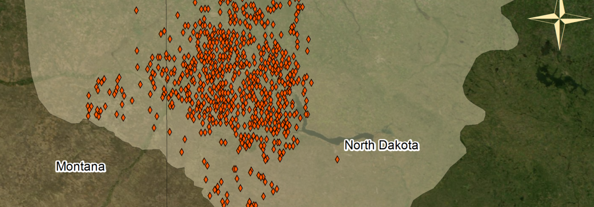
The primary, direct economic benefit reported to be associated with this industry’s presence in communities is job creation. Industry leaders espouse the notion that allowing drilling in an area opens up job opportunities for rig workers. Extractive industries are typically located in economically depressed, non-metropolitan areas6. Thus, the benefit of employment and inferred family support is a great touted advantage4.
Additional direct benefits are associated with leasing of both land and mineral rights to grant drilling access to industry. Selling the mineral rights below a plot of land can be a lucrative option for those who own them. However, the mineral rights owners are not always the same people as those who own the land above the minerals to be leased. As such, landowners must be mindful of what is going on with the minerals beneath their property.
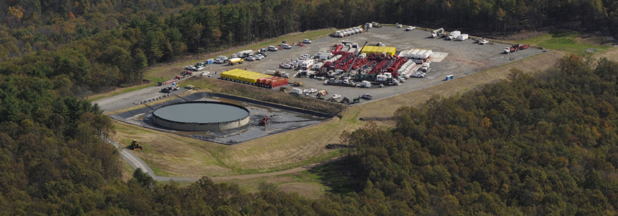
Ancillary businesses may also reap economic benefits associated with industry. Primarily, businesses that supply the materials needed in the construction and maintenance of the drilling operation can potentially benefit from industry presence. More indirectly, unrelated businesses such as hotels and restaurants in the community may stand to benefit from the influx of wealth associated with residents’ newfound employment.
These direct and indirect economic consequences are commonly viewed as a positive investment in the community by industry, and the local political leaders that support industry’s presence. If residents allow drilling, industry claims, they are making an investment towards economic stability and sustainability – which will be propagated by the influx of wealth due to job creation. Negative environmental and social impacts that may occur alongside this economic boon typically fall short of outweighing its benefits in the eyes of the industry.
How Industry Makes Use of Current Research
At present, there is relatively little scientific research done on the impacts of unconventional drilling. What research does exist on the sustainable impacts of unconventional drilling consists largely of studies funded by industry4. As hydraulic fracturing is a relatively new practice, more research continues to burgeon and inform questions regarding economic, social, and environmental impacts from all angles.
One way industry gets around the lack of pre-existing research is to do input-output analysis4. This analysis links the primary industry with ancillary ones through tables of coefficients, and calculates the estimated direct and indirect economic impacts through calculations using that table. While some of the calculated benefits may be viewed positively across the board, public perception of these gains may be different in different locations5, making it tough to generalize acceptance of findings.
Relatedly, industry also takes research done on the economic benefits incurred by communities and states where unconventional drilling has been in place longer, and applies the methods or results to areas where drilling is new4. For example, coefficients generated from an input-output equation from a Texas community could be used to project benefits for a community in New York. Analogy can be a powerful tool, and with the lack of research on current industrial practices, it is the best tool to use in certain circumstances. However, as geographic, economic, social, and environmental contingencies are different between locations of drilling, comparison may be somewhat limited.
Additionally, many pro-industry groups are dedicated to refuting scientific studies that have been put out by academics, environmental regulatory bodies, or independent researchers. For example, the website Energy in Depth published a thorough critique of the HBO documentary Gasland, debunking it point-by-point. When scientific research cannot be entirely disproved, promoting the benefits of unconventional drilling over the costs of another dirtier fuel, like coal, is also another way to promote drilling. While these cost-benefit-analyses can be legitimate, they often fail to incorporate the use and potential benefits of other energy resources, like wind.
What’s Next?
In the next installment of this series, I will discuss how regulatory committees are defining sustainability, and how they are mobilizing science towards their definition.
References
1. Dernbach, J. C., & Bernstein, S. (2003). Pursuing sustainable communities: Looking back, looking forward. The Urban Lawyer, 35(3), 495-532.
2. Finewood, M. H., & Stroup, L. J. (2012). Fracking and the neoliberalization of the hyrdo-social cycle in Pennsylvania’s Marcellus shale. Journal of Contemporary Water Research and Education, (147), 72-79.
3. Star, S. L., & Griesemer, J. R. (1989). Institutional ecology, ‘translations’ and boundary objects: Amateurs and professionals in Berkeley’s museum of vertebrate zoology, 1907-39. Social Studies of Science, 19, 387-420.
4. Barth, J. M. (2013). The economic impact of shale gas development on state and local economies: Benefits, costs, and uncertainties. New Solutions, 23(1), 85-101.
5. Perkins, N. D. (2012). The fracturing of place: The regulation of Marcellus Shale development and the subordination of local experience. (research paper). Retrieved from Duquesne University School of Law Legal Studies Research Paper Series. (2012-17).
6. Freudenburg, W.R., and L.J. Wilson. “Mining the data: Analyzing the economic implications of mining for nonmetropolitan regions.” Sociological Inquiry. 72.4 (2002): 549-575. Print.


 By Samantha Malone, MPH, CPH – Manager of Science and Communications, FracTracker Alliance