Latest Articles
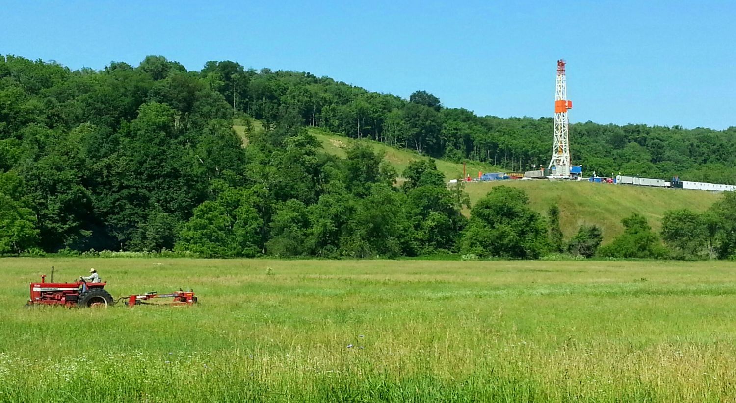 https://www.fractracker.org/a5ej20sjfwe/wp-content/uploads/2023/10/gilooly-farmer-pa-2013.jpg
823
1500
Guest Author
https://www.fractracker.org/a5ej20sjfwe/wp-content/uploads/2021/04/2021-FracTracker-logo-horizontal.png
Guest Author2024-04-26 11:34:082024-04-26 11:35:48Holes in FracFocus
https://www.fractracker.org/a5ej20sjfwe/wp-content/uploads/2023/10/gilooly-farmer-pa-2013.jpg
823
1500
Guest Author
https://www.fractracker.org/a5ej20sjfwe/wp-content/uploads/2021/04/2021-FracTracker-logo-horizontal.png
Guest Author2024-04-26 11:34:082024-04-26 11:35:48Holes in FracFocus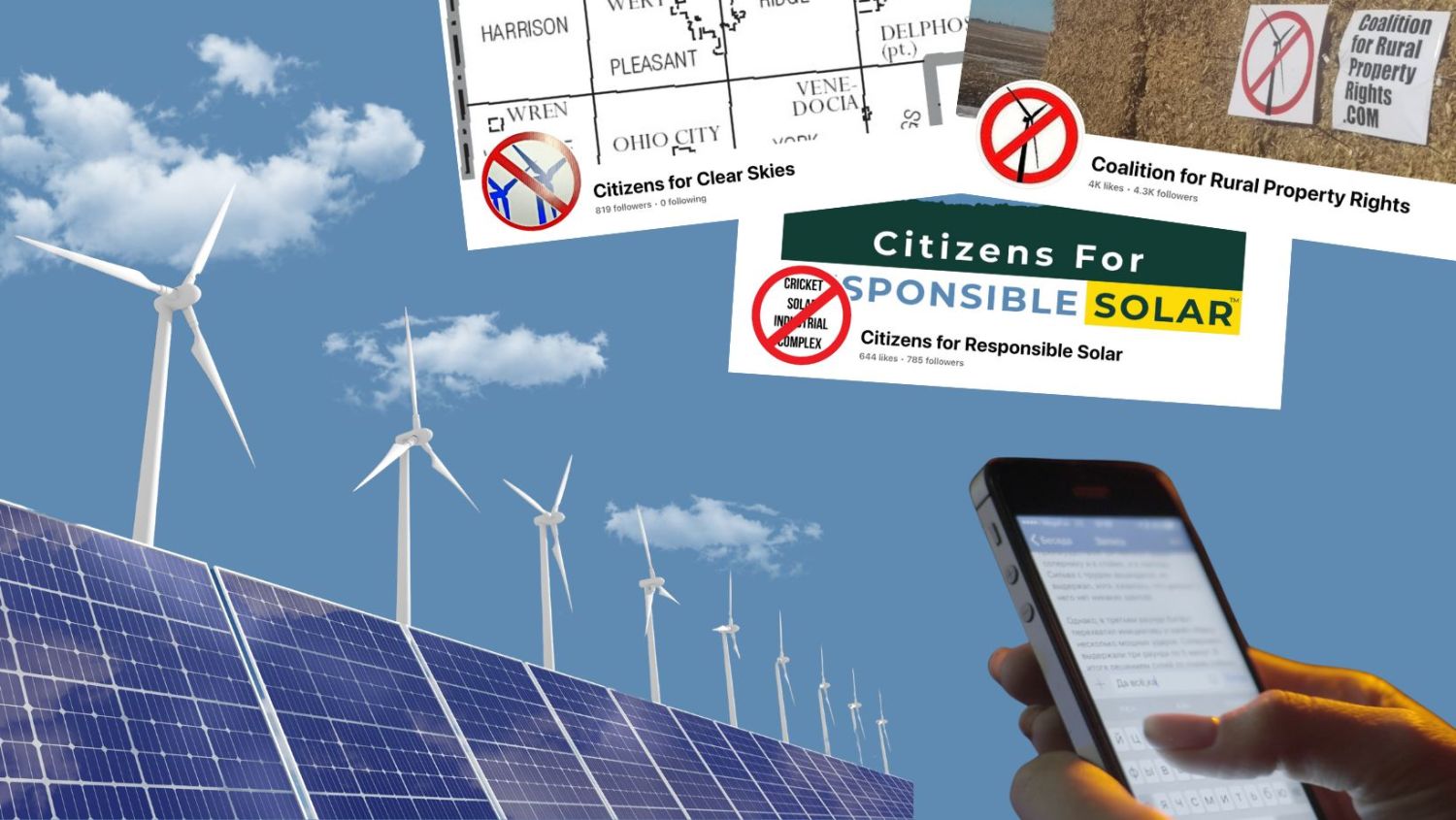 Sarah Jessie Liez, FracTracker Alliance, 2024
https://www.fractracker.org/a5ej20sjfwe/wp-content/uploads/2024/04/Clean-Energy-Misinformation-Cover-Art.jpg
845
1500
FracTracker Alliance
https://www.fractracker.org/a5ej20sjfwe/wp-content/uploads/2021/04/2021-FracTracker-logo-horizontal.png
FracTracker Alliance2024-04-03 15:58:552024-04-05 12:28:47The Power of Misinformation in Blocking Clean Energy Reform
Sarah Jessie Liez, FracTracker Alliance, 2024
https://www.fractracker.org/a5ej20sjfwe/wp-content/uploads/2024/04/Clean-Energy-Misinformation-Cover-Art.jpg
845
1500
FracTracker Alliance
https://www.fractracker.org/a5ej20sjfwe/wp-content/uploads/2021/04/2021-FracTracker-logo-horizontal.png
FracTracker Alliance2024-04-03 15:58:552024-04-05 12:28:47The Power of Misinformation in Blocking Clean Energy Reform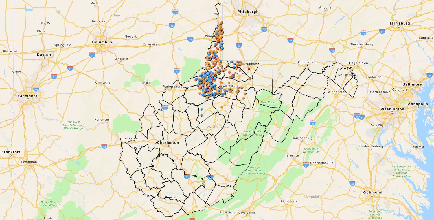 FracTracker Alliance, 2024
https://www.fractracker.org/a5ej20sjfwe/wp-content/uploads/2024/03/WV-PFAS-Map.jpeg
763
1500
Matt Kelso, BA
https://www.fractracker.org/a5ej20sjfwe/wp-content/uploads/2021/04/2021-FracTracker-logo-horizontal.png
Matt Kelso, BA2024-03-29 15:06:512024-03-29 15:42:29Mapping PFAS Chemicals Used in Fracking Operations in West Virginia
FracTracker Alliance, 2024
https://www.fractracker.org/a5ej20sjfwe/wp-content/uploads/2024/03/WV-PFAS-Map.jpeg
763
1500
Matt Kelso, BA
https://www.fractracker.org/a5ej20sjfwe/wp-content/uploads/2021/04/2021-FracTracker-logo-horizontal.png
Matt Kelso, BA2024-03-29 15:06:512024-03-29 15:42:29Mapping PFAS Chemicals Used in Fracking Operations in West Virginia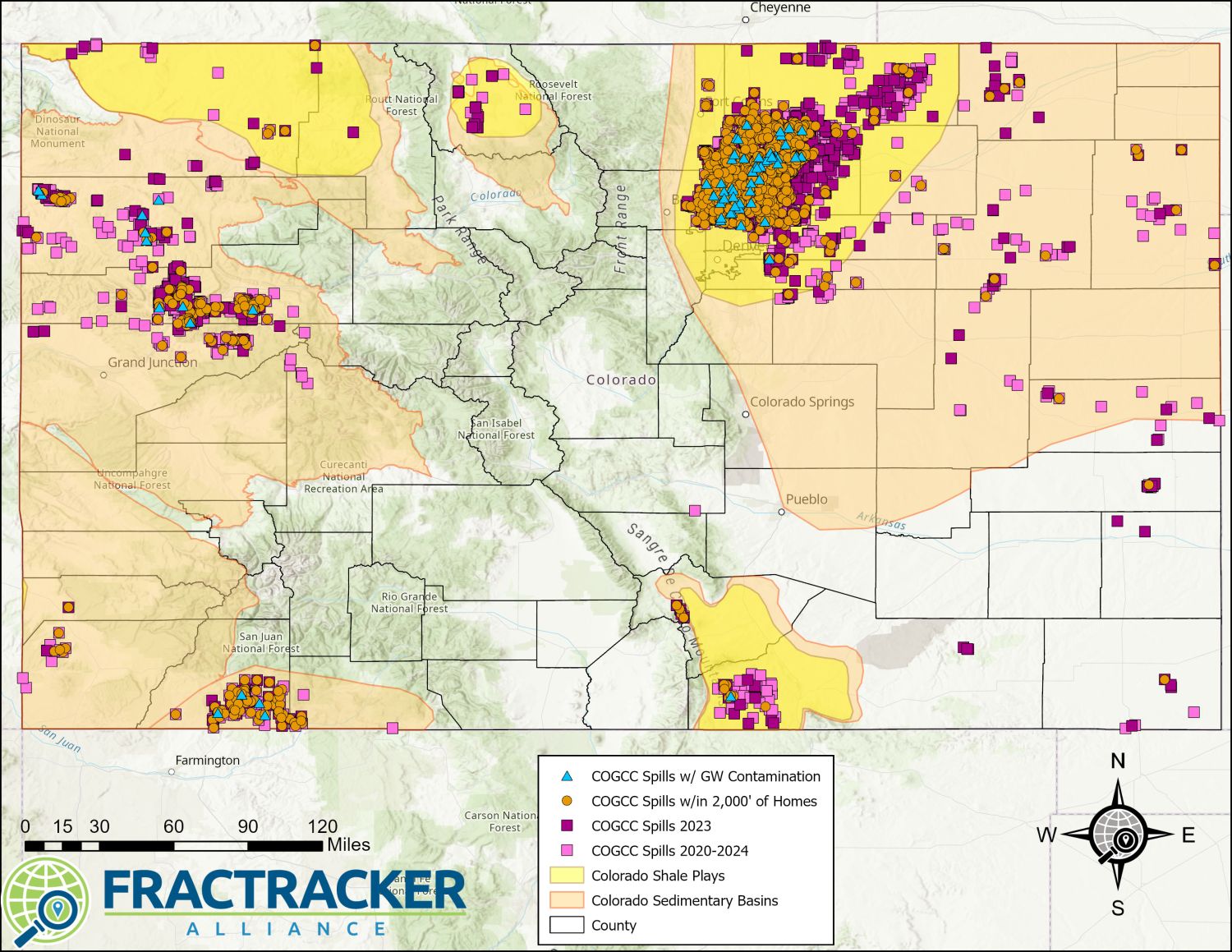 https://www.fractracker.org/a5ej20sjfwe/wp-content/uploads/2024/03/ColoradoSpills_3.22.24.jpg
1159
1500
Kyle Ferrar, MPH
https://www.fractracker.org/a5ej20sjfwe/wp-content/uploads/2021/04/2021-FracTracker-logo-horizontal.png
Kyle Ferrar, MPH2024-03-25 16:57:102024-03-26 22:18:53Empowering Colorado Communities: The Importance of the Community Right to Know Act
https://www.fractracker.org/a5ej20sjfwe/wp-content/uploads/2024/03/ColoradoSpills_3.22.24.jpg
1159
1500
Kyle Ferrar, MPH
https://www.fractracker.org/a5ej20sjfwe/wp-content/uploads/2021/04/2021-FracTracker-logo-horizontal.png
Kyle Ferrar, MPH2024-03-25 16:57:102024-03-26 22:18:53Empowering Colorado Communities: The Importance of the Community Right to Know Act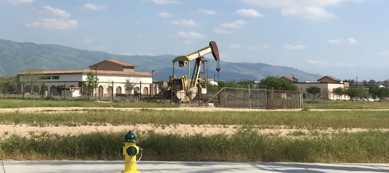 https://www.fractracker.org/a5ej20sjfwe/wp-content/uploads/2020/04/California-well-pad.jpg
666
1500
FracTracker Alliance
https://www.fractracker.org/a5ej20sjfwe/wp-content/uploads/2021/04/2021-FracTracker-logo-horizontal.png
FracTracker Alliance2024-03-07 17:01:582024-03-12 09:55:39Chevron’s $2.3 Billion Asset Adjustment Raises Questions Amidst Regulatory Changes in California
https://www.fractracker.org/a5ej20sjfwe/wp-content/uploads/2020/04/California-well-pad.jpg
666
1500
FracTracker Alliance
https://www.fractracker.org/a5ej20sjfwe/wp-content/uploads/2021/04/2021-FracTracker-logo-horizontal.png
FracTracker Alliance2024-03-07 17:01:582024-03-12 09:55:39Chevron’s $2.3 Billion Asset Adjustment Raises Questions Amidst Regulatory Changes in California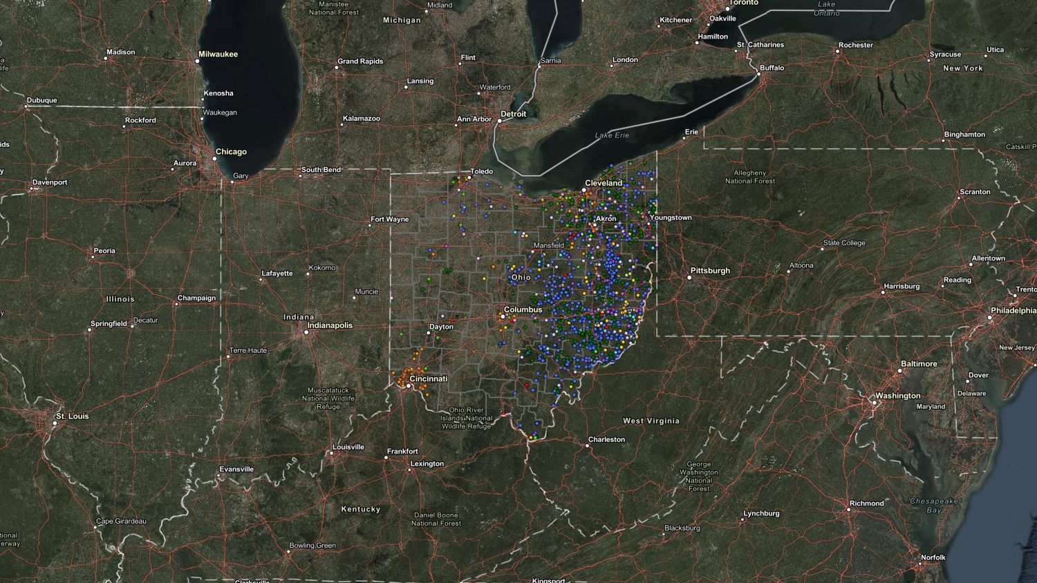 FracTracker Alliance, 2024
https://www.fractracker.org/a5ej20sjfwe/wp-content/uploads/2024/03/ODNR-Oil-and-Gas-Incidents-2018-2023.jpg
844
1500
Gwen Klenke
https://www.fractracker.org/a5ej20sjfwe/wp-content/uploads/2021/04/2021-FracTracker-logo-horizontal.png
Gwen Klenke2024-03-05 11:47:452024-03-05 14:33:47Data Gaps: A Critical Examination of Oil and Gas Well Incidents in Ohio
FracTracker Alliance, 2024
https://www.fractracker.org/a5ej20sjfwe/wp-content/uploads/2024/03/ODNR-Oil-and-Gas-Incidents-2018-2023.jpg
844
1500
Gwen Klenke
https://www.fractracker.org/a5ej20sjfwe/wp-content/uploads/2021/04/2021-FracTracker-logo-horizontal.png
Gwen Klenke2024-03-05 11:47:452024-03-05 14:33:47Data Gaps: A Critical Examination of Oil and Gas Well Incidents in Ohio Graphic by Sarah Jessie Liez, 2024
https://www.fractracker.org/a5ej20sjfwe/wp-content/uploads/2024/03/Fast-Fashion-Image.jpg
845
1500
FracTracker Alliance
https://www.fractracker.org/a5ej20sjfwe/wp-content/uploads/2021/04/2021-FracTracker-logo-horizontal.png
FracTracker Alliance2024-03-04 18:00:222024-04-03 14:49:21Fossil Fashion: How Oil and Gas Fuel the Fashion Industry
Graphic by Sarah Jessie Liez, 2024
https://www.fractracker.org/a5ej20sjfwe/wp-content/uploads/2024/03/Fast-Fashion-Image.jpg
845
1500
FracTracker Alliance
https://www.fractracker.org/a5ej20sjfwe/wp-content/uploads/2021/04/2021-FracTracker-logo-horizontal.png
FracTracker Alliance2024-03-04 18:00:222024-04-03 14:49:21Fossil Fashion: How Oil and Gas Fuel the Fashion Industry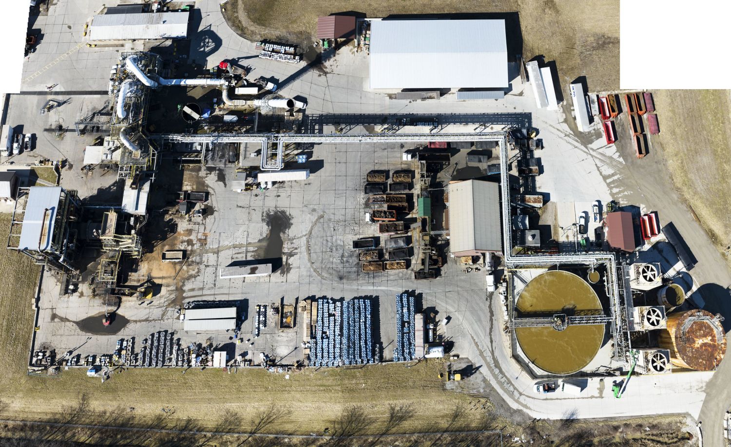 Ross incinerator in Eaton Township. Photo by Ted Auch, FracTracker Alliance, 2023
https://www.fractracker.org/a5ej20sjfwe/wp-content/uploads/2024/02/52748252528_19364d2943_k.jpg
918
1500
Guest Author
https://www.fractracker.org/a5ej20sjfwe/wp-content/uploads/2021/04/2021-FracTracker-logo-horizontal.png
Guest Author2024-02-07 21:56:582024-02-09 13:47:09Stop Toxic Threat: A Heavy Industrial Zoning Battle
Ross incinerator in Eaton Township. Photo by Ted Auch, FracTracker Alliance, 2023
https://www.fractracker.org/a5ej20sjfwe/wp-content/uploads/2024/02/52748252528_19364d2943_k.jpg
918
1500
Guest Author
https://www.fractracker.org/a5ej20sjfwe/wp-content/uploads/2021/04/2021-FracTracker-logo-horizontal.png
Guest Author2024-02-07 21:56:582024-02-09 13:47:09Stop Toxic Threat: A Heavy Industrial Zoning Battle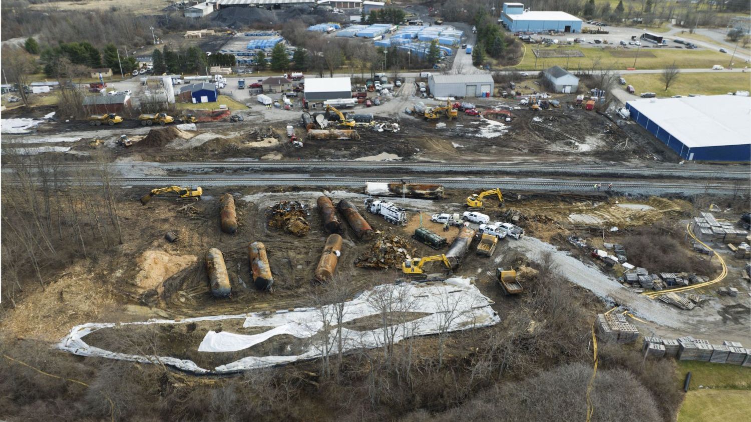 Ted Auch, FracTracker Alliance, 2023
https://www.fractracker.org/a5ej20sjfwe/wp-content/uploads/2023/04/1-e1680543676237.jpg
843
1500
Guest Author
https://www.fractracker.org/a5ej20sjfwe/wp-content/uploads/2021/04/2021-FracTracker-logo-horizontal.png
Guest Author2024-02-01 23:07:302024-02-09 13:46:16Where Do We Cross the Line: From Public Service to Public Threat
Ted Auch, FracTracker Alliance, 2023
https://www.fractracker.org/a5ej20sjfwe/wp-content/uploads/2023/04/1-e1680543676237.jpg
843
1500
Guest Author
https://www.fractracker.org/a5ej20sjfwe/wp-content/uploads/2021/04/2021-FracTracker-logo-horizontal.png
Guest Author2024-02-01 23:07:302024-02-09 13:46:16Where Do We Cross the Line: From Public Service to Public Threat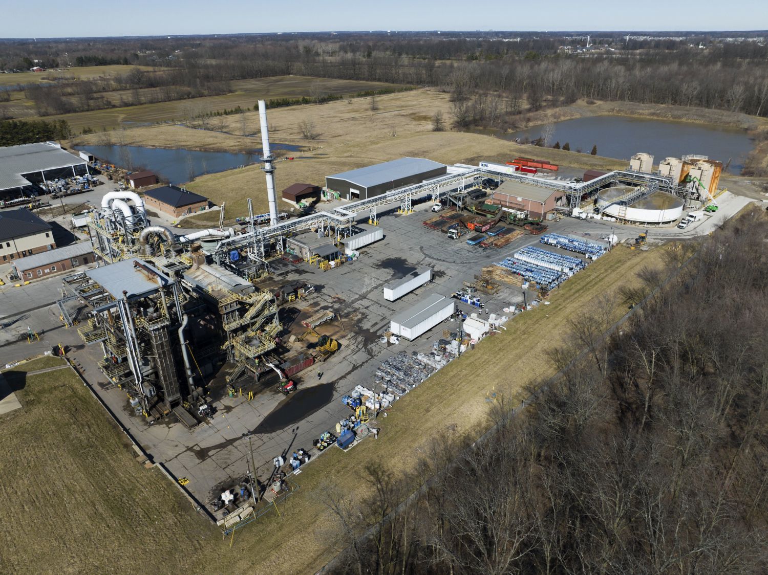 Ross Environmental Hazardous Waste Incinerator in Eaton Township, Ohio. Ted Auch, FracTracker Alliance, 2023
https://www.fractracker.org/a5ej20sjfwe/wp-content/uploads/2024/02/52747231757_2834f8bd30_k.jpg
1124
1500
Guest Author
https://www.fractracker.org/a5ej20sjfwe/wp-content/uploads/2021/04/2021-FracTracker-logo-horizontal.png
Guest Author2024-02-01 22:00:352024-02-09 13:45:10East Palestine Warning: The Growing Threat From Hazardous Waste Storage
Ross Environmental Hazardous Waste Incinerator in Eaton Township, Ohio. Ted Auch, FracTracker Alliance, 2023
https://www.fractracker.org/a5ej20sjfwe/wp-content/uploads/2024/02/52747231757_2834f8bd30_k.jpg
1124
1500
Guest Author
https://www.fractracker.org/a5ej20sjfwe/wp-content/uploads/2021/04/2021-FracTracker-logo-horizontal.png
Guest Author2024-02-01 22:00:352024-02-09 13:45:10East Palestine Warning: The Growing Threat From Hazardous Waste Storage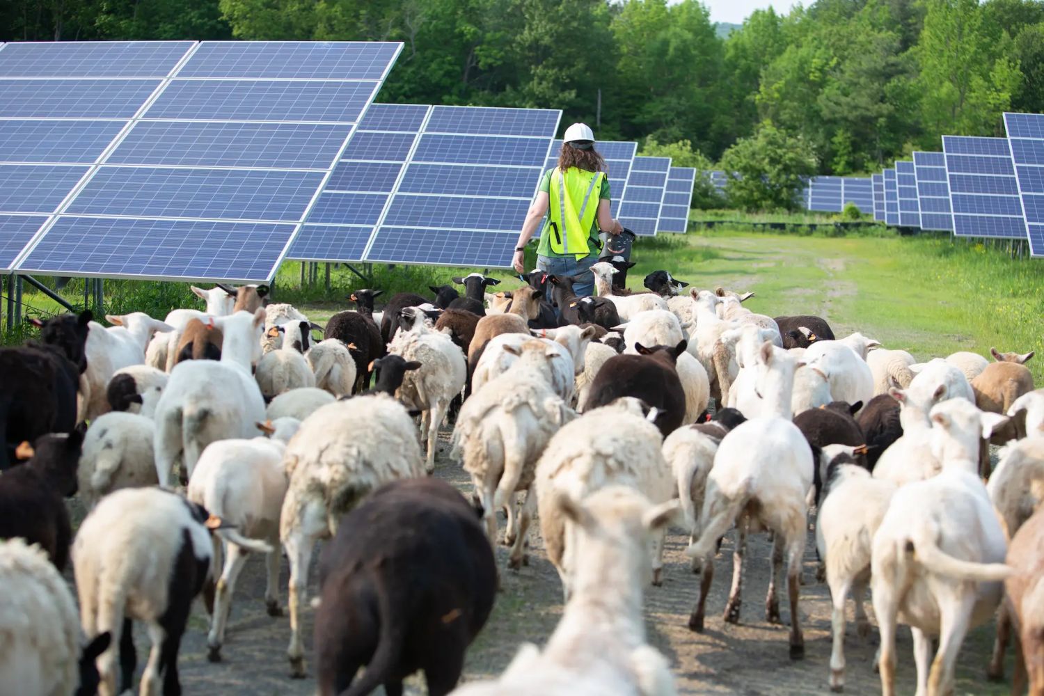 Photo Courtesy of American Solar Grazing Association
https://www.fractracker.org/a5ej20sjfwe/wp-content/uploads/2024/02/Lexie-Leading-Sheep.jpg
1000
1500
Guest Author
https://www.fractracker.org/a5ej20sjfwe/wp-content/uploads/2021/04/2021-FracTracker-logo-horizontal.png
Guest Author2024-02-01 15:49:482024-02-06 15:21:14Solar Grazing: Connecting Farming Communities and Solar Site Operators
Photo Courtesy of American Solar Grazing Association
https://www.fractracker.org/a5ej20sjfwe/wp-content/uploads/2024/02/Lexie-Leading-Sheep.jpg
1000
1500
Guest Author
https://www.fractracker.org/a5ej20sjfwe/wp-content/uploads/2021/04/2021-FracTracker-logo-horizontal.png
Guest Author2024-02-01 15:49:482024-02-06 15:21:14Solar Grazing: Connecting Farming Communities and Solar Site Operators FracTracker Alliance, 2024
https://www.fractracker.org/a5ej20sjfwe/wp-content/uploads/2024/01/California-Daily-Oil-Production-2024.jpg
844
1500
Kyle Ferrar, MPH
https://www.fractracker.org/a5ej20sjfwe/wp-content/uploads/2021/04/2021-FracTracker-logo-horizontal.png
Kyle Ferrar, MPH2024-01-30 05:00:012024-02-05 13:46:42Index of Oil and Gas Operator Health in California Shows Risks to State Economy and Taxpayers
FracTracker Alliance, 2024
https://www.fractracker.org/a5ej20sjfwe/wp-content/uploads/2024/01/California-Daily-Oil-Production-2024.jpg
844
1500
Kyle Ferrar, MPH
https://www.fractracker.org/a5ej20sjfwe/wp-content/uploads/2021/04/2021-FracTracker-logo-horizontal.png
Kyle Ferrar, MPH2024-01-30 05:00:012024-02-05 13:46:42Index of Oil and Gas Operator Health in California Shows Risks to State Economy and Taxpayers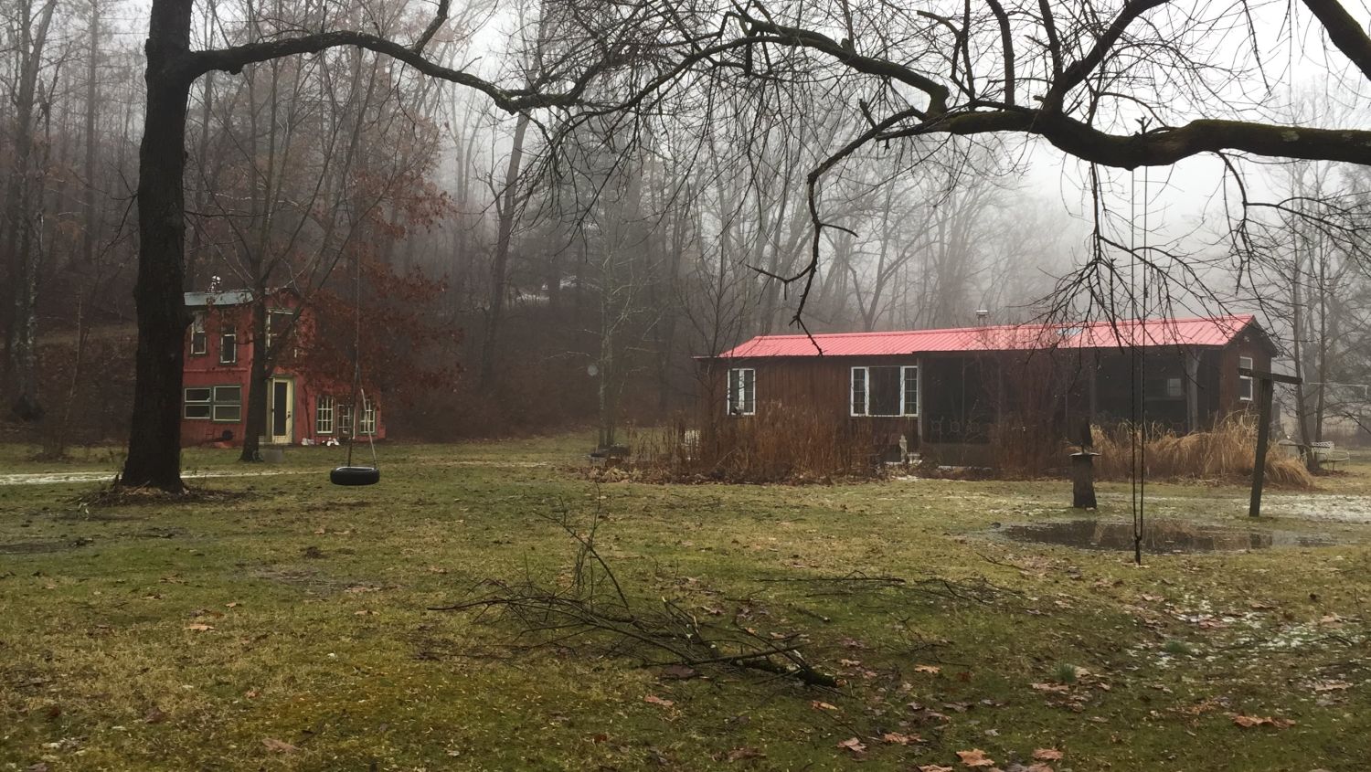 The cottage along Slope Creek, months after being vacated due to health concerns caused by nearby oil and gas operations. Photo courtesy of Chloe Mankin
https://www.fractracker.org/a5ej20sjfwe/wp-content/uploads/2024/01/slopecreek2018.jpg
845
1500
Chloe Mankin
https://www.fractracker.org/a5ej20sjfwe/wp-content/uploads/2021/04/2021-FracTracker-logo-horizontal.png
Chloe Mankin2024-01-12 12:51:302024-01-12 16:32:21Calling for Change: Life on the Fracking Frontlines
The cottage along Slope Creek, months after being vacated due to health concerns caused by nearby oil and gas operations. Photo courtesy of Chloe Mankin
https://www.fractracker.org/a5ej20sjfwe/wp-content/uploads/2024/01/slopecreek2018.jpg
845
1500
Chloe Mankin
https://www.fractracker.org/a5ej20sjfwe/wp-content/uploads/2021/04/2021-FracTracker-logo-horizontal.png
Chloe Mankin2024-01-12 12:51:302024-01-12 16:32:21Calling for Change: Life on the Fracking Frontlines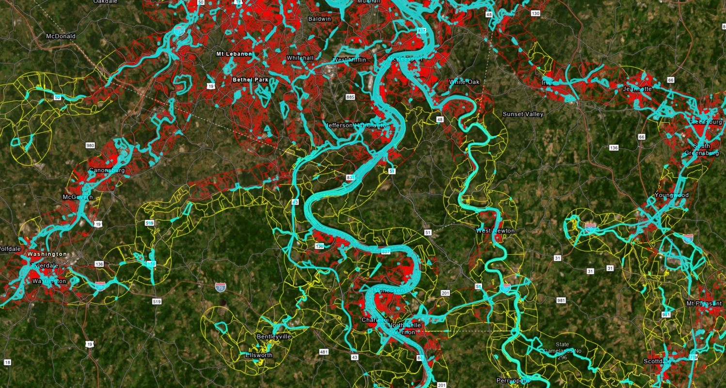 https://www.fractracker.org/a5ej20sjfwe/wp-content/uploads/2023/12/Figure-6-Rail-Population.jpg
801
1498
Matt Kelso, BA
https://www.fractracker.org/a5ej20sjfwe/wp-content/uploads/2021/04/2021-FracTracker-logo-horizontal.png
Matt Kelso, BA2023-12-14 16:26:372023-12-15 11:47:53On the Wrong Track: Risks to Residents of the Upper Ohio River Valley From Railroad Incidents
https://www.fractracker.org/a5ej20sjfwe/wp-content/uploads/2023/12/Figure-6-Rail-Population.jpg
801
1498
Matt Kelso, BA
https://www.fractracker.org/a5ej20sjfwe/wp-content/uploads/2021/04/2021-FracTracker-logo-horizontal.png
Matt Kelso, BA2023-12-14 16:26:372023-12-15 11:47:53On the Wrong Track: Risks to Residents of the Upper Ohio River Valley From Railroad Incidents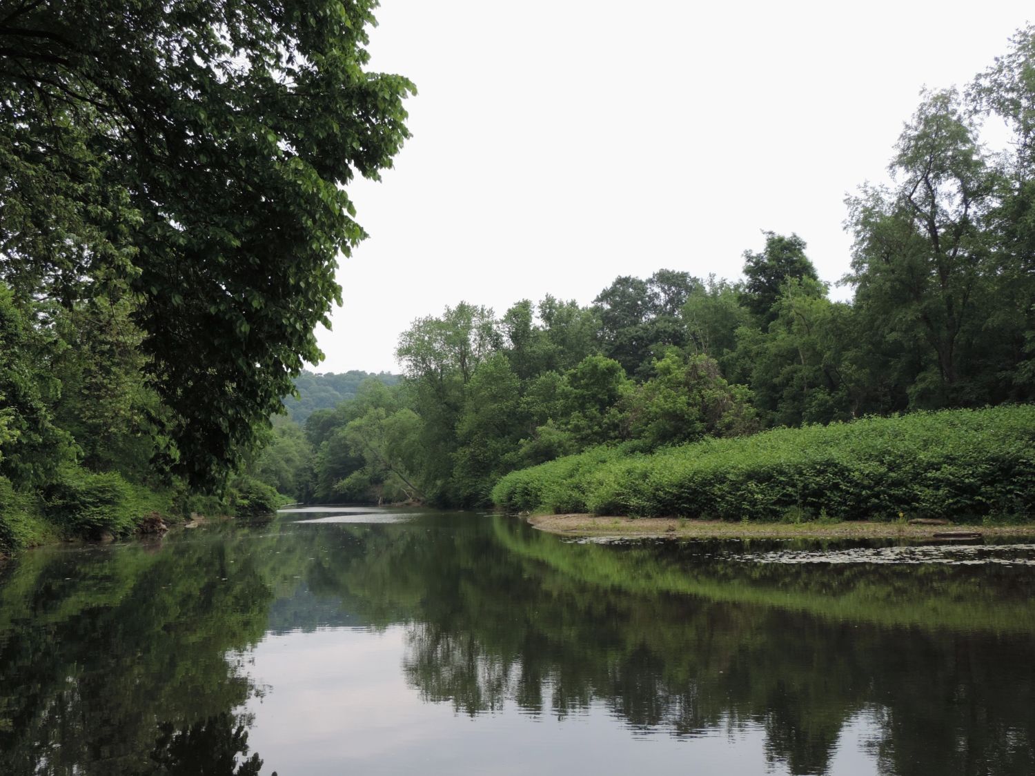 Matt Kelso, FracTracker Alliance, 2023
https://www.fractracker.org/a5ej20sjfwe/wp-content/uploads/2023/11/DSCN1328.jpg
1125
1500
Matt Kelso, BA
https://www.fractracker.org/a5ej20sjfwe/wp-content/uploads/2021/04/2021-FracTracker-logo-horizontal.png
Matt Kelso, BA2023-11-16 13:25:082023-11-27 17:16:08Digital Atlas: Exploring Nature and Industry in the Raccoon Creek Watershed
Matt Kelso, FracTracker Alliance, 2023
https://www.fractracker.org/a5ej20sjfwe/wp-content/uploads/2023/11/DSCN1328.jpg
1125
1500
Matt Kelso, BA
https://www.fractracker.org/a5ej20sjfwe/wp-content/uploads/2021/04/2021-FracTracker-logo-horizontal.png
Matt Kelso, BA2023-11-16 13:25:082023-11-27 17:16:08Digital Atlas: Exploring Nature and Industry in the Raccoon Creek Watershed https://www.fractracker.org/a5ej20sjfwe/wp-content/uploads/2016/10/Nix-Pix-021.jpg
3336
5001
Ted Auch, PhD
https://www.fractracker.org/a5ej20sjfwe/wp-content/uploads/2021/04/2021-FracTracker-logo-horizontal.png
Ted Auch, PhD2023-11-14 22:11:292024-02-05 13:44:01Fertilizer Production in the United States: How Big Ag is Fossil Fueled
https://www.fractracker.org/a5ej20sjfwe/wp-content/uploads/2016/10/Nix-Pix-021.jpg
3336
5001
Ted Auch, PhD
https://www.fractracker.org/a5ej20sjfwe/wp-content/uploads/2021/04/2021-FracTracker-logo-horizontal.png
Ted Auch, PhD2023-11-14 22:11:292024-02-05 13:44:01Fertilizer Production in the United States: How Big Ag is Fossil Fueled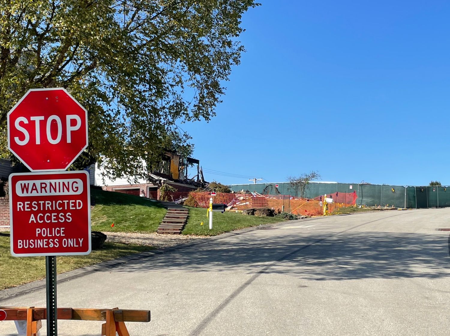 https://www.fractracker.org/a5ej20sjfwe/wp-content/uploads/2023/10/RusticRidge_102023.jpg
1119
1500
Matt Kelso, BA
https://www.fractracker.org/a5ej20sjfwe/wp-content/uploads/2021/04/2021-FracTracker-logo-horizontal.png
Matt Kelso, BA2023-11-09 19:01:252023-12-11 17:47:12Why Do Houses Keep Exploding in One Pennsylvania Suburb?
https://www.fractracker.org/a5ej20sjfwe/wp-content/uploads/2023/10/RusticRidge_102023.jpg
1119
1500
Matt Kelso, BA
https://www.fractracker.org/a5ej20sjfwe/wp-content/uploads/2021/04/2021-FracTracker-logo-horizontal.png
Matt Kelso, BA2023-11-09 19:01:252023-12-11 17:47:12Why Do Houses Keep Exploding in One Pennsylvania Suburb? https://www.fractracker.org/a5ej20sjfwe/wp-content/uploads/2023/10/Sentinel-Promo-1.jpg
844
1500
Erica Jackson
https://www.fractracker.org/a5ej20sjfwe/wp-content/uploads/2021/04/2021-FracTracker-logo-horizontal.png
Erica Jackson2023-10-19 19:12:372023-12-11 17:48:29The 2023 Legacy of Heroes Award
https://www.fractracker.org/a5ej20sjfwe/wp-content/uploads/2023/10/Sentinel-Promo-1.jpg
844
1500
Erica Jackson
https://www.fractracker.org/a5ej20sjfwe/wp-content/uploads/2021/04/2021-FracTracker-logo-horizontal.png
Erica Jackson2023-10-19 19:12:372023-12-11 17:48:29The 2023 Legacy of Heroes Award https://www.fractracker.org/a5ej20sjfwe/wp-content/uploads/2023/10/Header-Backgrounds.jpg
844
1500
FracTracker Alliance
https://www.fractracker.org/a5ej20sjfwe/wp-content/uploads/2021/04/2021-FracTracker-logo-horizontal.png
FracTracker Alliance2023-10-18 17:15:202023-11-08 23:18:04Announcing the 2023 Community Sentinel Awards for Environmental Justice
https://www.fractracker.org/a5ej20sjfwe/wp-content/uploads/2023/10/Header-Backgrounds.jpg
844
1500
FracTracker Alliance
https://www.fractracker.org/a5ej20sjfwe/wp-content/uploads/2021/04/2021-FracTracker-logo-horizontal.png
FracTracker Alliance2023-10-18 17:15:202023-11-08 23:18:04Announcing the 2023 Community Sentinel Awards for Environmental Justice https://www.fractracker.org/a5ej20sjfwe/wp-content/uploads/2023/10/Wells-Within-3200-Feet-of-Schools-Childcare-CA.jpg
595
1500
Kyle Ferrar, MPH
https://www.fractracker.org/a5ej20sjfwe/wp-content/uploads/2021/04/2021-FracTracker-logo-horizontal.png
Kyle Ferrar, MPH2023-10-04 16:38:472023-10-04 21:19:54Oil and Gas Activity Within California Public Health Protection Zones
https://www.fractracker.org/a5ej20sjfwe/wp-content/uploads/2023/10/Wells-Within-3200-Feet-of-Schools-Childcare-CA.jpg
595
1500
Kyle Ferrar, MPH
https://www.fractracker.org/a5ej20sjfwe/wp-content/uploads/2021/04/2021-FracTracker-logo-horizontal.png
Kyle Ferrar, MPH2023-10-04 16:38:472023-10-04 21:19:54Oil and Gas Activity Within California Public Health Protection ZonesFracTracker National Energy Map
U.S. Map of Energy and Petrochemical Data

Gallery
View all images and videos


FracTracker Mobile App Feed
Explore oil and gas infrastructure in your community and across the United States in FracTracker’s free app. You can add to the feed of user reports below by downloading the mobile app.